River Right
- 9 routes
- 5.7 – 5.10
- Trad
- Mar–Jun, Sep–Nov
- best months
Is River Right open right now?
Alert in the area
The Forest Service lists 10 alerts for Mark Twain National Forest.
Crane Lake Dam
Agency alert covering Mark Twain National Forest · USFS · Mark Twain National Forest
Delays on Forest Road 557
Agency alert covering Mark Twain National Forest · USFS · Mark Twain National Forest
Forest Order - Trail 119 Closure Extended (Chadwick Motorized Trail System)
Agency alert covering Mark Twain National Forest · USFS · Mark Twain National Forest
Weather Conditions
Agency alert covering Mark Twain National Forest · USFS · Mark Twain National Forest
Red Bridge Road - Bridge Closure
Agency alert covering Mark Twain National Forest · USFS · Mark Twain National Forest
As of · Source: USFS · Mark Twain National Forest. Agencies don't list every closure — check before you go.
River Right is a climbing area in the Potosi / Fredericktown Ranger District of Mark Twain National Forest in Missouri, managed by the Forest Service. It sits among a cluster of climbing and hiking spots, with Beaver Slide and Splitter Crack Wall both about 0.1 mile away and the Silver Mines East Trail just as close. The area has nine trad routes, ranging from 5.7 to 5.10. The Commandments Stone (5.7) and Fist Full Of Granite (5.8) are among the easier options, while Hammer Head (5.10) is the hardest of the listed routes. All were first ascended by Reidhead and Thurmond. Spring and fall are the most comfortable times to visit. Typical averages from a nearby weather station in Fredericktown show May highs around 76°F and October highs near 69°F, with July peaking at about 88°F. The Silver Mines fishing area is about 0.2 mile away, and the Turkey Creek Trail is about 0.6 mile off. For an overnight stay, Marble Creek Campground is roughly 9 miles away.
- Beaver SlideRock climbing0.1 mi
- Silver Mines East TrailHiking0.1 mi
- Splitter Crack WallRock climbing0.1 mi
- Silver Mines West TrailHiking0.2 mi
- River LeftRock climbing0.2 mi
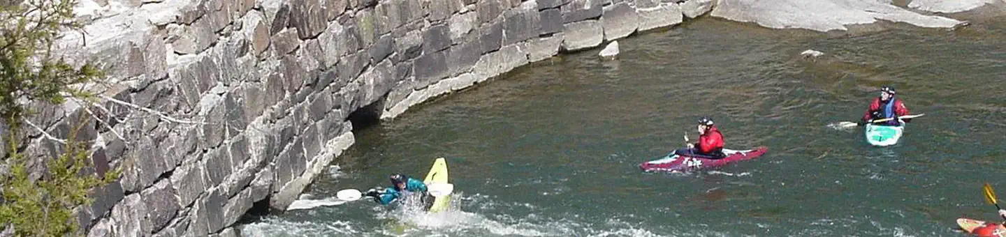 Silver MinesRiver fishing0.2 mi
- Turkey Creek TrailHiking0.6 mi
- Marble Creek CampgroundCamping9 mi
Source: Roamze catalog (indexable pages within 10 miles, PostGIS distance)
 B: Upper Picnic AreaRock climbing · ~26 min drivePhoto: Fredlyfish4, CC BY-SA 3.0 (via Wikimedia Commons)
- A: Picnic AreaRock climbing · ~26 min drivePhoto: Fredlyfish4, CC BY-SA 3.0 (via Wikimedia Commons)
- D: The PorchRock climbing · ~26 min drivePhoto: Fredlyfish4, CC BY-SA 3.0 (via Wikimedia Commons)
 C: The Front RangeRock climbing · ~26 min drivePhoto: Fredlyfish4, CC BY-SA 3.0 (via Wikimedia Commons)
 EM: Elephant Rocks SPRock climbing · ~26 min drivePhoto: Fredlyfish4, CC BY-SA 3.0 (via Wikimedia Commons)
- G: North MountainRock climbing · ~26 min drivePhoto: Fredlyfish4, CC BY-SA 3.0 (via Wikimedia Commons)
 Upper CliffRock climbing · ~37 min drivePhoto: Wikipedian Kbh3rd, CC BY-SA 3.0 (via Wikimedia Commons)
 EM: Johnson Shut-InsRock climbing · ~38 min drivePhoto: Kbh3rd, CC BY 4.0 (via Wikimedia Commons)
- Beaver SlideRock climbing · Next door
- Splitter Crack WallRock climbing · Next door
Best time to visit River Right
Best months: March–June and September–November. Best months have typical highs of 55–85 °F, lows of 30 °F or warmer (32 °F where the station doesn't record snow), at most one snowy day and no more than 12 wet days.
Jan
42° / 21°
8 wet · 1 snow
Feb
47° / 24°
8 wet · 2 snow
Mar
57° / 32°
9 wet · 1 snow
Apr
68° / 42°
10 wet
May
76° / 52°
11 wet
Jun
84° / 60°
8 wet
Jul
88° / 65°
8 wet
Aug
87° / 62°
8 wet
Sep
80° / 54°
7 wet
Oct
69° / 42°
8 wet
Nov
56° / 32°
8 wet
Dec
45° / 24°
9 wet · 1 snow
Typical high / low (°F) and days with rain or snow, 1991–2020. Measured at Fredericktown, MO, 7.4 mi away at 760 ft. Source: NOAA NCEI U.S. Climate Normals 1991–2020.
