Durden Creek
- 6.7 mi
- distance
- 303 ft
- high point
- Feb–May, Oct–Dec
- best months
Durden Creek is a canoeing route in Mississippi, about 2.5 miles from the town of Coffeeville. It is a paddling destination rather than a trail, and its location close to town makes it an easy addition to a day spent exploring the area. Spring and fall are the most comfortable times to paddle. Typical averages from a nearby weather station in Water Valley show October highs around 76°F with lows near 49°F, and April highs around 74°F. Midsummer is hotter, with July and August highs in the low 90s. Cypress Creek, another canoeing route, lies about 2.4 miles away. Turkey Creek is roughly 8.5 miles off. For time on foot, Spyglass Hill Trail and Water Valley Landing Trail are both within about 10 miles.
- Cypress CreekCanoeing2.4 mi
- Turkey CreekCanoeing8.5 mi
- Spyglass Hill TrailHiking9.7 mi
- Water Valley Landing TrailHiking9.9 mi
Source: Roamze catalog (indexable pages within 10 miles, PostGIS distance)
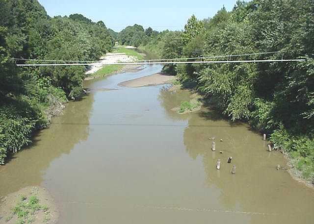 Skuna RiverCanoeing · ~1h 2m drivePhoto: NOAA employee, Public domain (via Wikimedia Commons)
- Hurricane LandingBoat launch · ~58 min drive
- Cypress CreekCanoeing · ~4 min drive
- Turkey CreekCanoeing · ~15 min drive
- Simmons CreekCanoeing · ~19 min drive
- South Fork Tillatoba CreekCanoeing · ~26 min drive
- Bynum CreekCanoeing · ~26 min drive
- Otoucalofa CreekCanoeing · ~26 min drive
- Tillatoba CreekCanoeing · ~30 min drive
- Long CreekCanoeing · ~31 min drive
Best time to visit Durden Creek
Best months: February–May and October–December. Best months have typical highs of 55–85 °F, lows of 30 °F or warmer (32 °F where the station doesn't record snow), at most one snowy day and no more than 12 wet days.
Jan
53° / 30°
9 wet
Feb
57° / 32°
8 wet
Mar
66° / 40°
9 wet
Apr
74° / 48°
9 wet
May
82° / 58°
9 wet
Jun
88° / 66°
8 wet
Jul
90° / 70°
8 wet
Aug
91° / 68°
7 wet
Sep
86° / 61°
6 wet
Oct
76° / 49°
6 wet
Nov
64° / 38°
8 wet
Dec
55° / 33°
9 wet
Typical high / low (°F) and days with rain or snow, 1991–2020. Measured at Water Valley, MS, 10.9 mi away at 310 ft. Source: NOAA NCEI U.S. Climate Normals 1991–2020.

