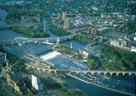
Minnehaha Falls
 Photo: Original uploader was The Statue With The Dictionary at en.wikipedia, CC BY-SA 3.0 (via Wikimedia Commons)
- 810 ft
- elevation
- Apr–Oct
- best months
Is Minnehaha Falls open right now?
No closures listed
The National Park Service lists no closures for Mississippi National River and Recreation Area.
As of · Source: NPS · Mississippi National River and Recreation Area. Agencies don't list every closure — check before you go.
Minnehaha Falls is a waterfall in Hennepin County, Minnesota, sitting at about 810 feet within Mississippi National River and Recreation Area. It also lies inside Minnehaha Park, and the nearest town is Mendota, about 3 miles away. Summer and early fall are the most comfortable times to visit. Typical averages from a nearby weather station show July highs around 83°F and September highs near 73°F, with lows in the 50s and 60s. Several short hikes start close by. Baltimore Oriole Loop is about 1.2 miles away, and Scarlet Tanager Loop and Indigo Bunting Loop are each about 1.3 miles off. In winter, Pike Island Trail, about 2.3 miles away, offers cross-country skiing.
- Elevation
- 810 ft
Elevation from USGS 3D Elevation Program terrain data (about 10 m resolution).
- Baltimore Oriole LoopHiking1.2 mi
- Scarlet Tanager LoopHiking1.3 mi
- Indigo Bunting LoopHiking1.3 mi
- Pike Island TrailCross-country skiing2.3 mi
- Winchell TrailHiking3.3 mi
 Hillside TrailHikingPhoto: U.S. Department of the Interior, CC BY-SA 2.0 (via Wikimedia Commons)3.9 mi
- Short Ski TrailCross-country skiing4.6 mi
- Long Ski TrailCross-country skiing5.2 mi
Source: Roamze catalog (indexable pages within 10 miles, PostGIS distance)
Best time to visit Minnehaha Falls
Best months: April–October. Best months have typical highs of 55–85 °F, lows of 30 °F or warmer (32 °F where the station doesn't record snow), at most one snowy day and no more than 12 wet days.
Jan
24° / 9°
10 wet
Feb
29° / 13°
8 wet
Mar
42° / 25°
9 wet
Apr
57° / 38°
11 wet
May
69° / 50°
12 wet
Jun
79° / 60°
12 wet
Jul
83° / 65°
10 wet
Aug
81° / 63°
10 wet
Sep
73° / 54°
9 wet
Oct
58° / 41°
9 wet
Nov
42° / 28°
9 wet
Dec
29° / 15°
9 wet
Typical high / low (°F) and days with rain or snow, 1991–2020. Measured at Minneapolis/St Paul Ap, MN, 2.4 mi away at 872 ft. This station doesn't record snowfall. Source: NOAA NCEI U.S. Climate Normals 1991–2020.