Mississippi East Bank Trail
- 0.2 mi
- round trip
- 11 ft
- climb
- Out and back
- route
- Apr–Oct
- best months
Is Mississippi East Bank Trail open right now?
No closures listed
The National Park Service lists no closures for Mississippi National River and Recreation Area.
As of · Source: NPS · Mississippi National River and Recreation Area. Agencies don't list every closure — check before you go.
The Mississippi East Bank Trail is a short, easy mountain biking route in Minnesota, set within the Mississippi National River and Recreation Area and Sheridan Memorial Park. It is city-managed land, and the trail is an out-and-back that covers about 0.4 miles with a total elevation gain of 11 feet. The route is nearly flat, with the high point at 824 feet and the low at 816 feet, and the steepest stretch comes at about 0.05 miles in, with a grade of 3 percent. Summer is the most comfortable time to ride. Typical averages from a nearby weather station at Lower St Anthony Falls show July highs around 83°F with lows near 64°F, while winter highs stay in the 20s. Several cross-country ski routes lie about 2.5 miles away, including Judy Loop, Tornado Alley, La Squadra Loop and the Luce Line Regional Trail.
Local outfitters
- Cannon Falls Canoe and Bike Rental38 mi away
- Paddlefish Adventures41 mi away
Not on Roamze yet. Their page has how to reach them.
- Judy LoopCross-country skiing2.5 mi
- Tornado AlleyCross-country skiing2.5 mi
- La Squadra LoopCross-country skiing2.5 mi
- Bridge TrailCross-country skiing2.5 mi
- Luce Line Regional TrailCross-country skiing2.5 mi
- Trail 18 StadiumCross-country skiing2.6 mi
- The North FingerCross-country skiing2.6 mi
- Ridgeline TrailCross-country skiing2.6 mi
Source: Roamze catalog (indexable pages within 10 miles, PostGIS distance)
- Mississippi East Bank TrailMountain biking · Next door
- LugeMountain biking · ~22 min drive
- BowlMountain biking · ~32 min drive
- Bush Lake Walking TrailMountain biking · ~22 min drive
- Stillwater SingletrackMountain biking · ~38 min drive
- Aspen Loop (north)Mountain biking · ~23 min drive
- Prairie Loop (south)Mountain biking · ~23 min drive
- Prairie Loop (south)Mountain biking · ~23 min drive
- Prairie Loop (south)Mountain biking · ~23 min drive
- Prairie Loop (south)Mountain biking · ~23 min drive
Also worth it near here
- Nicollet IslandRock climbing · ~2 min drive
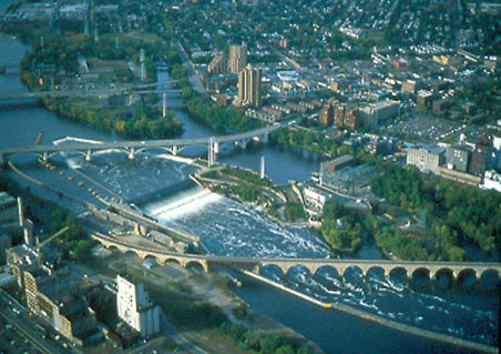 Saint Anthony FallsWaterfall · ~3 min drivePhoto: The original uploader was Mulad at English Wikipedia., Public domain (via Wikimedia Commons)
 Sunset HillSummit · ~4 min drivePhoto: Gobonobo, CC BY-SA 3.0 (via Wikimedia Commons)
- Judy LoopCross-country skiing · ~4 min drive
Best time to visit Mississippi East Bank Trail
Best months: April–October. Best months have typical highs of 55–85 °F, lows of 30 °F or warmer (32 °F where the station doesn't record snow), at most one snowy day and no more than 12 wet days.
Jan
22° / 8°
8 wet
Feb
27° / 12°
6 wet
Mar
40° / 24°
8 wet
Apr
55° / 36°
10 wet
May
69° / 49°
12 wet
Jun
79° / 59°
12 wet
Jul
83° / 64°
10 wet
Aug
80° / 62°
8 wet
Sep
72° / 54°
9 wet
Oct
56° / 41°
9 wet
Nov
40° / 27°
7 wet
Dec
27° / 15°
8 wet
Typical high / low (°F) and days with rain or snow, 1991–2020. Measured at Lower St Anthony Falls, MN, 2 mi away at 754 ft. This station doesn't record snowfall. Source: NOAA NCEI U.S. Climate Normals 1991–2020.
Map and trail data © OpenStreetMap contributors
