Mississippi East Bank Trail
- 0.5 mi
- round trip
- 39 ft
- climb
- Out and back
- route
- Apr–Oct
- best months
Is Mississippi East Bank Trail open right now?
No closures listed
The National Park Service lists no closures for Mississippi National River and Recreation Area.
As of · Source: NPS · Mississippi National River and Recreation Area. Agencies don't list every closure — check before you go.
The Mississippi East Bank Trail is a short, easy mountain biking route in the Mississippi National River and Recreation Area in Minnesota, about half a mile long. It is an out-and-back with a high point of 814 feet and a low of 806 feet, so the climb is almost flat, with a total gain and loss of about 40 feet each way. The steepest stretch comes at about 0.34 miles, with a grade of about 2 percent. Summer is the most comfortable time to ride. Typical averages from a nearby weather station at Lower St Anthony Falls show July highs around 83°F and lows near 64°F, while winter highs stay in the 20s. The trail sits within the Mississippi National River and Recreation Area, and several cross-country ski routes lie within a few miles, including the Luce Line Regional Trail, Tornado Alley, Bridge Trail and JD Rivers Trail.
Local outfitters
- Cannon Falls Canoe and Bike Rental38 mi away
- Paddlefish Adventures42 mi away
Not on Roamze yet. Their page has how to reach them.
- Luce Line Regional TrailCross-country skiing2.5 mi
- Tornado AlleyCross-country skiing2.5 mi
- Bridge TrailCross-country skiing2.6 mi
- JD Rivers TrailCross-country skiing2.6 mi
- Wirth Lake TrailCross-country skiing2.6 mi
- La Squadra LoopCross-country skiing2.6 mi
- Judy LoopCross-country skiing2.7 mi
- Skyline TrailCross-country skiing2.7 mi
Source: Roamze catalog (indexable pages within 10 miles, PostGIS distance)
- Mississippi East Bank TrailMountain biking · Next door
- LugeMountain biking · ~22 min drive
- BowlMountain biking · ~32 min drive
- Bush Lake Walking TrailMountain biking · ~21 min drive
- Stillwater SingletrackMountain biking · ~38 min drive
- Aspen Loop (north)Mountain biking · ~22 min drive
- Prairie Loop (south)Mountain biking · ~22 min drive
- Prairie Loop (south)Mountain biking · ~23 min drive
- Prairie Loop (south)Mountain biking · ~23 min drive
- Prairie Loop (south)Mountain biking · ~23 min drive
Also worth it near here
- Nicollet IslandRock climbing · Next door
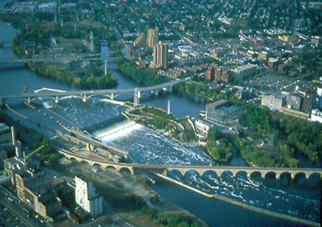 Saint Anthony FallsWaterfall · ~2 min drivePhoto: The original uploader was Mulad at English Wikipedia., Public domain (via Wikimedia Commons)
 Sunset HillSummit · ~4 min drivePhoto: Gobonobo, CC BY-SA 3.0 (via Wikimedia Commons)
- Luce Line Regional TrailCross-country skiing · ~4 min drive
Best time to visit Mississippi East Bank Trail
Best months: April–October. Best months have typical highs of 55–85 °F, lows of 30 °F or warmer (32 °F where the station doesn't record snow), at most one snowy day and no more than 12 wet days.
Jan
22° / 8°
8 wet
Feb
27° / 12°
6 wet
Mar
40° / 24°
8 wet
Apr
55° / 36°
10 wet
May
69° / 49°
12 wet
Jun
79° / 59°
12 wet
Jul
83° / 64°
10 wet
Aug
80° / 62°
8 wet
Sep
72° / 54°
9 wet
Oct
56° / 41°
9 wet
Nov
40° / 27°
7 wet
Dec
27° / 15°
8 wet
Typical high / low (°F) and days with rain or snow, 1991–2020. Measured at Lower St Anthony Falls, MN, 1.6 mi away at 754 ft. This station doesn't record snowfall. Source: NOAA NCEI U.S. Climate Normals 1991–2020.
Map and trail data © OpenStreetMap contributors
