Lake Trail
 Photo: controltheweb from US, CC BY-SA 2.0 (via Wikimedia Commons)
- 0.8 mi
- round trip
- 266 ft
- climb
- 966 ft
- high point
- Out and back
- route
- Apr, Jun–Oct
- best months
Lake Trail is a short, easy hike of about 0.79 miles in Minnewashta Regional Park, on county land in Minnesota. The trail is an out-and-back, about 1.6 miles long round trip, and the climb is minimal: the high point reaches about 966 feet, and the steepest stretch, a 9% grade, comes within the first 0.15 miles. Summer is the most comfortable time to go. Typical averages from a nearby weather station show July highs around 81°F with lows near 62°F, while winter highs stay in the 20s. Prairie Loop lies about 0.3 miles away, and Woodlands Loop is about 0.5 miles off. The Ridge Trail and Lost Pond Trail, both cross-country ski routes, are each about 1.5 miles away, and Lake Minnetonka is about 3.5 miles from the trail.
Best time to go · Apr, Jun–Oct
Best time to visit Lake Trail
Best months: April and June–October. Best months have typical highs of 55–85 °F, lows of 30 °F or warmer (32 °F where the station doesn't record snow), at most one snowy day and no more than 12 wet days.
Jan
22° / 6°
9 wet
Feb
27° / 9°
8 wet
Mar
40° / 22°
9 wet
Apr
55° / 35°
11 wet
May
68° / 47°
13 wet
Jun
77° / 58°
12 wet
Jul
81° / 62°
10 wet
Aug
79° / 60°
10 wet
Sep
71° / 51°
10 wet
Oct
57° / 38°
10 wet
Nov
41° / 25°
8 wet
Dec
27° / 12°
9 wet
Typical high / low (°F) and days with rain or snow, 1991–2020. Measured at Chanhassen Wsfo, MN, 2.5 mi away at 946 ft. This station doesn't record snowfall. Source: NOAA NCEI U.S. Climate Normals 1991–2020.
Keep exploring — more trails worth the drive
Photo: controltheweb from US, CC BY-SA 2.0 (via Wikimedia Commons)Woodlands Loop
Next door
1.10-mile loop trail in Minnesota with 154 ft gain and 224 ft loss.
 Photo: Joe Passe, CC BY-SA 2.0 (via Flickr)
Mazomani Trail
~17 min drive
5.60-mile out-and-back trail in Minnesota with 429 ft elevation gain.
 Photo: Wylbur, CC BY 2.0 (via Flickr)
Chaska Lake Trail
~12 min drive
1.78-mile out-and-back trail to Chaska Lake in Minnesota.
 Photo: Joe Passe, CC BY-SA 2.0 (via Flickr)
Minnesota Valley State Trail (Louisville Swamp Unit)
~20 min drive
5.65-mile out-and-back trail in Minnesota with 407 ft elevation gain.
Photo: Joe Passe, CC BY-SA 2.0 (via Flickr)State Access Trail
~17 min drive
1.19-mile out-and-back trail in Minnesota with 161 ft elevation gain.
 Photo: Joe Passe, CC BY-SA 2.0 (via Flickr)
River Bottoms Trail
~26 min drive
8.68-mile out-and-back hike in Minnesota with 983 ft gain.
 Photo: Joe Passe, CC BY-SA 2.0 (via Flickr)
Blue Lake Trail
~17 min drive
3.61-mile out-and-back trail in Minnesota with 300 ft elevation gain.
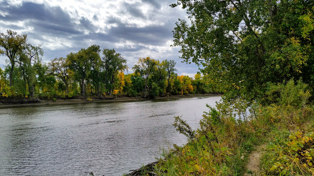 Photo: Joe Passe, CC BY-SA 2.0 (via Flickr)
Long Meadow Lake Trail
~29 min drive
Point-to-point trail to Long Meadow Lake through meadows and forest.
 Photo: Joe Passe, CC BY-SA 2.0 (via Flickr)
Jab's Dike Trail
~17 min drive
0.51-mile out-and-back trail in Minnesota with 91 ft gain.
HIKE
Lone Lake Mountain Bike Trail
~14 min drive
Fun 3.97-mile out-and-back mountain bike trail near Lone Lake in Minnesota.
Map and trail data © OpenStreetMap contributors
