Hurricane River Upper Campground
- 22
- sites
- May–Oct
- best months
Is Hurricane River Upper Campground open right now?
Closure in the area
There's a closure order in Pictured Rocks National Lakeshore. It doesn't name Hurricane River Upper Campground, so check the source for the area it covers.
Munising Falls Trail Closed Until Further Notice
Park closure covering Pictured Rocks National Lakeshore · NPS · Pictured Rocks National Lakeshore
As of · Source: NPS · Pictured Rocks National Lakeshore. Agencies don't list every closure — check before you go.
- 22 sites for RV campingReservable on Recreation.gov
- At 686 ft
- Pictured Rocks National Lakeshore
Hurricane River Upper Campground is a campground in Michigan at about 686 feet. It is managed by the National Park Service.
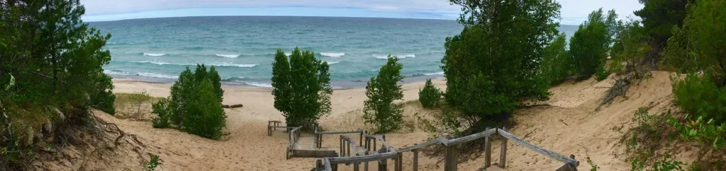
- Hurricane Campground BeachBeach0.3 mi
 Twelvemile Beach Campground and CabinCampingPhoto: Recreation.gov (RIDB) / public domain3.2 mi
 Grand Sable DunesSummitPhoto: NMMIMAJ, CC BY-SA 3.0 (via Wikimedia Commons)3.5 mi
- Public Shoreline Beach-Grand Sable DunesBeach3.9 mi
- Fox River PathwayHiking5.2 mi
 Sable FallsWaterfallPhoto: Yinan Chen, Public Domain (via Wikimedia Commons)7.1 mi
 Pictured Rocks National Lakeshore Backcountry Camping PermitCampingPhoto: Recreation.gov (RIDB) / public domain9.8 mi
- Chipmunk FallsWaterfall9.8 mi
Source: Roamze catalog (indexable pages within 10 miles, PostGIS distance)
- Twelvemile Beach Campground and CabinCamping · ~5 min drive
- Pictured Rocks National Lakeshore Backcountry Camping PermitCamping · ~17 min drive
- Hurricane River Lower CampgroundCamping · Next door
- Benchmark CampsiteCamping · ~4 min drive
- Au Sable Point CampgroundCamping · ~5 min drive
- Twelvemile Beach CampgroundCamping · ~5 min drive
- Masse Homestead Group CampsiteCamping · ~6 min drive
- Masse HomesteadCamping · ~6 min drive
- Sevenmile Group CampsiteCamping · ~9 min drive
- Sevenmile CampgroundCamping · ~10 min drive
Best time to visit Hurricane River Upper Campground
Best months: May–October. Best months have typical highs of 55–85 °F, lows of 30 °F or warmer (32 °F where the station doesn't record snow), at most one snowy day and no more than 12 wet days.
Jan
24° / 14°
Feb
27° / 13°
Mar
37° / 20°
Apr
47° / 28°
May
61° / 40°
Jun
70° / 48°
Jul
75° / 55°
Aug
75° / 56°
Sep
68° / 50°
Oct
55° / 39°
Nov
41° / 29°
Dec
30° / 20°
Typical high / low (°F) and days with rain or snow, 1991–2020. Measured at Grand Marais 2 E, MI, 10.1 mi away at 624 ft. This station doesn't record snowfall. Source: NOAA NCEI U.S. Climate Normals 1991–2020.
Facts about this campground
Hurricane River Upper Campground
22 sites for RV camping
Map and trail data © OpenStreetMap contributors
