Pictured Rocks National Lakeshore Backcountry Camping Permit
 Photo: Recreation.gov (RIDB) / public domain
- 72
- sites
- May–Oct
- best months
Is Pictured Rocks National Lakeshore Backcountry Camping Permit open right now?
Closure in the area
There's a closure order in Pictured Rocks National Lakeshore. It doesn't name Pictured Rocks National Lakeshore Backcountry Camping Permit, so check the source for the area it covers.
Munising Falls Trail Closed Until Further Notice
Park closure covering Pictured Rocks National Lakeshore · NPS · Pictured Rocks National Lakeshore
As of · Source: NPS · Pictured Rocks National Lakeshore. Agencies don't list every closure — check before you go.
- 72 sites for group campingReservable on Recreation.gov
- At 701 ft
- Near MunisingBeaver Basin Wilderness · Pictured Rocks National Lakeshore
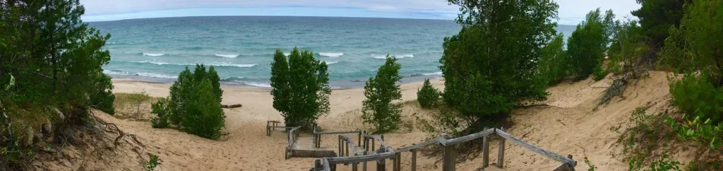
Pictured Rocks National Lakeshore hugs the Lake Superior shoreline for more than 40 miles along Michigan's northern coast. Lake Superior is the largest, deepest, coldest, and most pristine of all the Great Lakes. In addition to boating and kayaking on the lake, the park's backcountry offers nearly 100 miles of walking and hiking trails and opportunities for solitude, inspiration, physical challenge, renewal, and camping. Access to Pictured Rocks' backcountry is primarily along the 'Lakeshore Trail', a part of the 42-mile long North Country National Scenic Trail where you can experience forests, dunes, beaches, waterfalls and wonderful panoramic views. Please download the Backcountry Camping Planner form the park website for complete details. The backcountry campgrounds are accessed by hiking or kayaking only. A backcountry camping permit is required year-round for all overnight trips into the Pictured Rocks National Lakeshore backcountry. Permits are not required for day hiking. To assist in planning an overnight backcountry trip into Pictured Rocks National Lakeshore, take time to carefully plan and prepare for your adventure. Pictured Rocks offers fourteen backcountry campgrounds, that are located at 2 to 5 mile intervals along the Lakeshore Trail. Private shuttle services are available. The permit holder must print and retain one copy of the permit when hiking to the campground; permit must be visibly secured to tent at campsite. You will be assigned a campsite number at every backcountry campground. Permit holder may have only one permit reserved at one time. Camp only in designated sites and follow permit itinerary. You must camp within 15 feet (4.5 m) of the numbered post at your chosen campsite. Individual campsites are available for groups of 1-6 people, and 3 tents or hammocks maximum (or a combination thereof). Group sites are available for groups of 7-20 people, and 10 tents or hammocks maximum (or a combination thereof). Group campsite reservations must camp in designated group sites. Each campground has a specific capacity; campsites within each backcountry campground are identified by a numbered post.
- Fox River PathwayHiking4.9 mi
 Twelvemile Beach Campground and CabinCampingPhoto: Recreation.gov (RIDB) / public domain6.7 mi
Source: Roamze catalog (indexable pages within 10 miles, PostGIS distance)
- Twelvemile Beach Campground and CabinCamping · ~12 min drive
- Lowney Creek CampgroundCamping · ~3 min drive
- Trappers Lake CampgroundCamping · ~3 min drive
- Trappers Lake Group CampsiteCamping · ~3 min drive
- Lowney Creek Group CampgroundCamping · ~3 min drive
- Pine Bluff CampgroundCamping · ~3 min drive
- Beaver Creek CampgroundCamping · ~4 min drive
- Little Beaver Lake CampgroundCamping · ~5 min drive
- Coves CampsiteCamping · ~6 min drive
- Kingston Lake State Forest CampgroundCamping · ~7 min drive
Best time to visit Pictured Rocks National Lakeshore Backcountry Camping Permit
Best months: May–October. Best months have typical highs of 55–85 °F, lows of 30 °F or warmer (32 °F where the station doesn't record snow), at most one snowy day and no more than 12 wet days.
Jan
24° / 14°
Feb
27° / 13°
Mar
37° / 20°
Apr
47° / 28°
May
61° / 40°
Jun
70° / 48°
Jul
75° / 55°
Aug
75° / 56°
Sep
68° / 50°
Oct
55° / 39°
Nov
41° / 29°
Dec
30° / 20°
Typical high / low (°F) and days with rain or snow, 1991–2020. Measured at Grand Marais 2 E, MI, 18.4 mi away at 624 ft. This station doesn't record snowfall. Source: NOAA NCEI U.S. Climate Normals 1991–2020.

Pictured Rocks National Lakeshore Backcountry Camping Permit
72 sites for group camping
