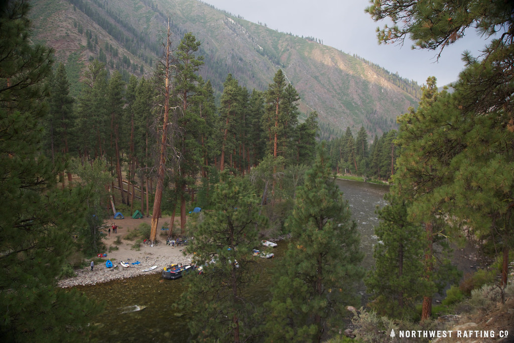
Loon Creek
- 26.6 mi
- distance
- 7,338 ft
- high point
- Jul–Aug
- best months
Is Loon Creek open right now?
Alert in the area
The Forest Service lists an alert for Salmon-Challis National Forest.
Stoddard Bridge Construction Closure
Agency alert covering Salmon-Challis National Forest · Order 0413-07-17 · USFS · Salmon-Challis National Forest
As of · Source: USFS · Salmon-Challis National Forest. Agencies don't list every closure — check before you go.
Loon Creek is a 27-mile paddling stretch near Stanley, Idaho, set within the Frank Church-River of No Return Wilderness. The land is managed by the U.S. Forest Service's Middle Fork Ranger District of the Salmon-Challis National Forest. The creek is intermittent and may run dry in some seasons, with USGS models showing an average flow of about 411 cubic feet per second and a gradient of about 107.8 feet per mile. Summer is the most comfortable time to paddle. Typical averages from a nearby weather station in Stanley show July highs around 80°F with lows near 34°F, and the creek sits higher than that station, so expect cooler temperatures up the valley. Tin Cup Campground sits just 0.6 miles away. Within about 4 miles you'll find the Rat Creek and Blue Lake hikes, and Mayfield Creek offers another paddling option.
Local outfitters
- The Sawmill Station30 mi away
- Camp Perkins47 mi away
Not on Roamze yet. Their page has how to reach them.
- Tin Cup CampgroundCamping0.6 mi
- Rat CreekHiking3.8 mi
- Blue LakeHiking4 mi
- Mayfield CreekCanoeing4.4 mi
- Deer CreekHiking4.5 mi
- Loon Creek PointHiking4.8 mi
- East Fork Mayfield CreekCanoeing6.8 mi
- Little Loon CreekCanoeing6.9 mi
Source: Roamze catalog (indexable pages within 10 miles, PostGIS distance)
 Middle Fork Salmon RiverCanoeing · ~41 min drivePhoto: Rex Parker, CC BY 2.0 (via Wikimedia Commons)
- Elk Creek Boat LaunchBoat launch · ~41 min drive
- Mayfield CreekCanoeing · ~8 min drive
- Torrey's Hole Boat RampBoat launch · ~46 min drive
- East Fork Mayfield CreekCanoeing · ~12 min drive
- Salmon River Bridge AccessBoat launch · ~46 min drive
- Little Loon CreekCanoeing · ~12 min drive
- South Butte Boat RampBoat launch · ~52 min drive
- Warm Spring CreekCanoeing · ~17 min drive
- Dugway River AccessBoat launch · ~53 min drive
Best time to visit Loon Creek
Best months: July–August. Best months have typical highs of 55–85 °F, lows of 30 °F or warmer (32 °F where the station doesn't record snow), at most one snowy day and no more than 12 wet days.
Jan
26° / -3°
Feb
33° / -1°
Mar
43° / 9°
Apr
50° / 18°
May
60° / 26°
Jun
69° / 31°
Jul
80° / 34°
Aug
79° / 32°
Sep
70° / 25°
Oct
56° / 19°
Nov
38° / 10°
Dec
25° / -2°
Typical high / low (°F) and days with rain or snow, 1991–2020. Measured at Stanley, ID, 27.2 mi away at 6,249 ft. The station sits about 1,100 ft lower than this place, so expect it a little cooler here. This station doesn't record snowfall. Source: NOAA NCEI U.S. Climate Normals 1991–2020.