Lost Moose Campground
Hiking business nearby (~17 mi away) — hasn't claimed their Roamze page yet
0.94-mile out-and-back out-and-back in Idaho with 494 ft gain and 3,366 ft max elevation.
Best months: April–October. Best months have typical highs of 55–85 °F, lows of 30 °F or warmer (32 °F where the station doesn't record snow), at most one snowy day and no more than 12 wet days.
Jan
37° / 24°
Feb
40° / 25°
Mar
47° / 29°
Apr
55° / 34°
May
65° / 41°
Jun
70° / 45°
Jul
81° / 52°
Aug
83° / 51°
Sep
73° / 44°
Oct
57° / 36°
Nov
43° / 30°
Dec
35° / 23°
Typical high / low (°F) and days with rain or snow, 1991–2020. Measured at Plummer 3 Wsw, ID, 9.4 mi away at 2,905 ft. This station doesn't record snowfall. Source: NOAA NCEI U.S. Climate Normals 1991–2020.
Shoeffler Butte Loop is a 0.94-mile out-and-back trail in Idaho with 494 feet of elevation gain and loss. The trail reaches a maximum elevation of 3,366 feet.
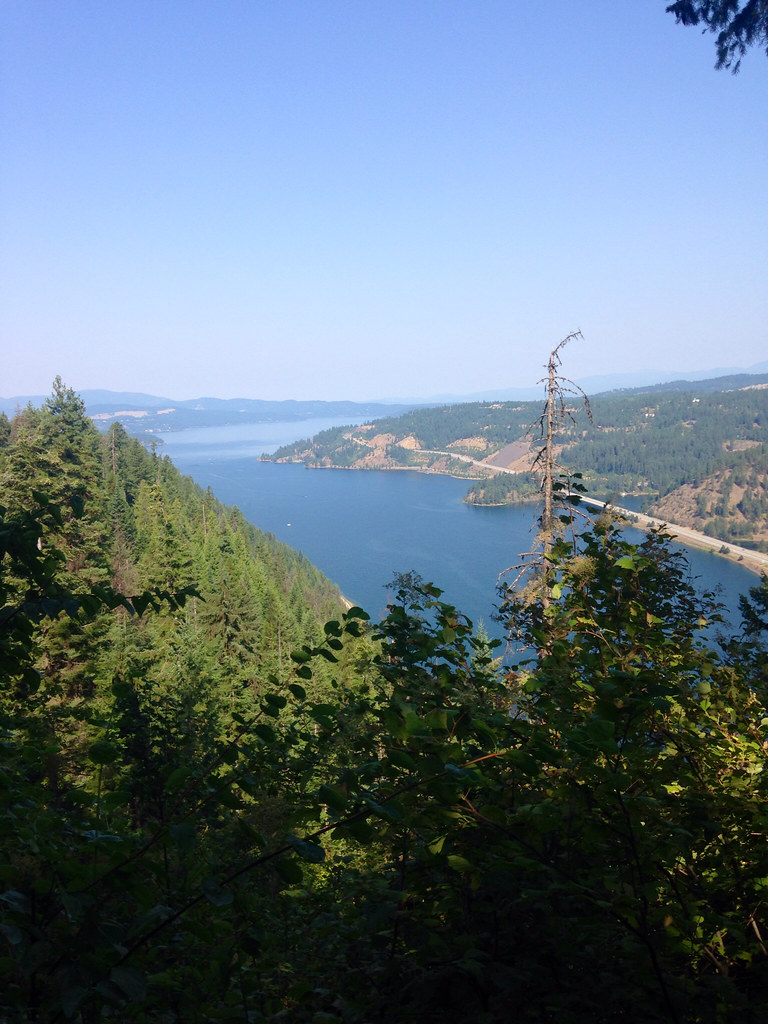 Photo: Umnak, CC BY-SA 2.0 (via Flickr)
Mineral Ridge Trail
~29 min drive
2.26-mile loop with 1,267 ft gain in Idaho
 Photo: waterarchives, CC BY-SA 2.0 (via Flickr)
Red Trail
~31 min drive
0.48-mile lollipop trail in Idaho with 147 ft of elevation gain.
Pleasant Creek
~25 min drive
7.02-mile out-and-back trail in Idaho with 463 ft gain and 2,322 ft loss.
Caribou Ridge
~27 min drive
9.81-mile out-and-back trail on a ridge in Idaho with 2,056 ft gain
Indian Cliffs Trail
~2 min drive
2.48-mile loop in Idaho with 1,218 ft gain and 2,777 ft max elevation.
Photo: waterarchives, CC BY-SA 2.0 (via Flickr)Orange Trail
~32 min drive
1.19-mile loop in Idaho with 99 ft of elevation gain.
California Creek Trail
~33 min drive
6.6-mile out-and-back trail in Washington with 2,529 ft elevation gain.
Trail 257 South
~26 min drive
10.96-mile out-and-back trail in Idaho with 1,303 ft elevation gain.
Photo: waterarchives, CC BY-SA 2.0 (via Flickr)Blue Trail
~32 min drive
5.04-mile out-and-back trail in Idaho with 614 ft of elevation gain.
Mica Peak
~34 min drive
7.68-mile out-and-back trail in Washington with 2,871 ft elevation gain.
About 0.5 mi round trip.
About 494 ft of climbing round trip.
It is rated easy.
About 0.5 hours round trip.
Daily highs and lows, wind and the chance of precipitation at the summit and route start for the next 7 days, from the Open-Meteo model.
Map and trail data © OpenStreetMap contributors
Outfitters and businesses. They haven’t set up their Roamze page yet.
Lost Moose Campground
Hiking business nearby (~17 mi away) — hasn't claimed their Roamze page yet
Tour CDA
Hiking business nearby (~20 mi away) — hasn't claimed their Roamze page yet
CDA River RV
Hiking business nearby (~24 mi away) — hasn't claimed their Roamze page yet
