Johnson Creek
- 0.9 mi
- round trip
- 993 ft
- climb
- 8,464 ft
- high point
- Out and back
- route
Is JOHNSON CREEK open right now?
Alert in the area
The Forest Service lists 4 alerts for Sawtooth National Forest.
Paradise Prescribed Burn Restricted Access
Agency alert covering Sawtooth National Forest · USFS · Sawtooth National Forest
Grandjean Area, Road, and Trail Closure
Agency alert covering Sawtooth National Forest · Order 0414-04-165 · USFS · Sawtooth National Forest
Over-Snow Vehicle and Bicycle Prohibitions
Agency alert covering Sawtooth National Forest · Order 0414-00-028 · USFS · Sawtooth National Forest
Occupancy and Use - Food Storage
Agency alert covering Sawtooth National Forest · Order 0414-04-143 · USFS · Sawtooth National Forest
As of · Source: USFS · Sawtooth National Forest. Agencies don't list every closure — check before you go.
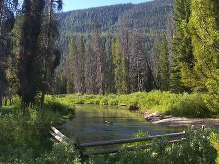
Johnson Creek is a moderate out-and-back hike in Idaho's Sawtooth National Forest, within the Fairfield Ranger District. The trail is about 1.9 miles long, with a total elevation gain of 993 feet, and it starts at roughly 8,326 feet, reaching a high point of 8,464 feet. The climb is steady, and the steepest stretch comes at about 0.83 miles in, where the grade reaches 18 percent. The hike is managed by the Forest Service, and the route is a short, single-day outing. Plan on about an hour for the trip. The trail is a compact option for a day in the Fairfield area, and it pairs easily with other outings in the surrounding forest. Nearby, the North Fork Ross Fork Trail lies about half a mile away, and the Alturas Lake-Mattingly hike is about 1.4 miles off. Jake's Gulch is roughly 1.9 miles away. For an overnight stay, Alturas Lake Inlet campground is about 5.4 miles from the trail.
Local outfitters
- Camp Perkins8 mi away
- The Sawmill Station37 mi away
Not on Roamze yet. Their page has how to reach them.
- North Fork Ross Fork TrailHiking0.5 mi
- Alturas Lake-MattinglyHiking1.4 mi
- Jake's GulchHiking1.9 mi
 Alturas Lake InletCampingPhoto: Recreation.gov (RIDB) / public domain5.4 mi
- Alturas Inlet CgCamping5.9 mi
- North Shore CgCamping6.9 mi
- Middle Fork Boise RiverCanoeing7 mi
- Perkins LakeLake fishing8.3 mi
Source: Roamze catalog (indexable pages within 10 miles, PostGIS distance)
 Alpine Creek TrailHiking · ~7 min drivePhoto: Stupid Dingo, CC BY 2.0 (via Flickr)
 Yellowbelly TrailHiking · ~14 min drivePhoto: Fredlyfish4, CC BY-SA 3.0 (via Wikimedia Commons)
- Jake's GulchHiking · ~4 min drive
- Vienna Creek TrailHiking · ~7 min drive
- Alice Lake - Redfish Lake TrailHiking · ~15 min drivePhoto: Fredlyfish4, CC BY-SA 3.0 (via Wikimedia Commons)
- Middle Fork Boise RiverHiking · ~13 min drive
- Little BearHiking · ~9 min drive
- Mount Cramer TrailHiking · ~16 min drive
- Emma Creek TrailHiking · ~14 min drive
- Ten Lake Basin TrailHiking · ~13 min drive

