Hanover Creek
- 4.2 mi
- round trip
- 3,650 ft
- climb
- 7,956 ft
- high point
- Out and back
- route
Is HANOVER CREEK open right now?
Closure in the area
There's a closure order in Nez Perce-Clearwater National Forest. It doesn't name HANOVER CREEK, so check the source for the area it covers.
Updated 250 Road Closure
Agency closure covering Nez Perce-Clearwater National Forest · USFS · Nez Perce-Clearwater National Forest
Grangeville Salmon Road Closure Extension
Agency alert covering Salmon River Ranger District · Order 01-17-01-26-004 · USFS · Salmon River Ranger District
Laird Park Water Unavailable For 2026 Season
Agency alert covering Nez Perce-Clearwater National Forest · USFS · Nez Perce-Clearwater National Forest
As of · Source: USFS · Nez Perce-Clearwater National Forest. Agencies don't list every closure — check before you go.
Hanover Creek is an out-and-back hike on the Salmon River Ranger District of the Nez Perce-Clearwater National Forest in Idaho, about 4 miles from the district's boundaries and managed by the Forest Service. The trail's total round-trip distance is about 8.4 miles, with an elevation gain of about 3,650 feet. The climb is front-loaded, and the steepest stretch comes around 2 miles in, with a grade of about 35 percent. The route starts at roughly 6,136 feet and climbs to about 7,956 feet, with the most difficult stretch of the hike up front. That makes it a good choice for anyone planning to take on a long day with a significant gain. Several trails and paddling waters sit within a few miles. Hanover Creek Trail #90 is just 0.2 miles away, and the Florence-Moores Trail is about 0.6 miles off. Paddlers can head to the Wind River, about 3.9 miles away, and Lookout Butte Lookout offers a place to camp about 6 miles away.
Local outfitters
- Black Bear RV Park44 mi away
Not on Roamze yet. Their page has how to reach them.
Conditions and forecast on Hanover Mountain
Daily highs and lows, wind and the chance of precipitation at the summit and route start for the next 7 days, from the Open-Meteo model.
- Hanover Creek Trail #90Hiking0.2 mi
- Florence-Moores TrailHiking0.6 mi
- Lovell Gulch TrailHiking3.2 mi
- Wind RiverCanoeing3.9 mi
- Little Slate CreekCanoeing5.1 mi
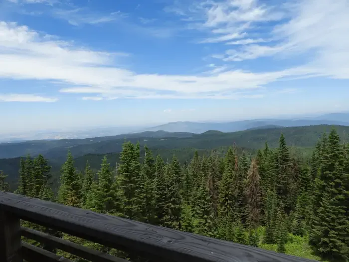 Lookout Butte LookoutCampingPhoto: Recreation.gov (RIDB) / public domain6 mi
- Rocky BluffCamping7.3 mi
- Adams Ranger StationCamping9.1 mi
Source: Roamze catalog (indexable pages within 10 miles, PostGIS distance)
- Hanover Creek Trail #90Hiking · Next door
- VAN BUREN CREEKHiking · ~6 min drive
- JACKSON RIDGEHiking · ~8 min drive
- Rubie Creek TrailHiking · ~8 min drive
- Florence-Moores TrailHiking · Next door
- Hanover Mountain TrailHiking · ~8 min drive
- Knob Lakes TrailHiking · ~11 min drive
- Black Bute Lookout TrailHiking · ~10 min drive
- Lovell Gulch TrailHiking · ~5 min drive
- TELEPHONE RIDGEHiking · ~12 min drive
Route details
- Distance
- 4.2 mi round trip
- Climbing
- About 3,650 ft
- Summit
- 7,972 ft
- Difficulty
- Expert
- Time
- About 2.5 hours
Hazards
- Creek crossings
- Muddy conditions
- Wildlife encounters
- Afternoon thunderstorms
Season
Season: Spring, summer, fall.
Spring offers flowing creek water and emerging vegetation, while fall provides colorful foliage along the creek corridor.
Other routes up Hanover Mountain
Questions about this route
How long is the HANOVER CREEK on Hanover Mountain?
About 4.2 mi round trip.
How much elevation gain is on the HANOVER CREEK?
About 3,650 ft of climbing round trip.
How hard is the HANOVER CREEK?
It is rated expert.
How long does the HANOVER CREEK take?
About 2.5 hours round trip.
When is the best time for the HANOVER CREEK?
Spring, summer, fall.
How many routes go up Hanover Mountain?
2: Hanover Creek Trail #90 and HANOVER CREEK.
