Grizzly Basin
- 3.4 mi
- round trip
- 1,352 ft
- climb
- 6,100 ft
- high point
- Out and back
- route
- May–Sep
- best months
Is Grizzly Basin open right now?
Alert in the area
The Forest Service lists 5 alerts for Payette National Forest.
Over Snow Vehicle Closure
Agency alert covering Payette National Forest · Order 0412-638 · USFS · Payette National Forest
Brundage Mountain Resort Snowcat Route Closure
Agency alert covering Payette National Forest · Order 0412-637 · USFS · Payette National Forest
Lost Valley Log Hauling
Agency alert covering Payette National Forest · USFS · Payette National Forest
Granite Mountain Over Snow Vehicle Closure
Agency alert covering Payette National Forest · Order 0412-635 · USFS · Payette National Forest
Gordon Titus Upper Elevation Parking Lot Winter Restrictions
Agency alert covering Payette National Forest · Order 0412-543 · USFS · Payette National Forest
As of · Source: USFS · Payette National Forest. Agencies don't list every closure — check before you go.
Grizzly Basin is a moderate hike in the Weiser Ranger District of Idaho's Payette National Forest, about 3.4 miles long with a one-way elevation gain of 1,352 feet. The trail starts at roughly 4,728 feet and climbs to about 6,100 feet, and it is an out-and-back route. The trail is on natural surface, and it is open to both horses and bikes, according to the USDA Forest Service's trail records. The Forest Service manages the land. Summer is the most comfortable time to go. Typical averages from the nearby McCall weather station show July and August highs around 81°F with only about five wet days a month, while winter brings highs near freezing and regular snow days. Several other hikes lie within a few miles, including Calamity Creek, Cow Creek and the Weiser/Council Boundary Trail. For an overnight stay, Buck Park Cabin is about 7 miles away.
Local outfitters
- Cornucopia Lodge & Packstation25 mi away
- Black Bear RV Park32 mi away
Not on Roamze yet. Their page has how to reach them.
Best time to go · May–Sep
Best time to visit Grizzly Basin
Best months: May–September. Best months have typical highs of 55–85 °F, lows of 30 °F or warmer (32 °F where the station doesn't record snow), at most one snowy day and no more than 12 wet days.
Jan
31° / 13°
14 wet · 11 snow
Feb
36° / 14°
12 wet · 9 snow
Mar
43° / 20°
13 wet · 7 snow
Apr
51° / 27°
12 wet · 3 snow
May
61° / 35°
12 wet · 1 snow
Jun
70° / 40°
10 wet
Jul
81° / 45°
5 wet
Aug
81° / 43°
5 wet
Sep
72° / 36°
6 wet
Oct
57° / 28°
9 wet · 2 snow
Nov
40° / 21°
13 wet · 7 snow
Dec
30° / 13°
15 wet · 12 snow
Typical high / low (°F) and days with rain or snow, 1991–2020. Measured at Mccall, ID, 31.2 mi away at 5,025 ft. The station sits about 1,100 ft lower than this place, so expect it a little cooler here. Source: NOAA NCEI U.S. Climate Normals 1991–2020.
Keep exploring — more trails worth the drive
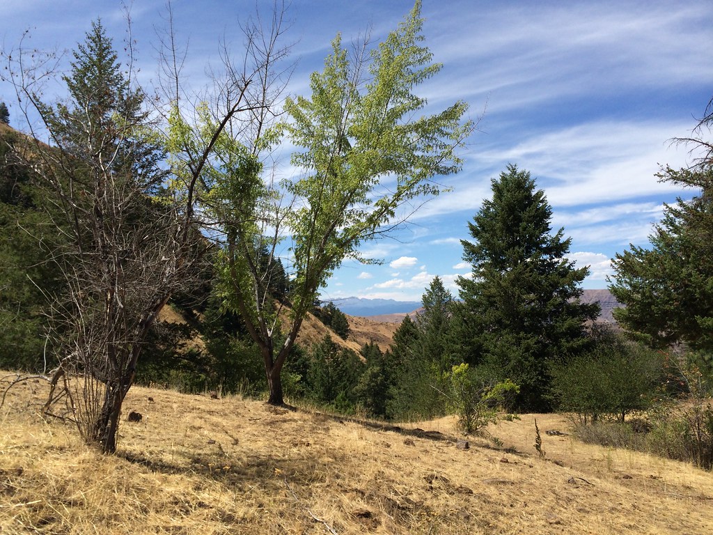 Photo: Sam Beebe, CC BY 2.0 (via Flickr)
DUKES CREEK-STARVEOUT CREEK
~19 min drive
10.54-mile out-and-back trail in Idaho with 5,047 ft elevation gain/loss
HIKE
WEISER/COUNCIL BOUNDARY TRAIL
~5 min drive
9.3-mile out-and-back trail in Idaho with 3,496 ft elevation gain and loss
HIKE
CALAMITY CREEK
~5 min drive
4.16-mile out-and-back trail in Idaho with 1,419 ft elevation gain and loss.
HIKE
Weiser River Trail
~15 min drive
1.4-mile out-and-back trail along the Weiser River in Idaho.
HIKE
E/F PINE CREEK
~12 min drive
15.88-mile out-and-back trail in Idaho with 3,915 ft elevation gain and loss.
HIKE
Big Flat
~5 min drive
3.20-mile out-and-back trail in Idaho with 1,610 ft elevation gain.
HIKE
Cow Creek
~5 min drive
4.88-mile out-and-back trail in Idaho with 179 ft gain and 1,493 ft loss.
HIKE
MILL CREEK
~18 min drive
2.86-mile out-and-back trail in Idaho with 905 ft gain and 5,070 ft max elevation.
HIKE
SHEEP CREEK
~28 min drive
16.7-mile out-and-back trail in Idaho with 5,231 ft elevation gain and loss.
HIKE
Rush Creek
~12 min drive
17.29-mile out-and-back trail in Idaho with 2,729 ft of elevation gain.
