Fox Prairie
- 3.4 mi
- round trip
- 957 ft
- climb
- 7,029 ft
- high point
- Out and back
- route
Is Fox Prairie open right now?
Alert in the area
The Forest Service lists 5 alerts for Payette National Forest.
Over Snow Vehicle Closure
Agency alert covering Payette National Forest · Order 0412-638 · USFS · Payette National Forest
Brundage Mountain Resort Snowcat Route Closure
Agency alert covering Payette National Forest · Order 0412-637 · USFS · Payette National Forest
Lost Valley Log Hauling
Agency alert covering Payette National Forest · USFS · Payette National Forest
Granite Mountain Over Snow Vehicle Closure
Agency alert covering Payette National Forest · Order 0412-635 · USFS · Payette National Forest
Gordon Titus Upper Elevation Parking Lot Winter Restrictions
Agency alert covering Payette National Forest · Order 0412-543 · USFS · Payette National Forest
As of · Source: USFS · Payette National Forest. Agencies don't list every closure — check before you go.
Fox Prairie is a moderate out-and-back hike in Idaho's Payette National Forest, within the Weiser Ranger District. The trail is about 3.4 miles long, with a one-way elevation gain of 957 feet, taking you from a low point of about 5,931 feet to a high of about 7,029 feet. The route is on natural surface, and it is open to both horses and bikes, so riders and pack animals can join the trip. The Forest Service manages the land, and the trail is open year-round. For a shorter outing, Cracker Jack Creek lies about a mile away. Big Flat and the Upper Camp Creek Trail are each roughly 3 miles off, and Buck Park Cabin offers a place to stay about 3.5 miles from the trail.
Local outfitters
- Cornucopia Lodge & Packstation20 mi away
- Black Bear RV Park34 mi away
Not on Roamze yet. Their page has how to reach them.
Keep exploring — more trails worth the drive
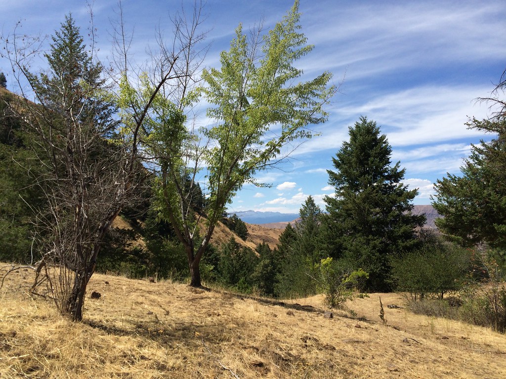 Photo: Sam Beebe, CC BY 2.0 (via Flickr)
DUKES CREEK-STARVEOUT CREEK
~12 min drive
10.54-mile out-and-back trail in Idaho with 5,047 ft elevation gain/loss
HIKE
CRACKER JACK CREEK
~2 min drive
6.62-mile out-and-back trail in Idaho with 1,737 ft elevation gain and loss.
HIKE
Big Flat
~5 min drive
3.20-mile out-and-back trail in Idaho with 1,610 ft elevation gain.
HIKE
Upper Camp Creek Trail
~5 min drive
1.60-mile out-and-back trail in Idaho with 240 ft elevation gain.
HIKE
E/F PINE CREEK
~6 min drive
15.88-mile out-and-back trail in Idaho with 3,915 ft elevation gain and loss.
HIKE
Cow Creek
~6 min drive
4.88-mile out-and-back trail in Idaho with 179 ft gain and 1,493 ft loss.
HIKE
E/F BROWNLEE CREEK
~6 min drive
6.06-mile out-and-back trail in Idaho with 3,519 ft elevation gain.
HIKE
MILL CREEK
~15 min drive
2.86-mile out-and-back trail in Idaho with 905 ft gain and 5,070 ft max elevation.
HIKE
CALAMITY CREEK
~6 min drive
4.16-mile out-and-back trail in Idaho with 1,419 ft elevation gain and loss.
HIKE
CAMP CREEK
~6 min drive
7.14-mile out-and-back trail in Idaho with 3,121 ft elevation gain.
