Bonneville
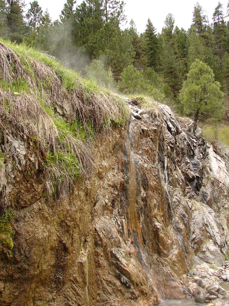 Photo: Fokket, CC BY 2.0 (via Flickr)
- 1.2 mi
- round trip
- 551 ft
- climb
- 5,219 ft
- high point
- Out and back
- route
- May–Jun, Sep
- best months
Is Bonneville open right now?
Closure in the area
There's a closure order in Boise National Forest. It doesn't name Bonneville, so check the source for the area it covers.
UPDATED Sept. 19 - Crooked Fire Area, Road, and Trail Closure
Agency closure covering Boise National Forest · Order 0402-03-140 · USFS · Boise National Forest
Lava Fire Road Closure
Agency alert covering Boise National Forest · Order 0402-06-84 · USFS · Boise National Forest
As of · Source: USFS · Boise National Forest. Agencies don't list every closure — check before you go.
Bonneville is an easy out-and-back hike in the Lowman Ranger District of Boise National Forest in Idaho, about 1.16 miles long with a one-way elevation gain of 551 feet. The trail rises from a low point of 4,685 feet to a high of 5,219 feet. The route is natural-surface and allows both bikes and horses, making it a flexible option for riders and pack animals. The Forest Service manages the land. Summer and early fall are the most comfortable times to go. Typical averages from a nearby weather station in Lowman put June highs around 77°F and September highs near 76°F, though that station sits well below the trail, so temperatures up high run cooler. The Chapman Scenic hike starts about 1.1 miles away, and Warm Springs Guard Station campground is about 1.2 miles off. Ten Mile Ridge and Jackson Peak lie roughly 4.5 and 5.9 miles away.
Local outfitters
- Camp Perkins28 mi away
- Riverpond Campground33 mi away
Not on Roamze yet. Their page has how to reach them.
Best time to go · May–Jun, Sep
Best time to visit Bonneville
Best months: May–June and September. Best months have typical highs of 55–85 °F, lows of 30 °F or warmer (32 °F where the station doesn't record snow), at most one snowy day and no more than 12 wet days.
Jan
34° / 16°
Feb
40° / 17°
Mar
49° / 25°
Apr
56° / 30°
May
68° / 35°
Jun
77° / 41°
Jul
87° / 45°
Aug
86° / 42°
Sep
76° / 37°
Oct
61° / 28°
Nov
43° / 22°
Dec
33° / 16°
Typical high / low (°F) and days with rain or snow, 1991–2020. Measured at Lowman, ID, 16 mi away at 3,920 ft. The station sits about 1,300 ft lower than this place, so expect it a little cooler here. This station doesn't record snowfall. Source: NOAA NCEI U.S. Climate Normals 1991–2020.
Keep exploring — more trails worth the drive
 Photo: Sam Beebe, CC BY 2.0 (via Flickr)
North Fork Boise River
~15 min drive
4.94-mile out-and-back trail on the North Fork Boise River in Idaho.
HIKE
Observation Peak
~19 min drive
2.41-mile out-and-back trail to Observation Peak in Idaho with 1,013 ft gain.
 Photo: Fredlyfish4 at English Wikipedia, Public domain (via Wikimedia Commons)
Alpine Way Trail
~22 min drive
35.46-mile out-and-back trail in Idaho with 1,745 ft elevation gain.
Photo: Fredlyfish4 at English Wikipedia, Public domain (via Wikimedia Commons)Iron Creek-Stanley Lake Trail
~24 min drive
1.16-mile out-and-back trail with 162 ft gain and loss, reaching 6,593 ft.
HIKE
Wapiti Creek Trail
~11 min drive
13.78-mile out-and-back trail in Idaho with 5,489 ft gain/loss.
 Photo: Eddie Yip, CC BY-SA 2.0 (via Flickr)
KIRKHAM RIDGE
~20 min drive
3.16-mile out-and-back trail in Idaho with 2,063 ft elevation gain and loss.
HIKE
Ten Mile Ridge
~8 min drive
22.46-mile out-and-back trail on Ten Mile Ridge in Idaho with 6,381 ft gain.
HIKE
Catpaw Lake
~14 min drive
0.62-mile out-and-back trail to Catpaw Lake in Idaho with 177 ft of elevation gain.
HIKE
Trail Creek Trail
~14 min drive
10.68-mile out-and-back trail in Idaho with 2,810 ft gain.
Photo: Fredlyfish4 at English Wikipedia, Public domain (via Wikimedia Commons)ELK MOUNTAIN
~23 min drive
7.12-mile out-and-back trail in Idaho with 626 ft gain and 7,120 ft max elevation.
