Porcupine Springs Cg
Campground
Campground · < 0.1 mi from the trail
Alert in the area
The Forest Service lists 4 alerts for Sawtooth National Forest.
Paradise Prescribed Burn Restricted Access
Agency alert covering Sawtooth National Forest · USFS · Sawtooth National Forest
Grandjean Area, Road, and Trail Closure
Agency alert covering Sawtooth National Forest · Order 0414-04-165 · USFS · Sawtooth National Forest
Over-Snow Vehicle and Bicycle Prohibitions
Agency alert covering Sawtooth National Forest · Order 0414-00-028 · USFS · Sawtooth National Forest
Occupancy and Use - Food Storage
Agency alert covering Sawtooth National Forest · Order 0414-04-143 · USFS · Sawtooth National Forest
As of · Source: USFS · Sawtooth National Forest. Agencies don't list every closure — check before you go.
Porcupine Springs Campground is a developed campground composed of 12 individual units and 3 group units. One group area can accommodate up to 100 people and 1 group area can accommodate up to 50 people. This is a fee campground and reservations are required for group camping only. Fee envelopes and a collection box are provided near the campground entrance. This area is suitable for trailer and tent camping and it is accessible for a season that varies usually between June and September. Campground amenities include water faucets, toilets, and an accessible Stock Transfer Station. Little Fork Trailhead (#163) is located at the campground and is an easy multi-use trail that accesses an extensive trail system. There is an additional trailhead at the end of Forest Road 504. Loop A is composed of 4 single and 2 double sites and one 2 unit toilet. Loop B is composed of 3 single sites, 3 double sites, one 2 unit toilet, and a horseman area. Loop C is composed of 3 single and 3 double sites and one 2 unit toilet. Loop D is composed of 18 new family units with faucets, and two 2 unit accessible toilets. The parking lot can accommodate up to 8 RVs.
Porcupine Springs Cg
Campground
Oakley Valley Historical Museum
Museum
Places © OpenStreetMap contributors, Places © Overture Maps Foundation
More in OakleyNot on Roamze yet. Their page has how to reach them.
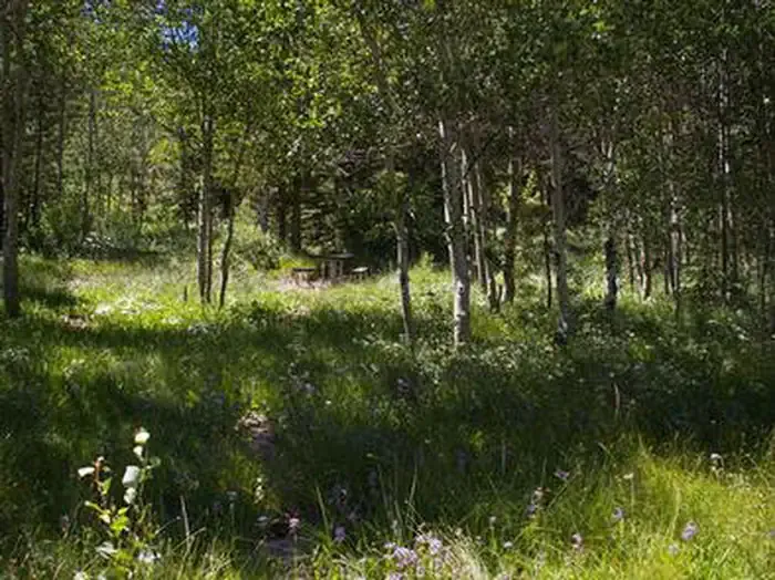 Lower PenstemonCampingPhoto: Recreation.gov (RIDB) / public domain2.3 mi
Source: Roamze catalog (indexable pages within 10 miles, PostGIS distance)
Best months: May–June and September. Best months have typical highs of 55–85 °F, lows of 30 °F or warmer (32 °F where the station doesn't record snow), at most one snowy day and no more than 12 wet days.
Jan
35° / 13°
8 wet
Feb
39° / 16°
7 wet
Mar
49° / 24°
7 wet
Apr
57° / 29°
9 wet
May
66° / 37°
10 wet
Jun
77° / 44°
7 wet
Jul
88° / 51°
5 wet
Aug
87° / 49°
5 wet
Sep
77° / 41°
4 wet
Oct
62° / 29°
5 wet
Nov
46° / 20°
7 wet
Dec
35° / 13°
8 wet
Typical high / low (°F) and days with rain or snow, 1991–2020. Measured at Grouse Creek, UT, 37.2 mi away at 5,320 ft. The station sits about 1,600 ft lower than this place, so expect it a little cooler here. This station doesn't record snowfall. Source: NOAA NCEI U.S. Climate Normals 1991–2020.
