Pettit Campground
Campground
Campground · 0.3 mi from the trail
Summit elevation
7,376 ft
Base elevation
6,700 ft
Vertical drop
676 ft
Magic Mountain Resort
Idaho
Data © OpenStreetMap contributors, available under the Open Database License (ODbL). View or edit on OpenStreetMap.
Pettit Campground
Campground
Oakley Valley Historical Museum
Museum
Places © OpenStreetMap contributors
More in OakleyActive alerts for Sawtooth National Forest as of Oct 9, 2026:
Stinson Creek Prescribed Burn Restricted Access
caution · posted Oct 5, 2026
Public Safety – Occupancy and Use
information · posted Sep 11, 2026
Occupancy and Use - Food Storage
caution · posted Aug 24, 2026
information · posted Aug 24, 2026
Hemingway-Boulders and Cecil D. Andrus-White Clouds Wilderness Areas - Occupancy and Use
information · posted Aug 24, 2026
Sawtooth Wilderness Area Occupancy and Use
information · posted Aug 24, 2026
Over-Snow Vehicle and Bicycle Prohibitions
caution · posted Aug 24, 2026
Sawtooth National Recreation Area - Occupancy and Use
information · posted Aug 24, 2026
Boating, Swimming, and Salmon River Corridor Use Prohibitions
information · posted Aug 24, 2026
information · posted Aug 24, 2026
Source: USFS forest alerts
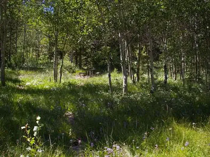 Lower PenstemonCampingPhoto: Recreation.gov (RIDB) / public domain0.6 mi
Source: Roamze catalog (indexable pages within 10 miles, PostGIS distance)
Alert in the area
The Forest Service lists 4 alerts for Sawtooth National Forest.
Paradise Prescribed Burn Restricted Access
Agency alert covering Sawtooth National Forest · USFS · Sawtooth National Forest
Grandjean Area, Road, and Trail Closure
Agency alert covering Sawtooth National Forest · Order 0414-04-165 · USFS · Sawtooth National Forest
Over-Snow Vehicle and Bicycle Prohibitions
Agency alert covering Sawtooth National Forest · Order 0414-00-028 · USFS · Sawtooth National Forest
Occupancy and Use - Food Storage
Agency alert covering Sawtooth National Forest · Order 0414-04-143 · USFS · Sawtooth National Forest
As of · Source: USFS · Sawtooth National Forest. Agencies don't list every closure — check before you go.
Tell Roamze when you're going and who's coming. It plans the days, gear and food around this place.
Map and trail data © OpenStreetMap contributors
