Boundary
Campground
Campground · < 0.1 mi from the trail
Alert in the area
The Forest Service lists 4 alerts for Sawtooth National Forest.
Paradise Prescribed Burn Restricted Access
Agency alert covering Sawtooth National Forest · USFS · Sawtooth National Forest
Grandjean Area, Road, and Trail Closure
Agency alert covering Sawtooth National Forest · Order 0414-04-165 · USFS · Sawtooth National Forest
Over-Snow Vehicle and Bicycle Prohibitions
Agency alert covering Sawtooth National Forest · Order 0414-00-028 · USFS · Sawtooth National Forest
Occupancy and Use - Food Storage
Agency alert covering Sawtooth National Forest · Order 0414-04-143 · USFS · Sawtooth National Forest
As of · Source: USFS · Sawtooth National Forest. Agencies don't list every closure — check before you go.
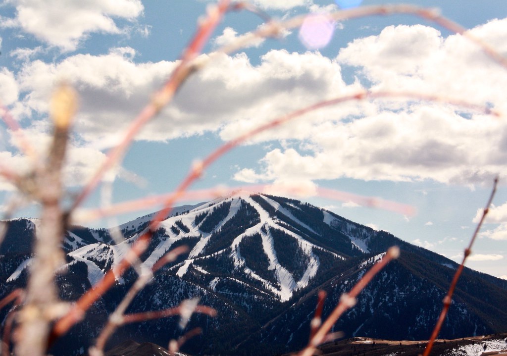
Boundary Campground is a developed, fee, non-reservation campground composed of 9 campsites located on Trail Creek approximately 2 miles northeast of the Sun Valley Resort Village. The 4-unit Boundary Picnic Area is adjacent to the campground and shares a vault toilet and hand pump for drinking water with it. The campground and picnic area are open the Friday before Memorial Day to September 30 annually. Amenities include drinking water from a hand pump; 2 vault toilets; refuse service; and a fire ring, grill stand, and picnic table in each site. Campsites also have a designated location to pitch a tent. Camp and picnic sites have hardened aprons allowing wheelchair access. Access roads and parking spurs are gravel. Toilets are ADA-accessible. Dogs must be leashed in the campground and picnic area, and their solid waste picked up and disposed of properly. Stock is not permitted. Campsites 1 and 7 are double units. Stay limit is 3 days and check-out time is 2:00 pm. The campground and picnic area are mostly open with large cottonwood trees providing intermittent shade. The campground has beautiful views of Bald Mountain Ski Area to the west.
Boundary
Campground
Sun Valley Museum of Art
Museum
Places © OpenStreetMap contributors, Places © Overture Maps Foundation
More in KetchumNot on Roamze yet. Their page has how to reach them.
 Trail CreekHikingPhoto: ArtBrom, CC BY-SA 2.0 (via Flickr)0.1 miProctor MountainHikingPhoto: ArtBrom, CC BY-SA 2.0 (via Flickr)0.6 mi
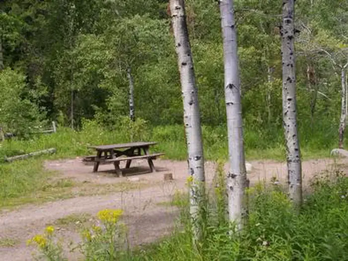 North Fork (id)CampingPhoto: Recreation.gov (RIDB) / public domain6.8 mi
Source: Roamze catalog (indexable pages within 10 miles, PostGIS distance)
Best months: May–September. Best months have typical highs of 55–85 °F, lows of 30 °F or warmer (32 °F where the station doesn't record snow), at most one snowy day and no more than 12 wet days.
Jan
31° / 8°
10 wet · 9 snow
Feb
35° / 11°
9 wet · 7 snow
Mar
43° / 19°
8 wet · 5 snow
Apr
52° / 27°
7 wet · 2 snow
May
62° / 35°
8 wet
Jun
70° / 40°
7 wet
Jul
80° / 45°
5 wet
Aug
79° / 43°
4 wet
Sep
69° / 36°
4 wet
Oct
56° / 28°
5 wet · 1 snow
Nov
41° / 17°
7 wet · 4 snow
Dec
30° / 9°
10 wet · 9 snow
Typical high / low (°F) and days with rain or snow, 1991–2020. Measured at Ketchum Rs, ID, 3.1 mi away at 5,890 ft. Source: NOAA NCEI U.S. Climate Normals 1991–2020.