Dicks Creek Dispersed Area
- Mar–May, Aug–Nov
- best months
Caution at last check
Agency alerts are in effect for this area; weather is good · USFS, OpenWeather · checked 13 h ago
Is Dicks Creek Dispersed Area open right now?
Closure in the area
There's a closure order in Chattahoochee-Oconee National Forests. It doesn't name Dicks Creek Dispersed Area, so check the source for the area it covers (4 listed).
Bear Creek Road, FS 241, Temporarily Closed
Agency closure covering Chattahoochee-Oconee National Forests · USFS · Chattahoochee-Oconee National Forests
Prescribed fire on Oconee Ranger District at Jasper County
Agency closure covering Chattahoochee-Oconee National Forests · USFS · Chattahoochee-Oconee National Forests
Muskrat Road, FS 218, Temporarily Closed
Agency closure covering Chattahoochee-Oconee National Forests · USFS · Chattahoochee-Oconee National Forests
Flash Flood Awareness
Agency closure covering Chattahoochee-Oconee National Forests · USFS · Chattahoochee-Oconee National Forests
Lake Winfield Scott closed except fishing pier
Agency alert covering Chattahoochee-Oconee National Forests · USFS · Chattahoochee-Oconee National Forests
As of · Source: USFS · Chattahoochee-Oconee National Forests. Agencies don't list every closure — check before you go.
- At 1,793 ft
- Blue Ridge Ranger DistrictChattahoochee-Oconee National Forests · Chestatee Wildlife Management Area
Dicks Creek Dispersed Area offers 80 primitive camping sites managed by the U.S. Forest Service across a scenic Georgia forest setting, operating on a first-come, first-served basis. This dispersed campground is ideal for visitors seeking a rustic, self-sufficient camping experience away from developed facilities, with access to nearby hiking, fishing, and forest exploration throughout the surrounding national forest lands.
Local outfitters
- North Georgia Ultimate Canopy Tours25 mi away
- Hiwassee Outfitters47 mi away
Not on Roamze yet. Their page has how to reach them.
Best time to go · Mar–May, Aug–Nov
Best time to visit Dicks Creek Dispersed Area
Best months: March–May and August–November. Best months have typical highs of 55–85 °F, lows of 30 °F or warmer (32 °F where the station doesn't record snow), at most one snowy day and no more than 12 wet days.
Jan
49° / 25°
12 wet
Feb
53° / 28°
12 wet
Mar
60° / 34°
12 wet
Apr
69° / 41°
11 wet
May
76° / 50°
12 wet
Jun
82° / 58°
13 wet
Jul
85° / 62°
13 wet
Aug
84° / 61°
12 wet
Sep
80° / 55°
9 wet
Oct
70° / 43°
10 wet
Nov
61° / 33°
10 wet
Dec
52° / 29°
12 wet
Typical high / low (°F) and days with rain or snow, 1991–2020. Measured at Blairsville Exp Stn, GA, 11.9 mi away at 1,949 ft. This station doesn't record snowfall. Source: NOAA NCEI U.S. Climate Normals 1991–2020.
Closures we've recorded since August 2026
Spring 2026 Forest-wide Fire Restrictions
Chattahoochee-Oconee National Forests · Order dated April 23, 2026; seen Aug 23, 2026 → lifted Oct 13, 2026 · Forest Service
Facts about this campground
Keep exploring — more campsites worth the drive
 Photo: Bas van Oorschot, CC BY-SA 3.0 (via Wikimedia Commons)
DeSoto Falls Campground
~4 min drive
Forested Georgia campground near waterfalls and mountain streams.
BED
Lake Winfield Scott Recreation Area
~8 min drive
 Photo: Chanilim714, CC BY-SA 3.0 (via Wikimedia Commons)
A.T. Gooch Mountain Shelter
~11 min drive
Rustic U.S. Forest Service shelter camping on Georgia's Appalachian Trail.
 Photo: Scott Long, CC BY 3.0 (via Wikimedia Commons)
Camp Hidden Lake
~14 min drive
Georgia campground near water recreation with reservable sites.
 Photo: Dsdugan, CC0 (via Wikimedia Commons)
Bear Ridge Group Camp
~18 min drive
Georgia group campground offering reservable sites for organized gatherings.
BED
Desoto Falls Rec. Area
~3 min drive
Desoto Falls Rec. Area has 120 sites in Georgia.
BED
Dockery Lake Campground
~4 min drive
Small, intimate Georgia lake campground with 11 sites for fishing and water recreation.
BED
Dockery Lake Rec. Area
~4 min drive
BED
Turners Corner Campground
~4 min drive
Georgia campground offering outdoor recreation access in a natural setting.
BED
Lance Creek Campsite
~6 min drive
Lance Creek Campsite is a campground in Georgia.
Also worth it near here
 Photo: Thomsonmg2000, CC0 (via Wikimedia Commons)
DeSoto Falls
~5 min drive
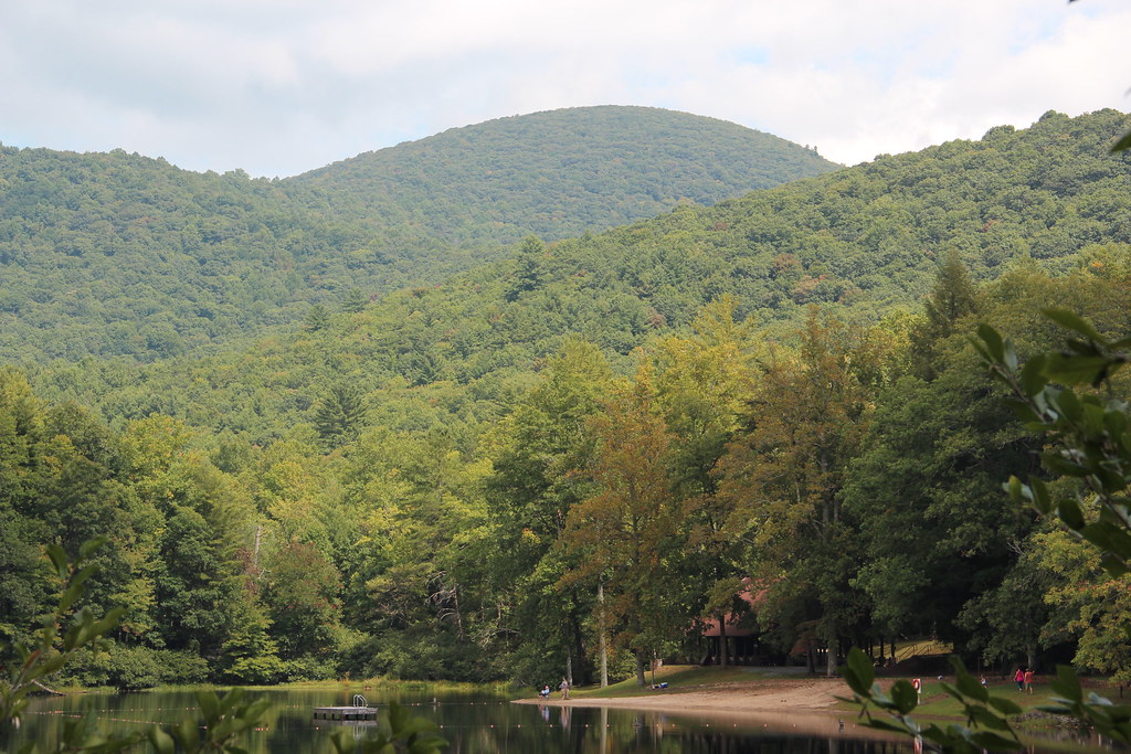 Photo: Thomson20192, Public Domain Dedication (CC0) (via Flickr)
Jarrard Gap
~6 min drive
 Photo: Thomson200, CC0 (via Wikimedia Commons)
Blood Mountain
~7 min drive
 Photo: Thomsonmg2000, CC0 (via Wikimedia Commons)
Tesnatee Gap Trail
~10 min drive
