Tosohatchee Wildlife Management Area Trail
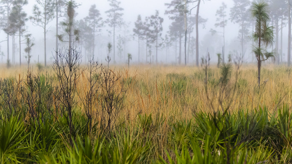
 Photo: FartyBoi, CC BY-SA 4.0 (via Wikimedia Commons)
- 25.8 mi
- one way
- 10 ft
- climb
- 39 ft
- high point
- Point to point
- route
- Oct–May
- best months
The Tosohatchee Wildlife Management Area Trail is a 25.8-mile point-to-point route through Florida's Tosohatchee Wildlife Management Area, managed by State Fish and Wildlife. The trail is rated easy, with an elevation gain of about 10 feet, and it is open to both horses and bikes. The route runs from a low point of about 7 feet to a high of about 39 feet, with the steepest stretch at about 5% grade near mile 7.3. Winter and early spring are the most comfortable times to go. Typical averages from a nearby weather station in Titusville show January highs around 69°F and lows near 50°F, while summer brings highs near 90°F and more frequent wet days. Paddlers can reach the Saint Johns River about 7.5 miles away, and the Seminole Ranch Conservation Area Trail is about 7.7 miles off.
Local outfitters
Not on Roamze yet. Their page has how to reach them.
Source: Roamze catalog (indexable pages within 10 miles, PostGIS distance)
 Pioneer Village TrailHiking · ~58 min drivePhoto: mededeler, CC BY 2.0 (via Flickr)
 Wekiwa Volksmarch TrailHiking · ~1h 6m drivePhoto: gary_leavens, CC BY-SA 2.0 (via Wikimedia Commons)
- Deseret Ranch TrailHiking · ~40 min drive
 Longhorn Steakhouse LoopHiking · ~59 min drivePhoto: k7hpn, CC BY 2.0 (via Flickr)
 Red Blaze TrailHiking · ~21 min drivePhoto: gary_leavens, CC BY-SA 2.0 (via Flickr)
- Wekiwa Main Hiking TrailHiking · ~1h 5m drivePhoto: gary_leavens, CC BY-SA 2.0 (via Wikimedia Commons)
- White Blaze TrailHiking · ~20 min drive
 Lower Wekiva River Preserve State Park TrailHiking · ~1h 6m drivePhoto: gary_leavens, CC BY-SA 2.0 (via Flickr)
- Yellow Blaze TrailHiking · ~20 min drive
- Wekiwa East-WestHiking · ~1h 6m drivePhoto: gary_leavens, CC BY-SA 2.0 (via Wikimedia Commons)
Best time to visit Tosohatchee Wildlife Management Area Trail
Best months: October–May. Best months have typical highs of 55–85 °F, lows of 30 °F or warmer (32 °F where the station doesn't record snow), at most one snowy day and no more than 12 wet days.
Jan
69° / 50°
8 wet
Feb
71° / 53°
6 wet
Mar
75° / 57°
7 wet
Apr
79° / 63°
6 wet
May
84° / 69°
8 wet
Jun
88° / 73°
13 wet
Jul
90° / 74°
14 wet
Aug
89° / 75°
15 wet
Sep
87° / 74°
14 wet
Oct
83° / 69°
10 wet
Nov
76° / 61°
7 wet
Dec
71° / 54°
8 wet
Typical high / low (°F) and days with rain or snow, 1991–2020. Measured at Titusville, FL, 13.3 mi away at 16 ft. Source: NOAA NCEI U.S. Climate Normals 1991–2020.

