Pioneer Village Trail
 Photo: mededeler, CC BY 2.0 (via Flickr)
- 0.5 mi
- round trip
- 19 ft
- climb
- 80 ft
- high point
- Out and back
- route
- Oct–Apr
- best months
Pioneer Village Trail is a short, easy walk in Shingle Creek Regional Park, on county land in Florida. The trail runs about 0.9 miles out and back, with an elevation gain of about 19 feet, so it's a flat, low-rise outing that makes for a quick stop on a longer day at the park. The trail starts at about 80 feet and reaches a high point of 80 feet, which makes the whole route nearly level. The steepest part comes at about 0.4 miles in, with a grade of around 2 percent. That small rise and fall make the hike a simple addition to a visit to the park, and it takes about half an hour to complete. Winter and early spring are the most comfortable times to go. Typical averages from a nearby weather station in Kissimmee show January highs around 72°F with lows near 48°F, and March highs around 78°F. Summer is hotter and wetter, with highs near 90°F and 15 to 17 wet days a month in June through September. Nearby, Countyline is about 2 miles away, and the Walking Path is about 5 miles out. Climbers can head to Lion King Boulders, about 6 miles away, and Lake Tohopekaliga offers fishing roughly 8 miles from the trail.
Local outfitters
Not on Roamze yet. Their page has how to reach them.
Best time to go · Oct–Apr
Best time to visit Pioneer Village Trail
Best months: October–April. Best months have typical highs of 55–85 °F, lows of 30 °F or warmer (32 °F where the station doesn't record snow), at most one snowy day and no more than 12 wet days.
Jan
72° / 48°
7 wet
Feb
74° / 51°
6 wet
Mar
78° / 54°
6 wet
Apr
83° / 60°
6 wet
May
87° / 66°
9 wet
Jun
90° / 72°
15 wet
Jul
91° / 74°
17 wet
Aug
91° / 74°
17 wet
Sep
90° / 73°
14 wet
Oct
85° / 66°
9 wet
Nov
79° / 57°
6 wet
Dec
73° / 52°
7 wet
Typical high / low (°F) and days with rain or snow, 1991–2020. Measured at Kissimmee 2, FL, 3.4 mi away at 60 ft. Source: NOAA NCEI U.S. Climate Normals 1991–2020.
Keep exploring — more trails worth the drive
 Photo: k7hpn, CC BY 2.0 (via Flickr)
Longhorn Steakhouse Loop
~12 min drive
0.48-mile out-and-back trail in Florida with 13 ft of elevation gain.
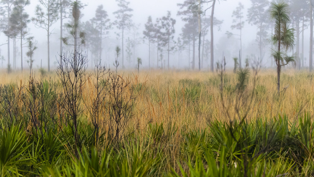 Photo: gary_leavens, CC BY-SA 2.0 (via Flickr)
Red Blaze Trail
~41 min drive
6.07-mile loop in Florida with 100 ft elevation gain.
HIKE
Deseret Ranch Trail
~1h drive
19.11-mile out-and-back trail in Florida with 126 ft gain.
 Photo: gary_leavens, CC BY-SA 2.0 (via Wikimedia Commons)
Wekiwa Main Hiking Trail
~47 min drive
8.2-mile point-to-point trail through Wekiwa Springs State Park's diverse ecosystems.
Photo: gary_leavens, CC BY-SA 2.0 (via Wikimedia Commons)Wekiwa Volksmarch Trail
~48 min drive
5-mile point-to-point trail in Florida with 343 ft elevation gain.
Photo: gary_leavens, CC BY-SA 2.0 (via Wikimedia Commons)Wekiwa East-West
~48 min drive
1.12-mile point-to-point trail in Florida with 61 ft gain.
HIKE
Yellow Blaze Trail
~40 min drive
5.84-mile loop trail in Florida with 102 ft gain.
 Photo: FartyBoi, CC BY-SA 4.0 (via Wikimedia Commons)
Tosohatchee Wildlife Management Area Trail
~58 min drive
25.78-mile point-to-point trail in Florida with 512 ft elevation gain
HIKE
White Blaze Trail
~41 min drive
A 4.60-mile point-to-point Florida trail with clear white blaze markings.
 Photo: gary_leavens, CC BY-SA 2.0 (via Flickr)
Lower Wekiva River Preserve State Park Trail
~59 min drive
0.65-mile out-and-back trail on the Wekiva River in Florida.
Map and trail data © OpenStreetMap contributors
