Sun Ridge Resort
Campground
Campground · 4.3 mi from the trail
Half Hill is a summit in Connecticut, rising to 547 feet about 2 miles from the town of Danielson. It sits right beside a cluster of climbing areas, with Party Wall, Roof Wall (aka Name Wall) and Ross Rocks all about 0.1 mile away. That makes it an easy addition to a day spent on the rock. Summer is the most comfortable time to visit. Typical averages from a nearby weather station show July highs around 80°F with lows near 61°F, while winter brings highs in the low to mid 30s and several snowy days a month from December through February. The Old Furnace Trail lies about 0.6 mile away, and the Sugar Brook Loop Trail is roughly 5.6 miles off. Across the state line in Rhode Island, the Moosup River offers canoeing about 5.8 miles away, and the Quinebaug Trail is about 6.9 miles from the summit.
Sun Ridge Resort
Campground
 If it rainsMagicpiano, CC BY-SA 3.0 · Wikimedia Commons
Paine House Museum
Museum
Places © OpenStreetMap contributors, Places © Overture Maps Foundation · Photos: Magicpiano, CC BY-SA 3.0 (commons)
More in DanielsonDaily highs and lows, wind and the chance of precipitation at the summit and route start for the next 7 days, from the Open-Meteo model.
Elevation from USGS 3D Elevation Program terrain data (about 10 m resolution).
547 ft (167 m).
One: Old Furnace Trail.
 Moosup RiverCanoeingPhoto: Morrowlong, CC BY-SA 4.0 (via Wikimedia Commons)5.8 mi
Source: Roamze catalog (indexable pages within 10 miles, PostGIS distance)
 Jerimoth HillSummit · ~12 min drivePhoto: Khoule23 at English Wikipedia, Public domain (via Wikimedia Commons)
 Cochegan RockSummit · ~43 min drivePhoto: Unknown authorUnknown author, Public domain (via Wikimedia Commons)
 Fox HillSummit · ~52 min drivePhoto: Elipongo, Public domain (via Wikimedia Commons)
 Peaked MountainSummit · ~53 min drivePhoto: John Phelan, CC BY-SA 3.0 (via Wikimedia Commons)
 Soapstone MountainSummit · ~53 min drivePhoto: Morrowlong, CC BY-SA 3.0 (via Wikimedia Commons)
 Pigeon HillSummit · ~57 min drivePhoto: Davidafranklin, CC BY-SA 4.0 (via Wikimedia Commons)
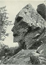 Profile RockSummit · ~1h 12m drivePhoto: Unknown authorUnknown author, Public domain (via Wikimedia Commons)
 Sligo HillSummit · ~1h 12m drivePhoto: Mufasa510, CC BY-SA 4.0 (via Wikimedia Commons)
Also worth it near here
Best months: April and June–October. Best months have typical highs of 55–85 °F, lows of 30 °F or warmer (32 °F where the station doesn't record snow), at most one snowy day and no more than 12 wet days.
Jan
35° / 18°
12 wet · 7 snow
Feb
38° / 20°
11 wet · 7 snow
Mar
46° / 27°
12 wet · 5 snow
Apr
58° / 37°
12 wet · 1 snow
May
68° / 47°
13 wet
Jun
76° / 56°
12 wet
Jul
80° / 61°
11 wet
Aug
79° / 60°
10 wet
Sep
72° / 53°
10 wet
Oct
61° / 42°
12 wet
Nov
50° / 33°
11 wet · 2 snow
Dec
40° / 24°
12 wet · 5 snow
Typical high / low (°F) and days with rain or snow, 1991–2020. Measured at N Foster 1 E, RI, 8.8 mi away at 630 ft. Source: NOAA NCEI U.S. Climate Normals 1991–2020.

