Cochegan Rock
 Photo: Unknown authorUnknown author, Public domain (via Wikimedia Commons)
- 240 ft
- summit
- Apr–Oct
- best months
Cochegan Rock is a summit in Southeastern Connecticut County, Connecticut, rising to about 240 feet. The nearest town is Oxoboxo River, about 1.8 miles away. For comfortable weather, late spring and early fall are the best bets. Typical averages from a nearby weather station show May highs around 70°F and September highs around 76°F, with July the warmest month at about 84°F. Stoddard Hill State Park, a climbing area, and the Blue Trail are both about 3 miles away. The Pine Swamp Yellow Trail is about 3.8 miles off, and paddlers can reach the East Branch Eightmile River, about 9 miles away.
Conditions and forecast
Daily highs and lows, wind and the chance of precipitation at the summit for the next 7 days, from the Open-Meteo model.
- Summit elevation
- 240 ft
Elevation from USGS 3D Elevation Program terrain data (about 10 m resolution).
We don't know of a mapped trail or route to the summit of Cochegan Rock. Plan the approach with local maps, a guidebook or a local guide, and check conditions before you go.
Questions about Cochegan Rock
How tall is Cochegan Rock?
240 ft (73 m).
Is there a trail to the top of Cochegan Rock?
We don't know of a mapped trail or route to the summit. Plan the approach with local maps, a guidebook or a local guide.
- Stoddard Hill State ParkRock climbing3 mi
- Blue TrailHiking3 mi
- Pine Swamp Yellow TrailHiking3.8 mi
- Pine Swamp Red TrailHiking3.8 mi
- Eastern Coastal SlopeRock climbing4.9 mi
- Ghost Face and Grave YardRock climbing5.1 mi
- East Branch Eightmile RiverCanoeing9.1 mi
- Yantic RiverCanoeing9.2 mi
Source: Roamze catalog (indexable pages within 10 miles, PostGIS distance)
 Jerimoth HillSummit · ~54 min drivePhoto: Khoule23 at English Wikipedia, Public domain (via Wikimedia Commons)
 Fox HillSummit · ~54 min drivePhoto: Elipongo, Public domain (via Wikimedia Commons)
 Pistapaug MountainSummit · ~55 min drivePhoto: 5ju989nfhs50 at English Wikipedia, CC BY 3.0 (via Wikimedia Commons)
- Fowler MountainSummit · ~55 min drivePhoto: 5ju989nfhs50 at English Wikipedia, CC BY 3.0 (via Wikimedia Commons)
 Beseck MountainSummit · ~55 min drivePhoto: 5ju989nfhs50 at English Wikipedia, CC BY 3.0 (via Wikimedia Commons)
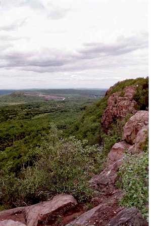 Higby MountainSummit · ~56 min drivePhoto: 5ju989nfhs50 at English Wikipedia, CC BY 3.0 (via Wikimedia Commons)
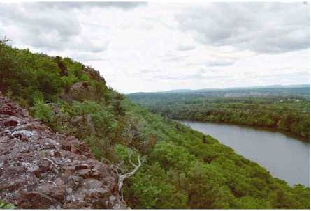 Chauncey PeakSummit · ~57 min drivePhoto: 5ju989nfhs50 at English Wikipedia, CC BY 3.0 (via Wikimedia Commons)
 Lamentation MountainSummit · ~58 min drivePhoto: Morrowlong, CC BY-SA 3.0 (via Wikimedia Commons)
 Soapstone MountainSummit · ~1h 3m drivePhoto: Morrowlong, CC BY-SA 3.0 (via Wikimedia Commons)
 Short MountainSummit · ~1h 4m drivePhoto: 5ju989nfhs50 at English Wikipedia, CC BY 3.0 (via Wikimedia Commons)
Best time to visit Cochegan Rock
Best months: April–October. Best months have typical highs of 55–85 °F, lows of 30 °F or warmer (32 °F where the station doesn't record snow), at most one snowy day and no more than 12 wet days.
Jan
38° / 21°
11 wet · 3 snow
Feb
41° / 23°
10 wet · 3 snow
Mar
48° / 29°
11 wet · 2 snow
Apr
59° / 39°
11 wet
May
70° / 49°
11 wet
Jun
78° / 58°
10 wet
Jul
84° / 65°
9 wet
Aug
83° / 63°
9 wet
Sep
76° / 55°
9 wet
Oct
64° / 44°
10 wet
Nov
53° / 34°
10 wet · 1 snow
Dec
43° / 27°
11 wet · 2 snow
Typical high / low (°F) and days with rain or snow, 1991–2020. Measured at Norwich Public Utility Plt, CT, 4.9 mi away at 20 ft. Source: NOAA NCEI U.S. Climate Normals 1991–2020.

