Northfield Brook Lake Group Shelters
Campground
The next 6 weekends are full on Recreation.gov
Eagle Rock is a summit in Connecticut, about 2 miles from the town of Thomaston. It sits at 407 feet, making it a modest high point in this corner of the state. Late spring and early fall are the most comfortable times to visit. Typical averages from a nearby weather station in Burlington put May highs around 70°F and September highs around 75°F, with July peaking near 84°F. The surrounding area offers plenty to pair with a visit. Sunset Boulders, a climbing area, is just 0.3 miles away, and the Branch Brook Trail and Mattatuck Trail are both within a mile. For an overnight stay, Northfield Brook Lake Group Shelters is about 2.5 miles off.
Northfield Brook Lake Group Shelters
Campground
 If it rainsPi.1415926535, CC BY-SA 4.0 · Wikimedia Commons
Railroad Museum of New England
Museum
Places © OpenStreetMap contributors, Places © Overture Maps Foundation · Photos: Pi.1415926535, CC BY-SA 4.0 (commons)
More in MiddletownDaily highs and lows, wind and the chance of precipitation at the summit for the next 7 days, from the Open-Meteo model.
Elevation from USGS 3D Elevation Program terrain data (about 10 m resolution).
We don't know of a mapped trail or route to the summit of Eagle Rock. Plan the approach with local maps, a guidebook or a local guide, and check conditions before you go.
407 ft (124 m).
We don't know of a mapped trail or route to the summit. Plan the approach with local maps, a guidebook or a local guide.
 Branch Brook TrailHikingPhoto: H. Morrow Long, CC BY-SA 3.0 (via Wikimedia Commons)0.6 mi
 Mattatuck TrailHikingPhoto: H. Morrow Long, CC BY-SA 3.0 (via Wikimedia Commons)0.8 mi
 Naugatuck RiverCanoeingPhoto: Morrow Long, CC BY-SA 3.0 (via Wikimedia Commons)3.4 mi
 Hop Brook Lake Recreation AreaCampingPhoto: Recreation.gov (RIDB) / public domain9.6 mi
Source: Roamze catalog (indexable pages within 10 miles, PostGIS distance)
 Bradley MountainSummit · ~23 min drivePhoto: Morrowlong, CC BY-SA 3.0 (via Wikimedia Commons)
 Pinnacle RockSummit · ~24 min drivePhoto: Janusz1993, CC BY-SA 4.0 (via Wikimedia Commons)
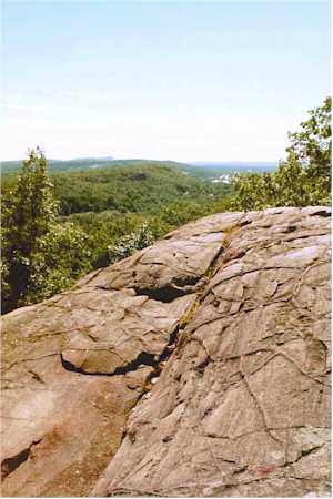 Rattlesnake MountainSummit · ~24 min drivePhoto: 5ju989nfhs50 at English Wikipedia, CC BY 3.0 (via Wikimedia Commons)
 Ragged MountainSummit · ~24 min drivePhoto: 5ju989nfhs50 at English Wikipedia, CC BY 3.0 (via Wikimedia Commons)Short MountainSummit · ~25 min drivePhoto: 5ju989nfhs50 at English Wikipedia, CC BY 3.0 (via Wikimedia Commons)
 Farmington MountainSummit · ~25 min drivePhoto: Original uploader was 5ju989nfhs50 at en.wikipedia, CC BY 3.0 (via Wikimedia Commons)
 Lamentation MountainSummit · ~31 min drivePhoto: Morrowlong, CC BY-SA 3.0 (via Wikimedia Commons)
 Onion MountainSummit · ~31 min drivePhoto: D. Galt, CC BY 3.0 (via Wikimedia Commons)
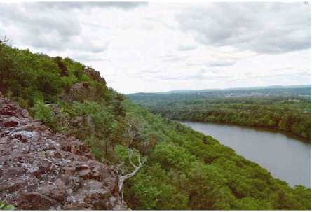 Chauncey PeakSummit · ~32 min drivePhoto: 5ju989nfhs50 at English Wikipedia, CC BY 3.0 (via Wikimedia Commons)
 Mount CarmelSummit · ~32 min drivePhoto: Ken Gallager at English Wikipedia, Public domain (via Wikimedia Commons)
Also worth it near here
Branch Brook TrailHiking · Next doorPhoto: H. Morrow Long, CC BY-SA 3.0 (via Wikimedia Commons) Right EndRock climbing · ~5 min drivePhoto: H. Morrow Long, CC BY-SA 3.0 (via Wikimedia Commons)Naugatuck RiverCanoeing · ~6 min drivePhoto: Morrow Long, CC BY-SA 3.0 (via Wikimedia Commons)
Best months: April–October. Best months have typical highs of 55–85 °F, lows of 30 °F or warmer (32 °F where the station doesn't record snow), at most one snowy day and no more than 12 wet days.
Jan
36° / 17°
10 wet · 4 snow
Feb
39° / 18°
9 wet · 3 snow
Mar
47° / 26°
10 wet · 2 snow
Apr
59° / 36°
11 wet
May
70° / 47°
12 wet
Jun
78° / 57°
11 wet
Jul
84° / 62°
11 wet
Aug
82° / 60°
10 wet
Sep
75° / 53°
9 wet
Oct
63° / 41°
10 wet
Nov
52° / 32°
9 wet
Dec
41° / 24°
11 wet · 2 snow
Typical high / low (°F) and days with rain or snow, 1991–2020. Measured at Burlington, CT, 12.9 mi away at 505 ft. Source: NOAA NCEI U.S. Climate Normals 1991–2020.
