Youth Camp I
Campground
Campground · 4.1 mi from the trail
The Ives Trail Greenway Alternative is a 1.6-mile point-to-point hike in Tarrywile Park in Connecticut, rated easy. The route runs from a low of about 580 feet to a high of about 794 feet, with a total gain of 257 feet and a loss of 558 feet, making it a short outing with a slight climb and a longer descent. The steepest stretch comes early, about a quarter mile in, with a grade of 19%. The most comfortable months for a visit are typically late spring through early fall. Typical averages from a nearby weather station in Danbury run from highs around 69°F in May to about 82°F in July, with September easing back to the mid-70s. The Ives Trail Greenway lies about 0.4 miles away, and Eureka Lake Path is about a mile off. Climbers can head to Tree Tops, Bethel CT, about 2 miles away, and paddlers to the Still River, also about 2 miles away.
Youth Camp I
Campground
 If it rainsDaniel Case, CC BY-SA 3.0 · Wikimedia Commons
Places © OpenStreetMap contributors · Photos: Daniel Case, CC BY-SA 3.0 (commons)
More in Mount KiscoBest months: April. Best months have typical highs of 55–85 °F, lows of 30 °F or warmer (32 °F where the station doesn't record snow), at most one snowy day and no more than 12 wet days.
Jan
36° / 18°
11 wet
Feb
39° / 20°
10 wet
Mar
47° / 27°
11 wet
Apr
59° / 37°
12 wet
May
69° / 46°
14 wet
Jun
78° / 56°
13 wet
Jul
82° / 62°
13 wet
Aug
80° / 60°
14 wet
Sep
74° / 52°
14 wet
Oct
62° / 41°
13 wet
Nov
51° / 31°
11 wet
Dec
41° / 24°
12 wet
Typical high / low (°F) and days with rain or snow, 1991–2020. Measured at Danbury Muni Ap, CT, 2 mi away at 457 ft. This station doesn't record snowfall. Source: NOAA NCEI U.S. Climate Normals 1991–2020.
 Photo: daveclausen, CC BY 2.0 (via Flickr)
Knapp Trail
~7 min drive
0.85-mile loop trail in Connecticut with 236 ft of elevation gain.
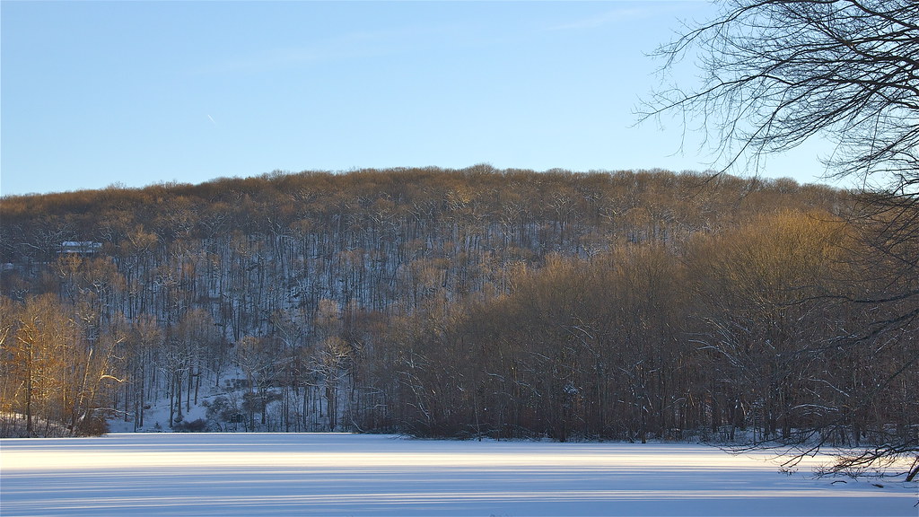 Photo: Chrisbkes, CC BY 2.0 (via Flickr)
Pierrepont Park Trail
~8 min drive
3.37-mile out-and-back hike in Pierrepont Park, Connecticut with 845 ft gain.
HIKE
Ives Trail Greenway
Next door
A 13.37-mile point-to-point greenway trail across Connecticut.
 Photo: muz4now, CC BY 2.0 (via Flickr)
Baldy Ridge Trail
~7 min drive
0.37-mile point-to-point trail in Connecticut with 148 ft gain.
Photo: muz4now, CC BY 2.0 (via Flickr)Pond Trail
~9 min drive
0.82-mile loop around a pond in Connecticut.
 Photo: Chrisbkes, CC BY 2.0 (via Flickr)
Ridegfield High School Cross Country Trail
~9 min drive
1.59-mile cross country loop with 242 ft elevation gain in Connecticut
 Photo: Laxworld123, CC BY-SA 3.0 (via Wikimedia Commons)
The Jones Trail
~11 min drive
A short point-to-point trail perfect for a quick Connecticut hike.
HIKE
Eureka Lake Path
~2 min drive
1.08-mile point-to-point trail in Connecticut with 427 ft gain
HIKE
Ives
~2 min drive
0.55-mile point-to-point trail in Connecticut with 212 ft gain.
HIKE
Stephenson Trail
~5 min drive
1.71-mile point-to-point trail in Connecticut with 365 ft gain
Map and trail data © OpenStreetMap contributors

