Mountain · 2 routes
Peak Six
12,596 ft · Colorado
- Summit
- 12,596 ft
- Routes
- 2 ways up
- Season
- Year-round
Routes up Peak Six
- Miner's Creek - Peak 6ModerateFrom Corn Lot Trailhead (about 12,395 ft) · about 131 ft of climbing3.5 mi round tripSee the route
- Trail near Peak 8Expertabout 2,421 ft of climbing12.6 mi round tripSee the route
| Miner's Creek - Peak 6 | Trail near Peak 8 | |
|---|---|---|
| Starts at | Corn Lot Trailhead | — |
| Climbing | About 131 ft | About 2,421 ft |
| Round trip | 3.5 mi | 12.6 mi |
| Difficulty | Moderate | Expert |
| Terrain | Hike | Hike |
| Season | Year-round | — |
About Peak Six
Peak Six is a summit in Colorado, 12,596 feet elevation. It is reached by the Trail near Peak 8, a 12.58-mile public trail with 2,421 feet of elevation gain.
Forecast on Peak Six
Daily highs and lows, wind and the chance of precipitation at the summit and route start for the next 7 days, from the Open-Meteo model.
Questions about Peak Six
How tall is Peak Six?
12,596 ft (3,839 m).
How many routes go to the summit of Peak Six?
2: Miner's Creek - Peak 6 and Trail near Peak 8.
What is the shortest route up Peak Six?
Miner's Creek - Peak 6, about 3.5 mi round trip.
Where do the routes up Peak Six start?
Miner's Creek - Peak 6 starts at Corn Lot Trailhead (about 12,395 ft).
When is the best time to climb Peak Six?
Year-round.
Mountains nearby
- Peak Seven12,682 ft · Colorado1 route1.1 mi away
- Peak Five12,859 ft · Colorado1 route1.5 mi away
 Peak Eight13,004 ft · Colorado1 route1.6 mi awayPhoto: Drew Stephens from San Mateo, CA, CC BY-SA 2.0 (via Wikimedia Commons)
- Peak Four12,870 ft · Colorado1 route2.0 mi away
- Peak Three12,672 ft · Colorado1 route2.4 mi away
- Peak Nine13,200 ft · Colorado1 route2.9 mi away
Facts about this place
When to go
Best time to go: Jun–Aug. The mildest months here, with typical highs of 61–67°F and lows of 34–40°F.
Typical monthly averages (not a forecast) from the Climax, CO weather station, 9.7 mi away. High / low in °F, and days with snow.
- Jan27° high3° low15 days with snow
- Feb29° high3° low15 days with snow
- Mar35° high8° low14 days with snow
- Apr40° high15° low13 days with snow
- May49° high25° low8 days with snow
- Jun61° high34° low2 days with snow
- Jul67° high40° low
- Aug64° high39° low
- Sep58° high32° low2 days with snow
- Oct47° high21° low7 days with snow
- Nov35° high11° low12 days with snow
- Dec27° high3° low15 days with snow
The station sits about 1,300 ft lower than this spot, so expect it to run cooler up here.
Where it is
- Dillon Ranger District · Ranger district
- White River National Forest · National forest
- Nearest town
- Breckenridge, Colorado · 3.7 mi
Conditions
Active alerts for White River National Forest as of Oct 9, 2026:
Holy Cross Wilderness, Prohibitions
information · posted Oct 8, 2026
Helicopter operations planned at Chapman Gulch Trailhead near Basalt Oct. 15 or Oct. 16
information · posted Oct 1, 2026
Xcel Energy Helicopter Maintenance Between Basalt and Leadville Through October 11
information · posted Oct 1, 2026
Crystal River Road east of Marble to be closed weekdays Oct. 5-13
caution · posted Sep 28, 2026
White River National Forest lifting fire restrictions on Friday Sept. 25
fire-restriction · posted Sep 23, 2026
FSR 286, Radical Hill, is closed due to washouts and unsafe conditions
caution · posted Sep 21, 2026
Maroon Creek Road open to vehicles
information · posted Sep 18, 2026
Maroon Bells - Snowmass Wilderness, Camping and other rules
information · posted Sep 17, 2026
Water not available at Lowry, Prospector, Windy Point and Marvine Campgrounds
caution · posted Sep 11, 2026
No water for campers at Ruedi Reservoir Campgrounds; Little Maud and Mollie B closed
information · posted Sep 9, 2026
Source: USFS forest alerts
Nearby
- Colorado TrailMountain biking0.1 mi
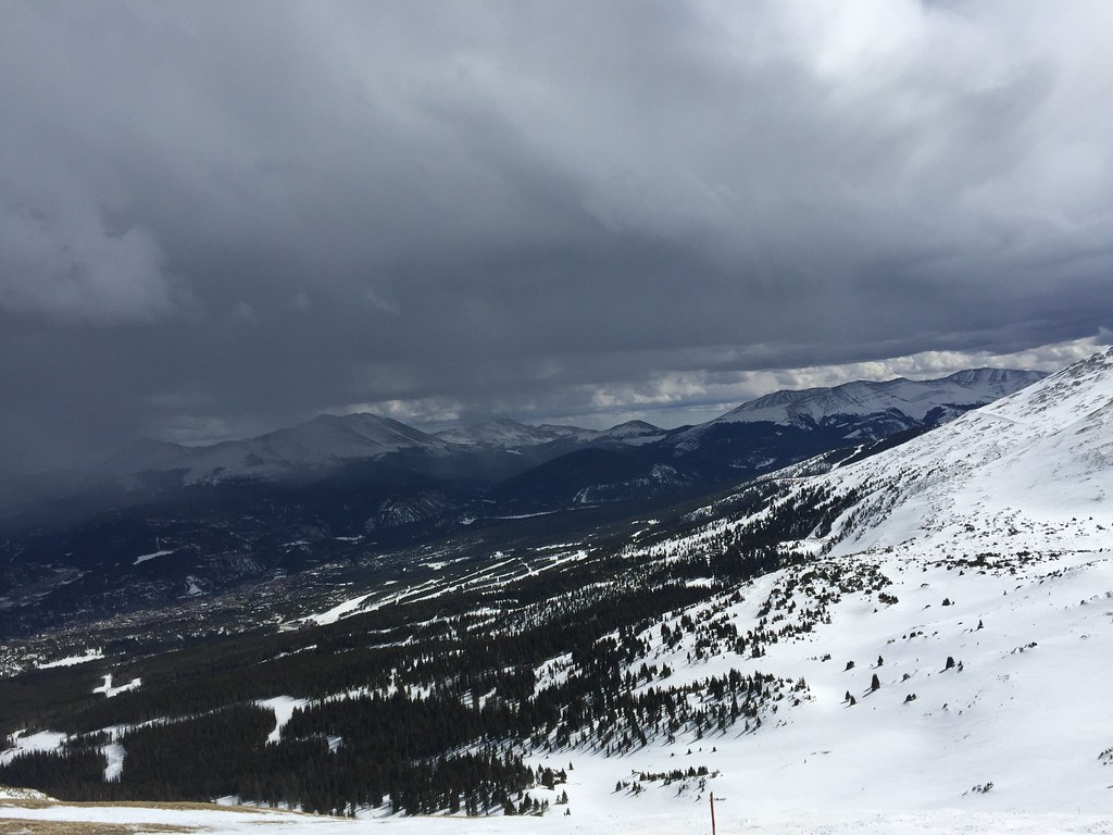 Miner's Creek - Peak 6HikingPhoto: zappowbang, CC BY-SA 2.0 (via Flickr)0.3 mi
- BreckenridgeRock climbing1.8 mi
 Tenmile CreekCanoeingPhoto: Jeffrey Beall, CC BY 3.0 (via Wikimedia Commons)1.8 mi
- Wheeler Lakes (Gore Range #60)Lake fishing2.5 mi
- Officer's Gulch WestRock climbing2.9 mi
- Peak One CampgroundCamping6.6 mi
- Pine Cove CampgroundCamping6.9 mi
Source: Roamze catalog (indexable pages within 10 miles, PostGIS distance)
Is Peak Six open right now?
Closure in the area
There's a closure order in White River National Forest. It doesn't name Peak Six, so check the source for the area it covers (2 listed).
Green Mountain Reservoir and Ruedi boat ramps closed for the season
Agency closure covering White River National Forest · USFS · White River National Forest
Eagle-Thomasville (400), Burnt Mtn (506), plus NFSR 414 and 416 openings delayed to June 16
Agency closure covering White River National Forest · USFS · White River National Forest
FSR 314, Crystal River Road, open but be prepared for delays
Agency alert covering White River National Forest · USFS · White River National Forest
FSR 286, Radical Hill, is closed due to washouts and unsafe conditions
Agency alert covering White River National Forest · USFS · White River National Forest
White River National Forest lifting fire restrictions on Friday Sept. 25
Agency alert covering White River National Forest · Order 2026 · USFS · White River National Forest
As of · Source: USFS · White River National Forest. Agencies don't list every closure — check before you go.
Best time to visit Peak Six
No month here meets our mild-weather rule. Best months have typical highs of 55–85 °F, lows of 30 °F or warmer (32 °F where the station doesn't record snow), at most one snowy day and no more than 12 wet days.
Jan
27° / 3°
15 wet · 15 snow
Feb
29° / 3°
15 wet · 15 snow
Mar
35° / 8°
14 wet · 14 snow
Apr
40° / 15°
13 wet · 13 snow
May
49° / 25°
10 wet · 8 snow
Jun
61° / 34°
8 wet · 2 snow
Jul
67° / 40°
13 wet
Aug
64° / 39°
15 wet
Sep
58° / 32°
11 wet · 2 snow
Oct
47° / 21°
9 wet · 7 snow
Nov
35° / 11°
12 wet · 12 snow
Dec
27° / 3°
15 wet · 15 snow
Typical high / low (°F) and days with rain or snow, 1991–2020. Measured at Climax, CO, 9.7 mi away at 11,344 ft. The station sits about 1,300 ft lower than this place, so expect it a little cooler here. Source: NOAA NCEI U.S. Climate Normals 1991–2020.
