Graham Creek Campground
Campground
Campground · 0.7 mi from the trail
 Photo: Jeffrey Beall, CC BY 4.0 (via Wikimedia Commons)
Closure in the area
There's a closure order in Columbine Ranger District. It doesn't name South Beach, so check the source for the area it covers (5 listed).
Pagosa Ranger District Road Closure
Agency closure covering Columbine Ranger District · Order 02-13-08-26-17 · USFS · Columbine Ranger District
COLUMBINE RANGER DISTRICT Road Closure
Agency closure covering Columbine Ranger District · Order 02-13-08-26-18 · USFS · Columbine Ranger District
Travel is not advised to the San Juan NF
Agency closure covering San Juan National Forest · USFS · San Juan National Forest
Closures and dangerous conditions on roads, bridges, and trails from flooding
Agency closure covering San Juan National Forest · USFS · San Juan National Forest
Multiple roads and trails damaged by flooding on SJNF
Agency closure covering San Juan National Forest · USFS · San Juan National Forest
As of · Source: USFS · Columbine Ranger District. Agencies don't list every closure — check before you go.
South Beach is a cross-country ski route in the Columbine Ranger District of Colorado's San Juan National Forest, managed by the Forest Service. The trail is short, about 0.4 miles, and the climb is gentle, with a total gain of 58 feet from a low point of 7,643 feet to a high of 7,715 feet. The steepest stretch comes early, at about 0.06 miles in, with a 14% grade. Winter is the natural season for this route. Typical averages from the nearby Vallecito Reservoir weather station show January highs around 37°F and lows near 9°F, while July and August run in the low 80s by day and around 50°F at night. The Classic Trail and Callie's Connection both lie within a quarter mile, making it easy to link routes. Graham Creek Campground and North Canyon Campground are each under a mile away for overnight stays.
Graham Creek Campground
Campground
Pop Sushi
Restaurant
 If it rainsJeffrey Beall, CC BY 4.0 · Wikimedia Commons
Places © OpenStreetMap contributors · Photos: Jeffrey Beall, CC BY 4.0 (commons)
More in DurangoNot on Roamze yet. Their page has how to reach them.
Classic TrailCross-country skiingPhoto: Jeffrey Beall, CC BY 4.0 (via Wikimedia Commons)0.1 miCallie'S ConnectionCross-country skiingPhoto: Jeffrey Beall, CC BY 4.0 (via Wikimedia Commons)0.2 mi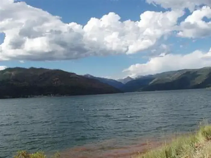 Graham Creek CampgroundCampingPhoto: Recreation.gov (RIDB) / public domain0.7 mi
 North Canyon CampgroundCampingPhoto: Recreation.gov (RIDB) / public domain0.9 mi
Source: Roamze catalog (indexable pages within 10 miles, PostGIS distance)
Classic TrailCross-country skiing · Next doorPhoto: Jeffrey Beall, CC BY 4.0 (via Wikimedia Commons) Beginner LoopCross-country skiing · ~38 min drivePhoto: Doss Imaging, CC BY 3.0 (via Wikimedia Commons)Bench LoopCross-country skiing · ~38 min drivePhoto: Doss Imaging, CC BY 3.0 (via Wikimedia Commons)Boyce Lake LoopCross-country skiing · ~39 min drivePhoto: Doss Imaging, CC BY 3.0 (via Wikimedia Commons)
 Hesperus Ski AreaDownhill skiing · ~49 min drivePhoto: Jeffrey Beall, CC BY 4.0 (via Wikimedia Commons)
 East CreekCross-country skiing · ~2 min drivePhoto: Ken Lund from Reno, Nevada, USA, CC BY-SA 2.0 (via Wikimedia Commons)
 Matterhorn Campground RoadCross-country skiing · ~1h 3m drivePhoto: Doncram, CC BY-SA 4.0 (via Wikimedia Commons)
 Shrine RoadCross-country skiing · ~52 min drivePhoto: WhisperToMe, Public domain (via Wikimedia Commons)North LoopCross-country skiing · ~39 min drivePhoto: Doss Imaging, CC BY 3.0 (via Wikimedia Commons)
 Silverton MountainDownhill skiing · ~59 min drivePhoto: Zach Dischner, CC BY 2.0 (via Wikimedia Commons)
Best months: May–October. Best months have typical highs of 55–85 °F, lows of 30 °F or warmer (32 °F where the station doesn't record snow), at most one snowy day and no more than 12 wet days.
Jan
37° / 9°
Feb
42° / 12°
Mar
48° / 21°
Apr
55° / 29°
May
64° / 37°
Jun
76° / 44°
Jul
80° / 53°
Aug
78° / 51°
Sep
72° / 45°
Oct
60° / 38°
Nov
47° / 25°
Dec
38° / 17°
Typical high / low (°F) and days with rain or snow, 1991–2020. Measured at Vallecito Reservoir, CO, 1.9 mi away at 7,673 ft. This station doesn't record snowfall. Source: NOAA NCEI U.S. Climate Normals 1991–2020.
Map and trail data © OpenStreetMap contributors

