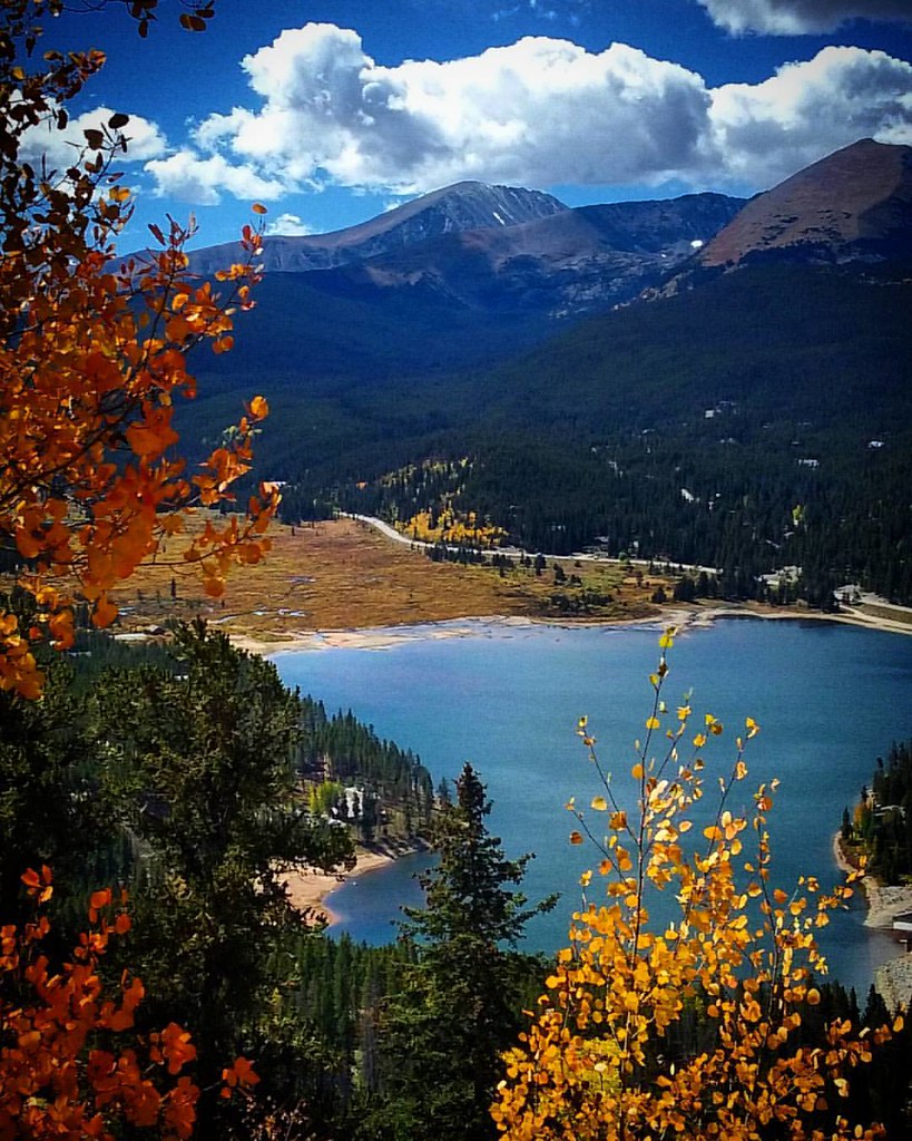
Breckenridge Area
Campground
Campground · 1.6 mi from the trail
 Photo: Pbritti, CC BY-SA 4.0 (via Wikimedia Commons)
Alert in the area
The Forest Service lists 6 alerts for White River National Forest.
FSR 286, Radical Hill, is closed due to washouts and unsafe conditions
Agency alert covering White River National Forest · USFS · White River National Forest
Limited parking at Snowmass Creek Trailhead
Agency alert covering White River National Forest · USFS · White River National Forest
Grizzly Creek Trail Closure
Agency alert covering White River National Forest · Order 2026-02 · USFS · White River National Forest
Ruedi Marina Day Use area Dump Station is CLOSED
Agency alert covering White River National Forest · USFS · White River National Forest
Asbestos safety closure - Camp Hale
Agency alert covering White River National Forest · USFS · White River National Forest
As of · Source: USFS · White River National Forest. Agencies don't list every closure — check before you go.
Gold Run Gulch Road is a cross-country skiing route in the Dillon Ranger District of Colorado's White River National Forest, about a mile long and rated moderate. It rises from roughly 9,958 feet to about 9,966 feet, with a total elevation gain of 321 feet, and the climb is short enough to fit easily into a day of exploring the surrounding roads. Winter is the natural season for this route. Typical averages from a nearby weather station in Dillon, which sits about 900 feet lower, show January highs around 31°F with lows near 1°F, while July highs reach about 75°F. Because the road sits higher than the station, temperatures here run cooler. Jumbo Mine Road and Extension Mill Road both lie about 0.1 mile away and are also used for cross-country skiing. Raspberry Boulders, a climbing area, is about 1.7 miles off, and the Swan River, a canoeing spot, is about 2.3 miles away.
Breckenridge Area
Campground
 If it rainsJeremy Olson, CC BY-SA 4.0 · Wikimedia Commons
Places © OpenStreetMap contributors · Photos: Jeremy Olson, CC BY-SA 4.0 (commons)
More in LeadvilleNot on Roamze yet. Their page has how to reach them.
Best months: June–July. Best months have typical highs of 55–85 °F, lows of 30 °F or warmer (32 °F where the station doesn't record snow), at most one snowy day and no more than 12 wet days.
Jan
31° / 1°
12 wet
Feb
33° / 4°
11 wet
Mar
41° / 10°
11 wet
Apr
47° / 18°
11 wet
May
58° / 26°
10 wet
Jun
69° / 33°
9 wet
Jul
75° / 38°
12 wet
Aug
73° / 37°
13 wet
Sep
66° / 30°
10 wet
Oct
54° / 21°
8 wet
Nov
41° / 11°
9 wet
Dec
32° / 3°
11 wet
Typical high / low (°F) and days with rain or snow, 1991–2020. Measured at Dillon 1 E, CO, 8.4 mi away at 9,065 ft. The station sits about 900 ft lower than this place, so expect it a little cooler here. This station doesn't record snowfall. Source: NOAA NCEI U.S. Climate Normals 1991–2020.
Photo: Pbritti, CC BY-SA 4.0 (via Wikimedia Commons)Jumbo Mine Road
Next door
0.13-mile ski trail in Colorado with 8 ft of elevation gain.
Photo: Pbritti, CC BY-SA 4.0 (via Wikimedia Commons)Hoo Doo Voo Doo
Next door
1.67-mile cross-country ski trail in Colorado with 472 ft of elevation gain.
Photo: Pbritti, CC BY-SA 4.0 (via Wikimedia Commons)Lodge Connection
~2 min drive
0.11-mile ski trail in Colorado with 1 ft of elevation gain.
 Photo: QKC, CC BY-SA 3.0 (via Wikimedia Commons)
B&B Mine Trail
~4 min drive
Short, beginner-friendly Colorado ski tour near historic mining area.
Photo: QKC, CC BY-SA 3.0 (via Wikimedia Commons)Mount Baldy Road
~6 min drive
Moderate 2.74-mile road-based ski tour in Colorado with steady climbing.
 Photo: 좀비 브렌다, CC BY-SA 4.0 (via Wikimedia Commons)
Breckenridge
~6 min drive
Breckenridge is a ski area in Colorado with 35 lifts, 128 runs, and 3,256 ft vertical drop.
Photo: Pbritti, CC BY-SA 4.0 (via Wikimedia Commons)Extension Mill Road
Next door
0.30-mile trail in Colorado with 239 ft of elevation gain.
 Photo: Bidgee, CC BY-SA 3.0 au (via Wikimedia Commons)
Shock Hill
~3 min drive
0.61-mile cross-country ski trail in Colorado with 215 ft of elevation gain.
 Photo: xpda, CC BY-SA 4.0 (via Wikimedia Commons)
Prize Box
~3 min drive
0.87-mile cross-country ski trail in Colorado with 54 ft of elevation gain.
Photo: QKC, CC BY-SA 3.0 (via Wikimedia Commons)Lincoln Park Road
~4 min drive
2.12-mile road ski route in Lincoln Park with 742 ft of elevation gain.
Map and trail data © OpenStreetMap contributors