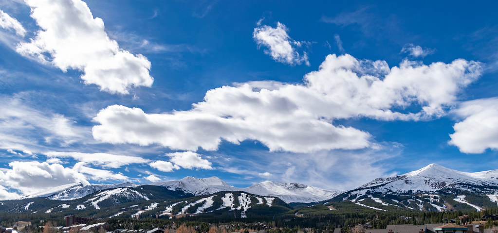
Breckenridge Area
Campground
Campground · 2.3 mi from the trail
 Photo: QKC, CC BY-SA 3.0 (via Wikimedia Commons)
Alert in the area
The Forest Service lists 6 alerts for White River National Forest.
FSR 286, Radical Hill, is closed due to washouts and unsafe conditions
Agency alert covering White River National Forest · USFS · White River National Forest
Limited parking at Snowmass Creek Trailhead
Agency alert covering White River National Forest · USFS · White River National Forest
Grizzly Creek Trail Closure
Agency alert covering White River National Forest · Order 2026-02 · USFS · White River National Forest
Ruedi Marina Day Use area Dump Station is CLOSED
Agency alert covering White River National Forest · USFS · White River National Forest
Asbestos safety closure - Camp Hale
Agency alert covering White River National Forest · USFS · White River National Forest
As of · Source: USFS · White River National Forest. Agencies don't list every closure — check before you go.
B&B Mine Trail is a short cross-country ski route in Colorado's White River National Forest, within the Dillon Ranger District and the B&B Mines, Golden Horseshoe area. The trail is on county land, and it covers less than a mile from a low point of about 9,940 feet to a high of about 10,140 feet, with a total elevation gain of 200 feet. Winter is the natural season for this trail. Typical averages from a nearby weather station at Fairplay run from highs around 31°F in December and January to about 71°F in July, with January lows near 10°F. That station sits at nearly the same elevation as the trail's low point, so temperatures on the higher end of the route run a little cooler. The Reiling Dredge and Turks mountain biking trails are each about 0.1 mile away. Raspberry Boulders and the Blue River, a paddling route, are both about 2.9 miles off.
Breckenridge Area
Campground
Traverse Restaurant and Bar
Restaurant
 If it rainsJeremy Olson, CC BY-SA 4.0 · Wikimedia Commons
Places © OpenStreetMap contributors · Photos: Jeremy Olson, CC BY-SA 4.0 (commons)
More in LeadvilleNot on Roamze yet. Their page has how to reach them.
Best months: June–September. Best months have typical highs of 55–85 °F, lows of 30 °F or warmer (32 °F where the station doesn't record snow), at most one snowy day and no more than 12 wet days.
Jan
31° / 10°
Feb
31° / 9°
Mar
38° / 16°
Apr
45° / 22°
May
55° / 29°
Jun
66° / 37°
Jul
71° / 42°
Aug
68° / 41°
Sep
62° / 35°
Oct
51° / 26°
Nov
39° / 17°
Dec
31° / 10°
Typical high / low (°F) and days with rain or snow, 1991–2020. Measured at Fairplay S Park Rd, CO, 18 mi away at 9,995 ft. This station doesn't record snowfall. Source: NOAA NCEI U.S. Climate Normals 1991–2020.
Photo: QKC, CC BY-SA 3.0 (via Wikimedia Commons)Nightmare On Baldy
Next door
2.35-mile cross-country ski trail in Colorado with 1,033 ft of elevation gain.
 Photo: Earth Science and Remote Sensing Unit, NASA Johnson Space Center, Public domain (via Wikimedia Commons)
Southern Cross Trail
~2 min drive
Southern Cross Trail is a 0.94-mile route in Colorado with 407 feet of elevation gain.
 Photo: Pbritti, CC BY-SA 4.0 (via Wikimedia Commons)
Hoo Doo Voo Doo
~4 min drive
1.67-mile cross-country ski trail in Colorado with 472 ft of elevation gain.
 Photo: Bidgee, CC BY-SA 3.0 au (via Wikimedia Commons)
Troll Forest
~5 min drive
1.01-mile cross-country ski trail in Colorado with 75 ft of elevation gain.
Photo: QKC, CC BY-SA 3.0 (via Wikimedia Commons)Mount Baldy Road
~2 min drive
Moderate 2.74-mile road-based ski tour in Colorado with steady climbing.
 Photo: 좀비 브렌다, CC BY-SA 4.0 (via Wikimedia Commons)
Breckenridge
~8 min drive
Breckenridge is a ski area in Colorado with 35 lifts, 128 runs, and 3,256 ft vertical drop.
Photo: QKC, CC BY-SA 3.0 (via Wikimedia Commons)Turks
Next door
Short, beginner-friendly Colorado ski trail perfect for quick winter outings.
Photo: Pbritti, CC BY-SA 4.0 (via Wikimedia Commons)Preston Way Road
~3 min drive
Preston Way Road is a 0.68-mile route in Colorado with 148 feet of elevation gain.
 Photo: Bidgee, CC BY-SA 3.0 au (via Wikimedia Commons)
Shock Hill
~5 min drive
0.61-mile cross-country ski trail in Colorado with 215 ft of elevation gain.
 Photo: xpda, CC BY-SA 4.0 (via Wikimedia Commons)
Prize Box
~6 min drive
0.87-mile cross-country ski trail in Colorado with 54 ft of elevation gain.
Map and trail data © OpenStreetMap contributors