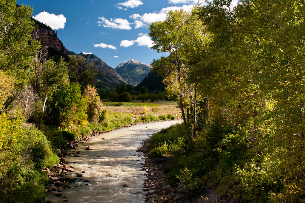
Ouray Rotary Park-Rink Wall
Ouray Rotary Park-Rink Wall is a sport climbing area in Colorado with 23 routes.
- 23 routes
- 5.3 – 5.12c
- Sport
Is Ouray Rotary Park-Rink Wall open right now?
Closure in the area
There's a closure order in Grand Mesa, Uncompahgre and Gunnison National Forests. It doesn't name Ouray Rotary Park-Rink Wall, so check the source for the area it covers (2 listed).
Gold Mountain Wildfire Roads and Trails Closure Order v 4.0
Agency closure covering Grand Mesa, Uncompahgre and Gunnison National Forests · USFS · Grand Mesa, Uncompahgre and Gunnison National Forests
Ophir Pass Road Closure
Agency closure covering Grand Mesa, Uncompahgre and Gunnison National Forests · USFS · Grand Mesa, Uncompahgre and Gunnison National Forests
TERMINATION OF ORDER - FIRE RESTRICTIONS
Agency alert covering Grand Mesa, Uncompahgre and Gunnison National Forests · USFS · Grand Mesa, Uncompahgre and Gunnison National Forests
Dallas Area Closure order
Agency alert covering Grand Mesa, Uncompahgre and Gunnison National Forests · USFS · Grand Mesa, Uncompahgre and Gunnison National Forests
Island Lake Road Closure
Agency alert covering Grand Mesa, Uncompahgre and Gunnison National Forests · USFS · Grand Mesa, Uncompahgre and Gunnison National Forests
As of · Source: USFS · Grand Mesa, Uncompahgre and Gunnison National Forests. Agencies don't list every closure — check before you go.
Best time to visit Ouray Rotary Park-Rink Wall
Best months: May–June and September–October. Best months have typical highs of 55–85 °F, lows of 30 °F or warmer (32 °F where the station doesn't record snow), at most one snowy day and no more than 12 wet days.
Jan
36° / 16°
11 wet
Feb
41° / 18°
11 wet
Mar
47° / 25°
12 wet
Apr
54° / 30°
12 wet
May
64° / 38°
10 wet
Jun
76° / 47°
8 wet
Jul
80° / 52°
15 wet
Aug
77° / 51°
15 wet
Sep
71° / 45°
11 wet
Oct
58° / 34°
10 wet
Nov
46° / 24°
8 wet
Dec
36° / 17°
11 wet
Typical high / low (°F) and days with rain or snow, 1991–2020. Measured at Ouray #2, CO, 1.3 mi away at 7,718 ft. This station doesn't record snowfall. Source: NOAA NCEI U.S. Climate Normals 1991–2020.
Ouray Rotary Park-Rink Wall is a climbing area in the Ouray Ranger District of the Grand Mesa, Uncompahgre and Gunnison National Forests in Colorado. It sits just outside the town of Ouray, close to several other outdoor destinations in the area. Summer is the most comfortable time to visit. Typical averages from the nearby Ouray #2 weather station, which sits at about the same elevation as the wall, show July highs around 80°F with lows near 52°F, while June and September are a little milder. The closest neighbors include the Uncompahgre River Walk, which is about 0.2 miles away, and the Silvershield Trail and Ouray RV Park, both about 0.3 miles away. The Alcove climbing area is about a mile off.
Routes (23)
Keep exploring — more climbs worth the drive
 Photo: markbyzewski, CC BY 2.0 (via Flickr)
Randall's Badger Sanctuary aka Spider Den
~3 min drive
Randall's Badger Sanctuary (Spider Den) in Colorado has 7 sport routes rated from 5.10a to 5.12c.
Coxcomb Peak
~14 min drive
Route to the summit of Coxcomb Peak (13,612 ft) from West Fork Cimarron River Trailhead.
 Photo: markbyzewski, CC BY 2.0 (via Flickr)
Five Fingers area
~3 min drive
Five Fingers area in Colorado has 5 climbing routes with 2 difficulty grades.
Dallas Peak
~18 min drive
Route to the summit of Dallas Peak (13,675 ft) from Mill Creek Trailhead.
 Photo: Jacob Montgomery, CC BY-SA 3.0 (via Wikimedia Commons)
Uncompahgre Gorge aka Ouray Ice Park
~3 min drive
2 trad routes at Uncompahgre Gorge / Ouray Ice Park in Colorado.
 Photo: ranok, CC BY 2.0 (via Flickr)
Camp Bird Mine Rd/Mountain Rescue Cache Crag
~3 min drive
Camp Bird Mine Rd/Mountain Rescue Cache Crag in Colorado has 6 mixed climbing routes.
 Photo: Jacob Montgomery, CC BY-SA 3.0 (via Wikimedia Commons)
Jimmy Cliff
~4 min drive
Jimmy Cliff in Colorado has 12 sport climbing routes across 7 difficulty grades.
 Photo: Sale Family Memories, CC BY 2.0 (via Flickr)
Camp Bird Road
~7 min drive
Camp Bird Road in Colorado has 9 traditional climbing routes across 7 grades.
 Photo: iagoarchangel, CC BY-SA 2.0 (via Flickr)
Technicolor Wall aka Techno Crag
~8 min drive
Technicolor Wall (Techno Crag) in Colorado has 11 sport routes with 9 difficulty grades.
Photo: iagoarchangel, CC BY-SA 2.0 (via Flickr)Waterfall Wall
~8 min drive
Waterfall Wall in Colorado has 11 climbing routes across 8 grades, offering mixed, sport, and trad styles.
Also worth it near here