Secret Campsite
Campground
Campground · < 0.1 mi from the trail
 Photo: Sandy Horvath-Dori from Grand Junction, CO, USA, CC BY 2.0 (via Wikimedia Commons)
Closure in the area
There's a closure order in Grand Mesa, Uncompahgre and Gunnison National Forests. It doesn't name Secret Campsite, so check the source for the area it covers (2 listed).
Gold Mountain Wildfire Roads and Trails Closure Order v 4.0
Agency closure covering Grand Mesa, Uncompahgre and Gunnison National Forests · USFS · Grand Mesa, Uncompahgre and Gunnison National Forests
Ophir Pass Road Closure
Agency closure covering Grand Mesa, Uncompahgre and Gunnison National Forests · USFS · Grand Mesa, Uncompahgre and Gunnison National Forests
Potter Basin and Beaver Park Roads Emergency Closures
Agency alert covering Grand Mesa, Uncompahgre and Gunnison National Forests · USFS · Grand Mesa, Uncompahgre and Gunnison National Forests
TERMINATION OF ORDER - FIRE RESTRICTIONS
Agency alert covering Grand Mesa, Uncompahgre and Gunnison National Forests · USFS · Grand Mesa, Uncompahgre and Gunnison National Forests
Dallas Area Closure order
Agency alert covering Grand Mesa, Uncompahgre and Gunnison National Forests · USFS · Grand Mesa, Uncompahgre and Gunnison National Forests
As of · Source: USFS · Grand Mesa, Uncompahgre and Gunnison National Forests. Agencies don't list every closure — check before you go.
Secret Campsite is a Forest Service campground in the Norwood Ranger District of the Grand Mesa, Uncompahgre and Gunnison National Forests in Colorado. The land is managed by the Forest Service, and the site sits within the district's boundaries. Summer is the most comfortable time to visit. Typical averages from a nearby weather station in Telluride show July highs around 77°F with lows near 41°F, while winter highs stay in the mid-30s. That station sits about 1,000 feet lower than the campsite, so temperatures at the site run cooler. Whipple Mountain is about 1.3 miles away, and the Telluride/Norwood area climbing area is about 2.1 miles off. Mary E Campground is about 4.2 miles away, and the Rio Grande Southern cross-country ski area is about 2.1 miles away.
Secret Campsite
Campground
The Tunnel
Restaurant
Telluride Arts District
Gallery
Places © OpenStreetMap contributors
More in TellurideNot on Roamze yet. Their page has how to reach them.
Best months: June–July and September. Best months have typical highs of 55–85 °F, lows of 30 °F or warmer (32 °F where the station doesn't record snow), at most one snowy day and no more than 12 wet days.
Jan
36° / 0°
10 wet
Feb
38° / 5°
9 wet
Mar
44° / 13°
10 wet
Apr
51° / 22°
9 wet
May
60° / 29°
9 wet
Jun
73° / 34°
7 wet
Jul
77° / 41°
12 wet
Aug
74° / 40°
15 wet
Sep
68° / 34°
11 wet
Oct
57° / 23°
8 wet
Nov
45° / 13°
8 wet
Dec
36° / 2°
9 wet
Typical high / low (°F) and days with rain or snow, 1991–2020. Measured at Telluride 4wnw, CO, 4.8 mi away at 8,646 ft. The station sits about 1,000 ft lower than this place, so expect it a little cooler here. This station doesn't record snowfall. Source: NOAA NCEI U.S. Climate Normals 1991–2020.
 Photo: Jeffrey Beall, CC BY 4.0 (via Wikimedia Commons)
Alta Lakes Camping Area
~15 min drive
 Photo: John Fowler from Placitas, NM, USA, CC BY 2.0 (via Wikimedia Commons)
Primitive Campsite near Ice Lake (San Juan National Forest)
~25 min drive
Rustic, first-come camping in Colorado for self-sufficient outdoor enthusiasts.
 Photo: Tobias from Germany, CC BY 2.0 (via Wikimedia Commons)
Dispersed camp site
~25 min drive
First-come dispersed camping on Colorado public lands with backcountry character.
BED
Cayton Campground
~25 min drive
BED
Amphitheater (co)
~27 min drive
 Photo: jimmy thomas, CC BY-SA 2.0 (via Wikimedia Commons)
Elk Ridge Campground
~34 min drive
Mountain campground in Colorado offering access to ridge-country recreation and wildlife viewing.
 Photo: Rainer Halama, CC BY-SA 3.0 (via Wikimedia Commons)
Silverton Lakes Campground
~34 min drive
Alpine campground near Silverton Lakes with mountain lake and peak views.
BED
Silver Pick Camping Area
~12 min drive
U.S. Forest Service campground with 35 sites in Colorado's scenic mountain setting.
BED
Sunshine Campground
~13 min drive
BED
Wilderness Campsite 1
~13 min drive
Wilderness Campsite 1 is a 6-site campground in Colorado managed by the Forest Service.
Also worth it near here
CLIMB
Telluride/Norwood area
~4 min drive
 Photo: Ken Lund from Reno, Nevada, USA, CC BY-SA 2.0 (via Wikimedia Commons)
Rio Grande Southern
~4 min drive
SEE
Deep Creek
~4 min drive
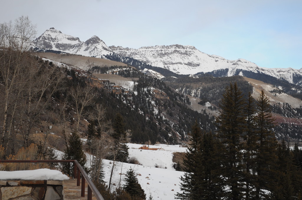 Photo: Chiara Coetzee, Public Domain Dedication (CC0) (via Flickr)
Penelope's Trail
~6 min drive
 Photo: Scott Ellis, CC BY-SA 2.0 (via Wikimedia Commons)
Hayden Peak
~7 min drive
Map and trail data © OpenStreetMap contributors
