Sig Creek Campground
Campground
Campground · 4.6 mi from the trail
Caution at last check
Agency alerts are in effect for this area; weather is good · USFS, usgs_nwis, OpenWeather · checked 23 h ago
Closure in the area
There's a closure order in Columbine Ranger District. It doesn't name Cascade Creek, so check the source for the area it covers (5 listed).
Pagosa Ranger District Road Closure
Agency closure covering Columbine Ranger District · Order 02-13-08-26-17 · USFS · Columbine Ranger District
COLUMBINE RANGER DISTRICT Road Closure
Agency closure covering Columbine Ranger District · Order 02-13-08-26-18 · USFS · Columbine Ranger District
Travel is not advised to the San Juan NF
Agency closure covering San Juan National Forest · USFS · San Juan National Forest
Closures and dangerous conditions on roads, bridges, and trails from flooding
Agency closure covering San Juan National Forest · USFS · San Juan National Forest
Multiple roads and trails damaged by flooding on SJNF
Agency closure covering San Juan National Forest · USFS · San Juan National Forest
As of · Source: USFS · Columbine Ranger District. Agencies don't list every closure — check before you go.
Cascade Creek is a 14-mile paddling stretch near Durango, Colorado, running through the Columbine Ranger District of the San Juan National Forest, where the land along its banks is managed by the U.S. Forest Service. The creek flows year-round, with a modeled average flow of about 184 cfs. This is a steep run. The creek drops at an average gradient of about 267 feet per mile, which works out to a lot of descent packed into roughly 14.2 miles of water. Engineer Mountain, a hike, sits about 1.2 miles away. The climbing areas at Cascade Canyon and Genesis Wall (Canyon Entrance) are about 1.4 miles off, and Sig Creek Campground is roughly 4.6 miles away.
Sig Creek Campground
Campground
Little Hawaii Grotto
Attraction
Places © OpenStreetMap contributors, Places © Overture Maps Foundation
More in Telluride Engineer MountainHikingPhoto: Frans-Banja Mulder, CC BY 3.0 (via Wikimedia Commons)1.2 mi
Source: Roamze catalog (indexable pages within 10 miles, PostGIS distance)
 Hermosa CreekCanoeing · ~17 min drivePhoto: Jeffrey Beall, CC BY 4.0 (via Wikimedia Commons)
 Animas RiverCanoeing · ~27 min drivePhoto: Clyde frogg, CC BY-SA 3.0 (via Wikimedia Commons)
 West Dolores RiverCanoeing · ~28 min drivePhoto: Jeffrey Beall, CC BY 4.0 (via Wikimedia Commons)
 Los Pinos RiverCanoeing · ~45 min drivePhoto: Jeffrey Beall, CC BY 4.0 (via Wikimedia Commons)
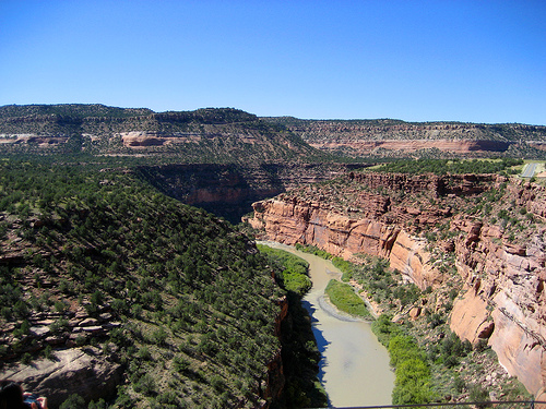 Dolores RiverCanoeing · ~45 min drivePhoto: Argyleist. Original uploader was Argyleist at en.wikipedia, CC BY 3.0 (via Wikimedia Commons)
Also worth it near here

