Blue Creek Lodge
Kayaking business nearby (~45 mi away) — hasn't claimed their Roamze page yet
Free — you'll pick up right here.
Watch this water
Sign up to watch it — saving subscribes you to gate, closure and report changes.
Colorado
No agency boundary, access route or field report is mapped to it — so there is no verdict, and we won't guess. We'll tell you the moment this water has something to say.
Covered nearby
Waters within 25 miles where we do have a current picture.
Nobody's filed a report here yet — be the first.
Why you'll love it
Long-term averages modeled by USGS (NHDPlus HR), not today's conditions. Check a gauge before you go.
Animas River
AI-suggested draft · review before you go
No permit or access details on file for this water — check with the local land manager before you go.
Animas River is a 15-mile paddling stretch near Silverton, Colorado. It flows year-round. USGS models an average flow of about 544 cfs and a gradient of about 131.4 feet per mile.
 Photo: Jeffrey Beall, CC BY 4.0 (via Wikimedia Commons)
Henson Creek
~26 min drive
Henson Creek is a 17-mile paddling stretch near Lake City, Colorado. It flows year-round. USGS models an average flow of about 107 cfs and a gradient of about 174.4 feet per mile. Land along it is managed by the Bureau of Land Management.
Junction Creek Campground
~1h 5m drive
A worthwhile stop near Colorado.
 Photo: Boyd Norton, Public domain (via Wikimedia Commons)
East Fork Dallas Creek
~34 min drive
East Fork Dallas Creek is a 11-mile paddling stretch near Ridgway, Colorado. It is intermittent and may run dry in some seasons. USGS models an average flow of about 34 cfs and a gradient of about 318.4 feet per mile.
 Photo: Jeffrey Beall, CC BY 4.0 (via Wikimedia Commons)
Los Pinos River
~36 min drive
Los Pinos River is a 12-mile paddling stretch near Pagosa Springs, Colorado. It is intermittent and may run dry in some seasons. USGS models an average flow of about 84 cfs and a gradient of about 146.7 feet per mile. Land along it is managed by the U.S. Forest Service.
 Photo: Jeffrey Beall, CC BY 4.0 (via Wikimedia Commons)
West Dolores River
~44 min drive
West Dolores River is a 12-mile paddling stretch near Dolores, Colorado. It flows year-round. USGS models an average flow of about 64 cfs and a gradient of about 241.8 feet per mile. Land along it is managed by the U.S. Forest Service.
 Photo: Jeffrey Beall, CC BY 4.0 (via Wikimedia Commons)
Hermosa Creek
~44 min drive
Hermosa Creek is a 29-mile paddling stretch near Durango, Colorado. It flows year-round. USGS models an average flow of about 270 cfs and a gradient of about 134.6 feet per mile. Land along it is managed by the U.S. Forest Service.
 Photo: Jeffrey Beall, CC BY 4.0 (via Wikimedia Commons)
Leopard Creek
~45 min drive
Leopard Creek is a 14-mile paddling stretch near Placerville, Colorado. It flows year-round. USGS models an average flow of about 56 cfs and a gradient of about 146.0 feet per mile.
 Photo: Sally Pearce, Colorado Department of Transportation; brightened and color-corrected by Howcheng, Public domain (via Wikimedia Commons)
Uncompahgre River
~54 min drive
Uncompahgre River is a 13-mile paddling stretch near Montrose, Colorado. It flows year-round. USGS models an average flow of about 281 cfs and a gradient of about 280.1 feet per mile. Land along it is managed by the Bureau of Land Management.
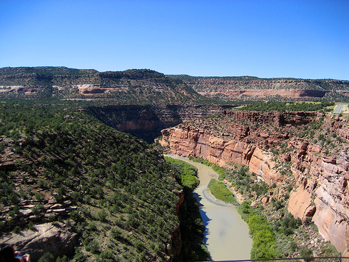 Photo: Argyleist. Original uploader was Argyleist at en.wikipedia, CC BY 3.0 (via Wikimedia Commons)
Dolores River
~56 min drive
Dolores River is a 13-mile paddling stretch near Norwood, Colorado. It flows year-round. USGS models an average flow of about 626 cfs and a gradient of about 163.6 feet per mile. Land along it is managed by the U.S. Forest Service.
 Photo: Jeffrey Beall, CC BY 4.0 (via Wikimedia Commons)
Cebolla Creek
~1h 1m drive
Cebolla Creek is a 37-mile paddling stretch near Lake City, Colorado. It flows year-round. USGS models an average flow of about 127 cfs and a gradient of about 67.0 feet per mile. Land along it is managed by the Bureau of Land Management.
Also worth it near here
Boulder Gulch Trail
~3 min drive
Little Giant Peak
~3 min drive
 Photo: Person-with-No Name, CC BY 2.5 (via Wikimedia Commons)
Tower Mountain
~3 min drive
 Photo: Rainer Halama, CC BY-SA 3.0 (via Wikimedia Commons)
Silverton Lakes Campground
~4 min drive
 Photo: WhisperToMe, Public domain (via Wikimedia Commons)
Shrine Road
~5 min drive
Local operators near Silvertonoffering guided trips. You book directly with them — Roamze doesn’t take a cut.
Blue Creek Lodge
Kayaking business nearby (~45 mi away) — hasn't claimed their Roamze page yet
Cedar Creek RV Park and Lodging
Kayaking business nearby (~47 mi away) — hasn't claimed their Roamze page yet
Wilderness Journeys Pagosa
Kayaking business nearby (~49 mi away) — hasn't claimed their Roamze page yet
