Backcountry Site 2
Campground
Campground · 0.5 mi from the trail
Westridge Trail is a 1.8-mile mountain biking route in Lory State Park in Colorado, on land managed by State Fish and Wildlife. It runs between roughly 6,660 and 6,975 feet in elevation. The ride gains about 370 feet one way and loses about 520 feet, so it trends downhill overall in the direction it is mapped. The hardest pitch comes right away. Grades reach about 16 percent around a tenth of a mile from the start, which is near 6,664 feet, so expect a stiff effort before you settle in. From there the trail tops out near 6,974 feet before dropping to its low point around 6,661 feet. For the most comfortable conditions, aim for September or June. A nearby weather station sits a little higher than the trail and typically averages highs around 70 degrees with lows in the upper 40s in those months. The trail sits close to several climbing spots, including Arthur's Rock and the Main Area, both about 0.2 miles away. Howard Trail is roughly 0.7 miles off for hiking, and the Cache la Poudre River offers paddling about 5 miles away.
Backcountry Site 2
Campground
Horsetooth Tavern
Bar
Almost East Gemstone Peak
Viewpoint
Places © OpenStreetMap contributors
More in Estes Park Cache la Poudre RiverCanoeingPhoto: Wusel007, CC BY-SA 3.0 (via Wikimedia Commons)5 mi
Source: Roamze catalog (indexable pages within 10 miles, PostGIS distance)
Also worth it near here
 Overlook TrailHiking · ~1 min drivePhoto: Michael Kirsh, CC BY-SA 2.0 (via Flickr)
 Eltuck BayRock climbing · ~2 min drivePhoto: KimonBerlin, CC BY-SA 2.0 (via Flickr)
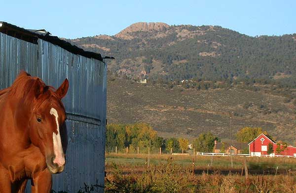 Horsetooth MountainSummit · ~3 min drivePhoto: Matthew Trump (talk) (Uploads)
Uploaded by Decumanus at en.wikipedia, CC BY-SA 3.0 (via Wikimedia Commons)
Best months: May–October. Best months have typical highs of 55–85 °F, lows of 30 °F or warmer (32 °F where the station doesn't record snow), at most one snowy day and no more than 12 wet days.
Jan
40° / 21°
5 wet
Feb
40° / 20°
6 wet
Mar
47° / 26°
8 wet
Apr
51° / 30°
10 wet
May
60° / 39°
12 wet
Jun
72° / 49°
11 wet
Jul
79° / 56°
11 wet
Aug
78° / 55°
11 wet
Sep
70° / 47°
8 wet
Oct
57° / 36°
7 wet
Nov
47° / 28°
6 wet
Dec
40° / 20°
6 wet
Typical high / low (°F) and days with rain or snow, 1991–2020. Measured at Buckhorn Mtn 1 E, CO, 6.7 mi away at 7,400 ft. This station doesn't record snowfall. Source: NOAA NCEI U.S. Climate Normals 1991–2020.
Map and trail data © OpenStreetMap contributors
