Free — you'll pick up right here.
Watch this trail
Sign up to watch it — saving subscribes you to gate, closure and report changes.
Colorado
quarry ridge loop
1.0 mi
Distance
98 ft
Gain
We don't cover this trail yet
No agency boundary, access route or field report is mapped to it — so there is no verdict, and we won't guess. We'll tell you the moment this trail has something to say.
Covered nearby
Trails within 25 miles where we do have a current picture.
Nobody's filed a report here yet — be the first.
Trail character
Here's your ride, mapped
quarry ridge loop
AI-suggested draft · review before you go
Elevation & route
- Distance
- 1.0 mi
- Elevation gain
- 98 ft
- Elevation loss
- 170 ft
- Highest point
- 5,709 ft
- Lowest point
- 5,611 ft
Gear for the day
Photos
Directions & GPX
About this trail
Quarry Ridge Loop is a 0.99-mile trail near Mill Cr, Colorado, gaining 98 feet of elevation. The route follows a loop shape and is rated as an intermediate / blue square by IMBA.
Permits & access
- Managing agency
- State Fish and Wildlife
- Dogs
- leash_required
Add to a trip & share
Keep exploring — more rides worth the drive
east valley trail
~0 min drive
2.31-mile out-and-back trail near Mill Cr, Colorado with 239 ft elevation gain.
mill creek link trail
~0 min drive
0.39-mile trail in Colorado with 267 ft gain
west valley trail
~1 min drive
2.26-mile blue square trail near Mill Cr with 167 ft gain
howard trail
~1 min drive
2.22-mile route in Colorado with 854 ft elevation gain.
foothills trail (maxwell loop)
~1 min drive
1.30-mile intermediate trail near College Lake, Colorado with 217 ft gain
overlook trail
~1 min drive
0.39-mile out-and-back trail with 134 ft gain near Horsetooth Reservoir
south valley loop
~1 min drive
2.64-mile easy trail near Mill Cr, Colorado with 234 ft elevation gain.
foothills trail
~2 min drive
0.99-mile black diamond trail near College Lake, Colorado with 117 ft gain
foothills trail (maxwell loop)
~2 min drive
0.83-mile Black Diamond trail near College Lake with 292 ft gain
westridge trail
~2 min drive
1.82-mile out-and-back trail near Arthurs Rock, Colorado with 371 ft of elevation gain.
Also worth it near here
Quarry Ridge South
~0 min drive
 Photo: Runner1928, CC BY-SA 4.0 (via Wikimedia Commons)
Rotary Park
~1 min drive
Horsetooth Reservoir
~2 min drive
Backcountry Site 1
~2 min drive
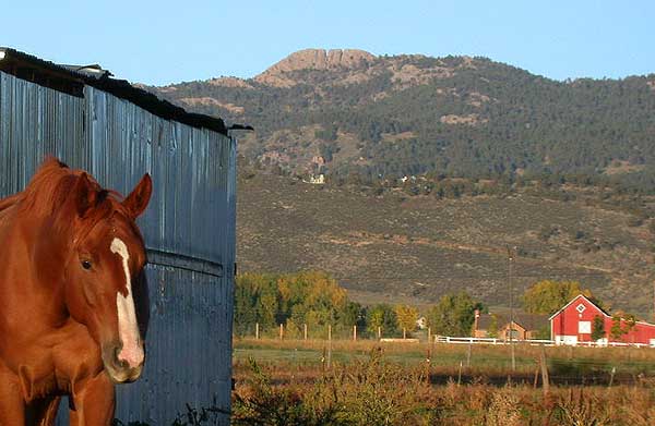 Photo: Matthew Trump (talk) (Uploads)
Uploaded by Decumanus at en.wikipedia, CC BY-SA 3.0 (via Wikimedia Commons)
Photo: Matthew Trump (talk) (Uploads)
Uploaded by Decumanus at en.wikipedia, CC BY-SA 3.0 (via Wikimedia Commons)Horsetooth Mountain
~4 min drive
Map and trail data © OpenStreetMap contributors
