Baxters
- 4.2 mi
- distance
- 1,357 ft
- climb
- Jun–Aug
- best months
Baxters is a mountain biking route in Colorado, about 1.6 miles from Crested Butte. The ride starts at roughly 8,930 feet and climbs to about 10,246 feet, with a total elevation gain of 1,357 feet over a route of about 4.2 miles. The climb is not a straightforward ascent: the route also drops about 2,233 feet, so the total change from start to finish is a net loss. Summer is the most comfortable time to ride. Typical averages from a nearby weather station in Crested Butte show July highs around 76°F with lows near 40°F, while winter highs stay in the mid-20s and lows drop to about -7°F in January. That station sits roughly 1,400 feet below the route's high point, so temperatures on the summit run cooler. The route sits within a short drive of several other destinations. Mogul Storage and the Beginner Track are both within about a mile and a half of the start. Crested Butte RV Resort is about 1.7 miles away, and The Joint Boulder climbing area is about 2.4 miles off.
Local outfitters
- Valley Mobile RV Park45 mi away
- Monarch Spur RV Park46 mi away
Not on Roamze yet. Their page has how to reach them.
- Mogul StorageMountain biking0.9 mi
- Beginner TrackMountain biking1.2 mi
- Crested Butte RV ResortCamping1.7 mi
- The Joint BoulderRock climbing2.4 mi
- The Hone StoneRock climbing2.4 mi
 Slate RiverCanoeingPhoto: Jeffrey Beall, CC BY 3.0 (via Wikimedia Commons)3.1 mi
- Splains Gulch Camping AreaCamping5 mi
- Brush CreekCanoeing6.4 mi
Source: Roamze catalog (indexable pages within 10 miles, PostGIS distance)
 Gunsight PassMountain biking · ~9 min drivePhoto: Sheila Sund from Salem, United States, CC BY 2.0 (via Wikimedia Commons)
 Kebler Wagon Trail SpurMountain biking · ~10 min drivePhoto: John Sowell, CC BY-SA 4.0 (via Wikimedia Commons)
- Kebler Wagon Trail 606Mountain biking · ~11 min drivePhoto: John Sowell, CC BY-SA 4.0 (via Wikimedia Commons)
 Ohio Pass SnowmobileMountain biking · ~10 min drivePhoto: Mshuang2, CC0 (via Wikimedia Commons)
- Mogul StorageMountain biking · ~2 min drive
- Beginner TrackMountain biking · ~2 min drive
- DeliMountain biking · ~2 min drive
- Green LakeMountain biking · ~3 min drive
- Woods Walk Conn.Mountain biking · ~3 min drive
- DivineMountain biking · ~4 min drive
Also worth it near here
 Riverbend TrailCross-country skiing · ~2 min drivePhoto: Jeffrey Beall, CC BY 3.0 (via Wikimedia Commons)
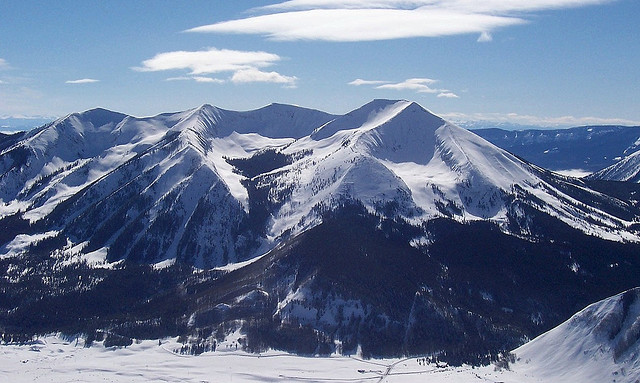 Whetstone MountainSummit · ~3 min drivePhoto: John Holm from Leadville, CO, USA, CC BY 2.0 (via Wikimedia Commons)
 Woods WalkSki touring · ~4 min drivePhoto: Nick Taylor, CC BY-SA 2.0 (via Wikimedia Commons)
- Lake GrantLake fishing · ~4 min drive
Best time to visit Baxters
Best months: June–August. Best months have typical highs of 55–85 °F, lows of 30 °F or warmer (32 °F where the station doesn't record snow), at most one snowy day and no more than 12 wet days.
Jan
26° / -7°
12 wet
Feb
29° / -2°
11 wet
Mar
38° / 7°
10 wet
Apr
47° / 19°
9 wet
May
58° / 28°
8 wet
Jun
70° / 34°
7 wet
Jul
76° / 40°
10 wet
Aug
74° / 38°
12 wet
Sep
66° / 31°
9 wet
Oct
54° / 22°
8 wet
Nov
39° / 9°
9 wet
Dec
27° / -4°
11 wet
Typical high / low (°F) and days with rain or snow, 1991–2020. Measured at Crested Butte, CO, 1.9 mi away at 8,867 ft. The station sits about 1,400 ft lower than this place, so expect it a little cooler here. This station doesn't record snowfall. Source: NOAA NCEI U.S. Climate Normals 1991–2020.
Map and trail data © OpenStreetMap contributors
