Indian Springs Campsites
Campground
Campground · 2.6 mi from the trail
 Photo: Vadim Manuylov, CC BY-SA 3.0 (via Wikimedia Commons)
Zip Trail is a short, easy out-and-back hike in Colorado, about a mile from the community of Black Eagle Mill. The trail is roughly 1.2 miles long, with a total elevation gain of about 490 feet, and it reaches a high point of about 9,000 feet. The climb is front-loaded, with the steepest stretch coming within the first tenth of a mile. That section rises about 19 percent, but the rest of the trail is gentler, and the round trip ends at nearly the same elevation as the start. Summer is the most comfortable time to go. Typical averages from a nearby weather station in Georgetown put July highs around 77°F with lows near 49°F, while winter highs stay in the mid-30s. The hike takes about half an hour, so it works well as a quick outing. Goat Trail is just 0.4 miles away, and Clear Creek offers canoeing about 2 miles off. Climbers can head to the Dumont vicinity, and Columbine Campground is about 5 miles away.
Indian Springs Campsites
Campground
 If it rainsUser:Magicpiano, CC BY-SA 4.0 · Wikimedia Commons
Historic house-museum in Georgetown, Colorado, United States
Places © OpenStreetMap contributors · Photos: User:Magicpiano, CC BY-SA 4.0 (commons)
More in Idaho SpringsNot on Roamze yet. Their page has how to reach them.
Goat TrailHikingPhoto: Vadim Manuylov, CC BY-SA 3.0 (via Wikimedia Commons)0.4 mi Clear CreekCanoeingPhoto: Ken Gallager at en.wikipedia, Public domain (via Wikimedia Commons)1.9 mi
Source: Roamze catalog (indexable pages within 10 miles, PostGIS distance)
Goat TrailHiking · Next doorPhoto: Vadim Manuylov, CC BY-SA 3.0 (via Wikimedia Commons) Devil's CanyonHiking · ~5 min drivePhoto: jtsmmm, CC BY 3.0 (via Wikimedia Commons)
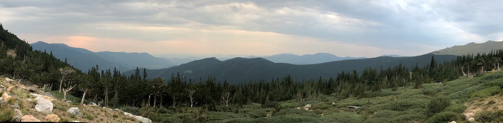 Resthouse MeadowsHiking · ~10 min drivePhoto: regexman, CC BY 2.0 (via Flickr)
 Bard PeakHiking · ~11 min drivePhoto: dirkdavidson1, Public Domain Dedication (CC0) (via Flickr)
 Sunny Skies TrailHiking · ~4 min drivePhoto: Vadim Manuylov, CC BY-SA 3.0 (via Wikimedia Commons)
 DEVILS CANYON SPURHiking · ~7 min drivePhoto: jtsmmm, CC BY 3.0 (via Wikimedia Commons)
 Chicago LakesHiking · ~13 min drivePhoto: cleong, CC BY-SA 2.0 (via Flickr)
 Mount BancroftHiking · ~13 min drivePhoto: Greg Younger from Parker, Colorado, USA, USA, CC BY-SA 2.0 (via Wikimedia Commons)
 Chief MountainHiking · ~8 min drivePhoto: designsbykari, CC BY 2.0 (via Flickr)
 Devils Canyon Spur TrailHiking · ~7 min drivePhoto: jtsmmm, CC BY 3.0 (via Wikimedia Commons)
Best months: May–June and September. Best months have typical highs of 55–85 °F, lows of 30 °F or warmer (32 °F where the station doesn't record snow), at most one snowy day and no more than 12 wet days.
Jan
36° / 16°
9 wet
Feb
38° / 15°
9 wet
Mar
44° / 21°
10 wet
Apr
50° / 26°
11 wet
May
60° / 35°
11 wet
Jun
72° / 42°
10 wet
Jul
77° / 49°
13 wet
Aug
75° / 47°
13 wet
Sep
68° / 39°
10 wet
Oct
57° / 30°
8 wet
Nov
44° / 22°
7 wet
Dec
36° / 15°
8 wet
Typical high / low (°F) and days with rain or snow, 1991–2020. Measured at Georgetown, CO, 7.8 mi away at 8,520 ft. This station doesn't record snowfall. Source: NOAA NCEI U.S. Climate Normals 1991–2020.
Map and trail data © OpenStreetMap contributors
