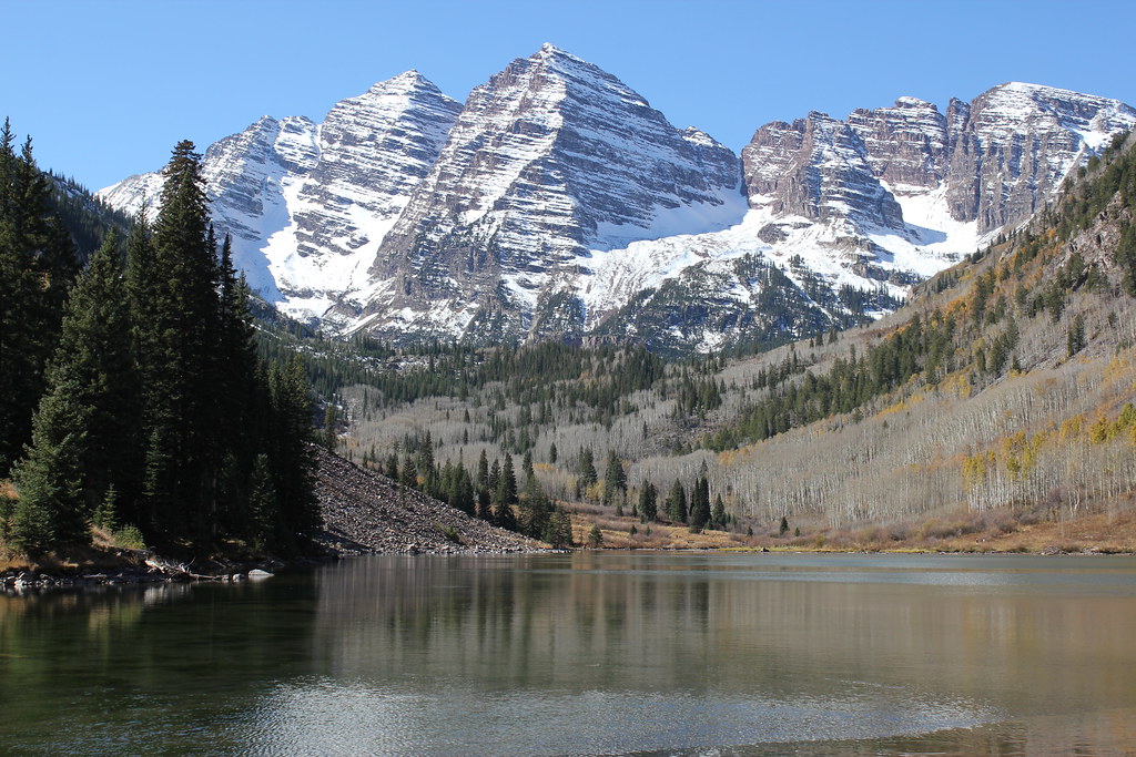
Trail near Maroon Peak
 Photo: KimonBerlin, CC BY-SA 2.0 (via Wikimedia Commons)
- 0.4 mi
- round trip
- 269 ft
- climb
- 10,773 ft
- high point
- Out and back
- route
- Jun–Sep
- best months
Caution at last check
Agency alerts are in effect for this area; weather is marginal · USFS, OpenWeather · checked 17 h ago
Is Trail near Maroon Peak open right now?
Alert in the area
The Forest Service lists 6 alerts for White River National Forest.
FSR 286, Radical Hill, is closed due to washouts and unsafe conditions
Agency alert covering White River National Forest · USFS · White River National Forest
Limited parking at Snowmass Creek Trailhead
Agency alert covering White River National Forest · USFS · White River National Forest
Grizzly Creek Trail Closure
Agency alert covering White River National Forest · Order 2026-02 · USFS · White River National Forest
Ruedi Marina Day Use area Dump Station is CLOSED
Agency alert covering White River National Forest · USFS · White River National Forest
Asbestos safety closure - Camp Hale
Agency alert covering White River National Forest · USFS · White River National Forest
As of · Source: USFS · White River National Forest. Agencies don't list every closure — check before you go.
This short out-and-back trail near Maroon Peak in Colorado is 0.40 miles and gains 269 feet of elevation. It is managed by the Forest Service.
Go with a guide
- Mineral Belt Trail Guided WalkNexPM AI · $25 per person · 39 mi away
- Maroon Bells Guide and Outfitters9 mi away
- West MaroonHiking · ~3 min drivePhoto: KimonBerlin, CC BY-SA 2.0 (via Wikimedia Commons)
 Scenic Trail (Maroon Lake)Hiking · ~4 min drivePhoto: Michael Kirsh, CC BY-SA 2.0 (via Flickr)
 Willow LakeHiking · ~4 min drivePhoto: kalestews, CC BY 2.0 (via Flickr)
 Treasury MountainHiking · ~9 min drivePhoto: The Greater Southwestern Exploration Company from Long Beach, California, United States, CC BY 2.0 (via Wikimedia Commons)
- Maroon-Snowmass TrailHiking · ~5 min drivePhoto: Michael Kirsh, CC BY-SA 2.0 (via Flickr)
- Trail near Maroon LakeHiking · ~5 min drivePhoto: Michael Kirsh, CC BY-SA 2.0 (via Flickr)
 East Snowmass TrailHiking · ~6 min drivePhoto: Jeffrey Beall, CC BY-SA 2.0 (via Flickr)
 Precarious PeakHiking · ~10 min drivePhoto: Jeffrey Pang from Berkeley, CA, USA, CC BY 2.0 (via Wikimedia Commons)
 East MaroonHiking · ~8 min drivePhoto: Cal Wolfe, CC BY-SA 3.0 (via Wikimedia Commons)
 Judd FallsHiking · ~12 min drivePhoto: Charlie DeTar, CC BY-SA 3.0 (via Wikimedia Commons)
Best time to visit Trail near Maroon Peak
Best months: June–September. Best months have typical highs of 55–85 °F, lows of 30 °F or warmer (32 °F where the station doesn't record snow), at most one snowy day and no more than 12 wet days.
Jan
29° / -8°
8 wet
Feb
33° / -5°
8 wet
Mar
40° / 4°
8 wet
Apr
47° / 18°
8 wet
May
58° / 29°
8 wet
Jun
69° / 36°
7 wet
Jul
72° / 42°
11 wet
Aug
70° / 41°
12 wet
Sep
64° / 34°
9 wet
Oct
54° / 25°
7 wet
Nov
40° / 13°
8 wet
Dec
28° / -4°
8 wet
Typical high / low (°F) and days with rain or snow, 1991–2020. Measured at Taylor Park, CO, 25.9 mi away at 9,179 ft. The station sits about 1,600 ft lower than this place, so expect it a little cooler here. This station doesn't record snowfall. Source: NOAA NCEI U.S. Climate Normals 1991–2020.


Map and trail data © OpenStreetMap contributors
