East Snowmass Trail
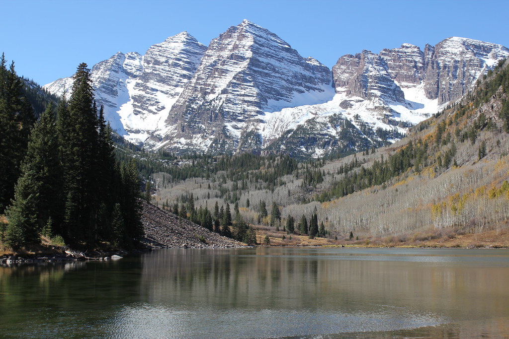 Photo: Jeffrey Beall, CC BY-SA 2.0 (via Flickr)
- 7.8 mi
- round trip
- 396 ft
- climb
- 12,691 ft
- high point
- Out and back
- route
Caution at last check
Agency alerts are in effect for this area; weather is marginal · USFS, OpenWeather · checked 23 h ago
Is East Snowmass Trail open right now?
Alert in the area
The Forest Service lists 6 alerts for White River National Forest.
FSR 286, Radical Hill, is closed due to washouts and unsafe conditions
Agency alert covering White River National Forest · USFS · White River National Forest
Limited parking at Snowmass Creek Trailhead
Agency alert covering White River National Forest · USFS · White River National Forest
Grizzly Creek Trail Closure
Agency alert covering White River National Forest · Order 2026-02 · USFS · White River National Forest
Ruedi Marina Day Use area Dump Station is CLOSED
Agency alert covering White River National Forest · USFS · White River National Forest
Asbestos safety closure - Camp Hale
Agency alert covering White River National Forest · USFS · White River National Forest
As of · Source: USFS · White River National Forest. Agencies don't list every closure — check before you go.
East Snowmass Trail is a 15.6-mile out-and-back hike in Colorado with 396 feet of elevation gain. The trail is managed by the Forest Service.
Go with a guide
- Mineral Belt Trail Guided WalkNexPM AI · $25 per person · 38 mi away
- Maroon Bells Guide and Outfitters6 mi away
 Willow LakeHiking · ~2 min drivePhoto: kalestews, CC BY 2.0 (via Flickr)
 West MaroonHiking · ~3 min drivePhoto: KimonBerlin, CC BY-SA 2.0 (via Wikimedia Commons)
 Trail near Maroon LakeHiking · ~3 min drivePhoto: Michael Kirsh, CC BY-SA 2.0 (via Flickr)
 Hagerman PeakHiking · ~11 min drivePhoto: The Greater Southwestern Exploration Company from Long Beach, California, United States, CC BY 2.0 (via Wikimedia Commons)
 Maroon CreekHiking · ~7 min drivePhoto: Tony Webster, CC BY 2.0 (via Flickr)
- Maroon-Snowmass TrailHiking · ~3 min drivePhoto: Michael Kirsh, CC BY-SA 2.0 (via Flickr)
- Scenic Trail (Maroon Lake)Hiking · ~3 min drivePhoto: Michael Kirsh, CC BY-SA 2.0 (via Flickr)
 Snowmass Mountain: Approach to 12,300 ftHiking · ~11 min drivePhoto: rjones0856, CC BY 2.0 (via Wikimedia Commons)
 SummitHiking · ~8 min drivePhoto: NHV, CC BY 3.0 (via Wikimedia Commons)
 East MaroonHiking · ~6 min drivePhoto: Cal Wolfe, CC BY-SA 3.0 (via Wikimedia Commons)

Map and trail data © OpenStreetMap contributors
