Shinglemill
- 7.4 mi
- round trip
- 305 ft
- climb
- 7,798 ft
- high point
- Out and back
- route
- Jun–Jul, Sep
- best months
Is Shinglemill open right now?
Alert in the area
The Forest Service lists 8 alerts for Pike and San Isabel National Forests.
FSR 286, Radical Hill, is closed due to washouts and unsafe conditions
Agency alert covering Pike and San Isabel National Forests · USFS · Pike and San Isabel National Forests
Interlaken Hotel Tree Hazards
Agency alert covering Pike and San Isabel National Forests · USFS · Pike and San Isabel National Forests
Sharpe Fire Update
Agency alert covering Pike and San Isabel National Forests · USFS · Pike and San Isabel National Forests
Turquoise Lake Road (County Road 4) Closure
Agency alert covering Pike and San Isabel National Forests · USFS · Pike and San Isabel National Forests
Downed and weakened trees on South Platte Ranger District
Agency alert covering South Platte Ranger District · USFS · South Platte Ranger District
As of · Source: USFS · Pike and San Isabel National Forests. Agencies don't list every closure — check before you go.
Shinglemill is a 7.4-mile out-and-back hike in Colorado's Pike and San Isabel National Forests, within the South Platte Ranger District. The trail rises from a low point of 6,995 feet to a high of 7,798 feet, with a total elevation gain of 305 feet. The Forest Service manages the land, and the route is rated hard. The trail is natural-surfaced and allows horses, so riders can take the path on foot or on horseback. The parking area is named Shinglemill, and the trail is open year-round. Summer is the most comfortable time to go. Typical averages from a nearby weather station in Bailey, at a similar elevation, show July highs around 79°F with lows near 44°F, while winter highs stay in the upper 30s. Buffalo Creek, a climbing area, sits just 0.4 miles away, and the Shinglemill 725 mountain biking route is 0.7 miles off. For an overnight stay, Meadows Group Campground is about 2 miles away, and Buffalo Campground is about 2.4 miles away.
Local outfitters
- Lostfork Basecamp22 mi away
- Camp Always Choose Adventures35 mi away
Not on Roamze yet. Their page has how to reach them.
Best time to go · Jun–Jul, Sep
Best time to visit Shinglemill
Best months: June–July and September. Best months have typical highs of 55–85 °F, lows of 30 °F or warmer (32 °F where the station doesn't record snow), at most one snowy day and no more than 12 wet days.
Jan
38° / 9°
4 wet
Feb
40° / 10°
5 wet
Mar
48° / 18°
6 wet
Apr
54° / 23°
7 wet
May
63° / 31°
8 wet
Jun
75° / 38°
8 wet
Jul
79° / 44°
12 wet
Aug
77° / 43°
13 wet
Sep
71° / 35°
7 wet
Oct
59° / 24°
5 wet
Nov
45° / 16°
4 wet
Dec
37° / 9°
4 wet
Typical high / low (°F) and days with rain or snow, 1991–2020. Measured at Bailey, CO, 10.9 mi away at 7,752 ft. This station doesn't record snowfall. Source: NOAA NCEI U.S. Climate Normals 1991–2020.
Keep exploring — more trails worth the drive
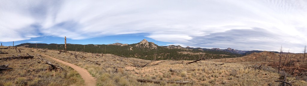 Photo: rb06, CC BY 2.0 (via Flickr)
Morrison Creek
~2 min drive
4.12-mile out-and-back trail in Colorado's Pike and San Isabel National Forests.
Photo: rb06, CC BY 2.0 (via Flickr)Tramway
~3 min drive
4.43-mile out-and-back trail in Colorado with 491 ft elevation gain.
HIKE
Little Scraggy
~3 min drive
18.53-mile out-and-back trail in Colorado managed by Pike and San Isabel National Forests.
HIKE
North Fork Trail
~13 min drive
19.66-mile out-and-back trail in Colorado with 4,065 ft elevation gain and loss.
 Photo: lamblukas, CC BY 2.0 (via Flickr)
Cynical Trail
~8 min drive
1.34-mile out-and-back trail in Colorado with 821 ft gain.
Photo: rb06, CC BY 2.0 (via Flickr)Baldy
~4 min drive
4.06-mile loop trail in Colorado's Pike and San Isabel National Forests.
HIKE
Green Mountain
~3 min drive
8.49-mile out-and-back hike in Colorado's Pike and San Isabel National Forests with 398 ft gain.
 Photo: lamblukas, CC BY 2.0 (via Flickr)
Eagle's View Trail
~14 min drive
2.23-mile loop in Colorado with 658 ft gain and 663 ft loss.
Photo: lamblukas, CC BY 2.0 (via Flickr)Sunshine Trail
~8 min drive
1.16-mile out-and-back trail in Colorado with 1,130 ft elevation gain
HIKE
Gashouse Gulch
~4 min drive
11.10-mile out-and-back trail in Colorado with 885 ft elevation gain.
Map and trail data © OpenStreetMap contributors
