Gashouse Gulch
- 11.1 mi
- round trip
- 885 ft
- climb
- 8,058 ft
- high point
- Out and back
- route
- Jun–Jul, Sep
- best months
Caution today
Agency alerts are in effect for this area; weather is good · USFS, OpenWeather · checked 2 h ago
Is Gashouse Gulch open right now?
Alert in the area
The Forest Service lists 8 alerts for Pike and San Isabel National Forests.
FSR 286, Radical Hill, is closed due to washouts and unsafe conditions
Agency alert covering Pike and San Isabel National Forests · USFS · Pike and San Isabel National Forests
Interlaken Hotel Tree Hazards
Agency alert covering Pike and San Isabel National Forests · USFS · Pike and San Isabel National Forests
Sharpe Fire Update
Agency alert covering Pike and San Isabel National Forests · USFS · Pike and San Isabel National Forests
Turquoise Lake Road (County Road 4) Closure
Agency alert covering Pike and San Isabel National Forests · USFS · Pike and San Isabel National Forests
Downed and weakened trees on South Platte Ranger District
Agency alert covering South Platte Ranger District · USFS · South Platte Ranger District
As of · Source: USFS · Pike and San Isabel National Forests. Agencies don't list every closure — check before you go.
Gashouse Gulch is a hard hike in the South Platte Ranger District of the Pike and San Isabel National Forests in Colorado, managed by the Forest Service. The route is an out-and-back of about 11 miles, with a one-way climb of roughly 885 feet from a low point of about 7,124 feet to a high of about 8,058 feet. Summer is the most comfortable time to go. Typical averages from a nearby weather station in Bailey, at a similar elevation, show July highs around 79°F with lows near 44°F, while winter highs stay in the upper 30s. The trail is on natural surface and allows horses. Buffalo Campground and the Baldy mountain biking area are both about 0.7 miles away, and the Tramway hike is about 0.4 miles off. Climbers can head to Buffalo Creek, about 2.1 miles away.
Local outfitters
- Lostfork Basecamp20 mi away
- Camp Always Choose Adventures34 mi away
Not on Roamze yet. Their page has how to reach them.
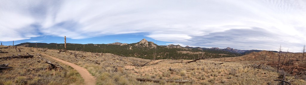 TramwayHikingPhoto: rb06, CC BY 2.0 (via Flickr)0.4 mi
- BaldyMountain biking0.7 mi
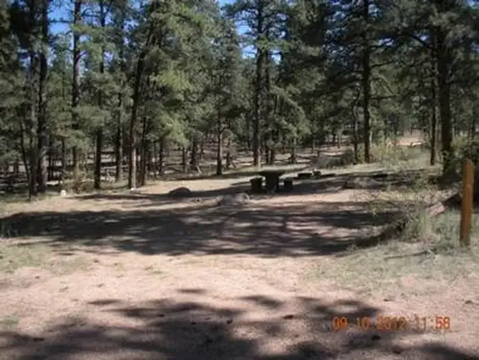 Buffalo CampgroundCampingPhoto: Recreation.gov (RIDB) / public domain0.7 mi
- Meadows Group CampgroundCamping1 mi
- Buffalo CreekRock climbing2.1 mi
- Little Scraggy DomeRock climbing2.7 mi
- West Resort CreekCanoeing7.5 mi
- Craig CreekCanoeing8.4 mi
Source: Roamze catalog (indexable pages within 10 miles, PostGIS distance)
- BaldyHiking · ~2 min drivePhoto: rb06, CC BY 2.0 (via Flickr)
 Cynical TrailHiking · ~10 min drivePhoto: lamblukas, CC BY 2.0 (via Flickr)
- Green MountainHiking · ~2 min drive
- North Fork TrailHiking · ~16 min drive
- Sunshine TrailHiking · ~10 min drivePhoto: lamblukas, CC BY 2.0 (via Flickr)
 Eagle's View TrailHiking · ~15 min drivePhoto: lamblukas, CC BY 2.0 (via Flickr)
- ShinglemillHiking · ~4 min drive
- Raven's Roost TrailHiking · ~16 min drivePhoto: lamblukas, CC BY 2.0 (via Flickr)
 Oxen Draw TrailHiking · ~16 min drivePhoto: lamblukas, CC BY 2.0 (via Flickr)
- Little ScraggyHiking · ~6 min drive
Also worth it near here
Best time to visit Gashouse Gulch
Best months: June–July and September. Best months have typical highs of 55–85 °F, lows of 30 °F or warmer (32 °F where the station doesn't record snow), at most one snowy day and no more than 12 wet days.
Jan
38° / 9°
4 wet
Feb
40° / 10°
5 wet
Mar
48° / 18°
6 wet
Apr
54° / 23°
7 wet
May
63° / 31°
8 wet
Jun
75° / 38°
8 wet
Jul
79° / 44°
12 wet
Aug
77° / 43°
13 wet
Sep
71° / 35°
7 wet
Oct
59° / 24°
5 wet
Nov
45° / 16°
4 wet
Dec
37° / 9°
4 wet
Typical high / low (°F) and days with rain or snow, 1991–2020. Measured at Bailey, CO, 8.9 mi away at 7,752 ft. This station doesn't record snowfall. Source: NOAA NCEI U.S. Climate Normals 1991–2020.
Map and trail data © OpenStreetMap contributors
