Deer Creek Campground
Campground
The next 6 weekends are full on Recreation.gov
Alert in the area
The Forest Service lists 8 alerts for Pike and San Isabel National Forests.
FSR 286, Radical Hill, is closed due to washouts and unsafe conditions
Agency alert covering Pike and San Isabel National Forests · USFS · Pike and San Isabel National Forests
Interlaken Hotel Tree Hazards
Agency alert covering Pike and San Isabel National Forests · USFS · Pike and San Isabel National Forests
Sharpe Fire Update
Agency alert covering Pike and San Isabel National Forests · USFS · Pike and San Isabel National Forests
Turquoise Lake Road (County Road 4) Closure
Agency alert covering Pike and San Isabel National Forests · USFS · Pike and San Isabel National Forests
Downed and weakened trees on South Platte Ranger District
Agency alert covering South Platte Ranger District · USFS · South Platte Ranger District
As of · Source: USFS · Pike and San Isabel National Forests. Agencies don't list every closure — check before you go.
Rosalie Peak is a high, steep out-and-back hike in Colorado's Pike and San Isabel National Forests, within the South Platte Ranger District. The route covers about 10.8 miles, with a total climb of 4,511 feet up to the summit at 13,576 feet. The elevation gain and loss are both about 4,500 feet, and the peak rises to just over 13,500 feet. The hike is rated expert, so plan on a full day. An estimated six hours should get you up and back, and Deer Creek Campground sits about 0.7 miles away for overnight stays. The South Platte Ranger District's Forest Service manages the land. Tanglewood is a nearby hike at about 1.1 miles, and Meridian Campground is about 1.7 miles away. Climbers can head to Mount Evans Side, roughly 5.8 miles off, and paddlers will find the North Fork South Platte River about 7.5 miles away.
Deer Creek Campground
Campground
 If it rainsUser:Magicpiano, CC BY-SA 4.0 · Wikimedia Commons
Historic house-museum in Georgetown, Colorado, United States
Places © OpenStreetMap contributors, Places © Overture Maps Foundation · Photos: User:Magicpiano, CC BY-SA 4.0 (commons)
More in Idaho SpringsDaily highs and lows, wind and the chance of precipitation at the summit and route start for the next 7 days, from the Open-Meteo model.
 Mt. Evans - mixed, couloirsRock climbingPhoto: regexman, CC BY 2.0 (via Flickr)6.7 mi
 North Fork South Platte RiverCanoeingPhoto: Jeffrey Beall, CC BY 3.0 (via Wikimedia Commons)7.5 mi
 Geneva CreekCanoeingPhoto: Plazak, CC BY-SA 3.0 (via Wikimedia Commons)8.7 mi
Source: Roamze catalog (indexable pages within 10 miles, PostGIS distance)
 Geneva CreekHiking · ~12 min drivePhoto: jaygannett, CC BY-SA 2.0 (via Flickr)
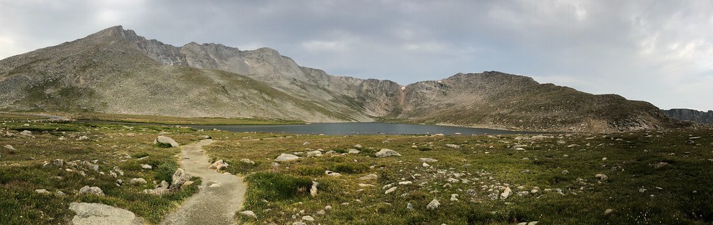 Mount Blue SkyHiking · ~12 min drivePhoto: regexman, CC BY 2.0 (via Flickr)
 Mount Blue Sky RidgeHiking · ~13 min drivePhoto: gregor_y, CC BY-SA 2.0 (via Flickr)
 Epaulet MountainHiking · ~13 min drivePhoto: Tony Webster, CC BY 2.0 (via Flickr)
 Sawtooth Ridge TraverseHiking · ~13 min drivePhoto: versute, CC BY-SA 3.0 (via Wikimedia Commons)Gray Wolf MountainHiking · ~12 min drivePhoto: regexman, CC BY 2.0 (via Flickr)
 Rusty BuckleHiking · ~14 min drivePhoto: kalestews, CC BY 2.0 (via Flickr)West Meadows LoopHiking · ~13 min drivePhoto: kalestews, CC BY 2.0 (via Flickr)Abyss LakeHiking · ~13 min drivePhoto: Tony Webster, CC BY 2.0 (via Flickr)
About 10.8 mi round trip from Deer Creek Trailhead.
About 4,511 ft of climbing round trip.
It is rated expert.
Deer Creek Trailhead.
© openrouteservice.org by HeiGIT | Map data © OpenStreetMap contributors


