Little Rock Lake
Campground
Campground · 1.7 mi from the trail
 Photo: Stabbur's Master, CC BY-SA 2.0 (via Flickr)
Blocked today
A road serving this area is closed; weather is good · State DOT 511, OpenWeather · checked 4 h ago
Road closed
US 34: Trail Ridge Road is listed as closed by CDOT 511 (2 listed).
US 34: Trail Ridge Road
Closed · ~2.7 km from Rock Cut · CDOT 511
US 34: road closure
Closed · ~0.0 km from Rock Cut · CDOT 511
Trail Ridge Road is Closed to Through Travel for the Season
Park closure covering Rocky Mountain National Park · NPS · Rocky Mountain National Park
As of · Source: CDOT 511. Agencies don't list every closure — check before you go.
At 12,110 feet, this stop along Trail Ridge Road is on the “Roof of the Rockies.” Weather can be severe up here – temperatures remain below freezing almost all winter, and wind speeds can exceed 150 miles per hour. The growing season is only 6-12 weeks long, allowing the tiny but mighty plant life to thrive. Despite severe conditions more than 100 species of flowering plants live on the rich alpine tundra. Common species include alpine avens and american bistorts. The fence near the parking area protects an ecological research plot established in 1958 by alpine botanist Beatrice Willard (1925-2003). For 40 years she monitored tundra plants and the rate of how trampled alpine habitat could recover. The plot was entered on the National Register of Historic Places in 2007 as the first ecological plot in the country to be so recognized. Due to her research, Rock Cut is a Tundra Closure Area which limits all hiking to paved asphalt trails to protect the fragile tundra plants. Thank you for enjoying the rare flowers and not picking them. Most alpine plants take several years to produce a single flower, and many are food to pikas and marmots. These small creatures can usually be seen bouncing up and around rocks throughout the area. Note: Trail Ridge Road closes mid-October to Memorial Day. Extreme weather can change the status of Trail Ridge Road at any time—be ready to adjust your travel plans if needed, and always check the weather before you start your drive. Altitude Warning: Altitude sickness affects many visitors every year. Symptoms include headache, nausea, fatigue, dizziness, vomiting, and even unconsciousness. Altitude can also aggravate pre-existing conditions like heart and lung disease. Take your time, drink water, eat, and rest. The only cure for altitude sickness is to go down to a lower altitude.
Little Rock Lake
Campground
Images of Rocky Mountain National Park
Gallery
Places © OpenStreetMap contributors, Places © Overture Maps Foundation
More in Estes ParkNot on Roamze yet. Their page has how to reach them.
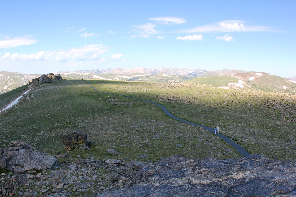 Tundra Communities TrailHikingPhoto: daveynin — CC BY 2.0 (via Flickr)0.1 mi
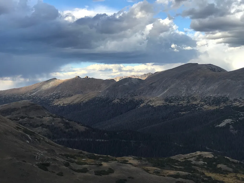 Lava CliffsHikingPhoto: George Bannister from Woodville, MS, USA — Wikimedia Commons (CC BY 2.0)1.4 mi
 Rock Of AgesRock climbingPhoto: lamblukas, CC BY 2.0 (via Flickr)5.8 mi
Source: Roamze catalog (indexable pages within 10 miles, PostGIS distance)
 Ypsilon MountainHiking · ~3 min drivePhoto: Unknown authorUnknown author, Public domain (via Wikimedia Commons)Chapin Creek TrailHiking · ~3 min drivePhoto: Unknown authorUnknown author, Public domain (via Wikimedia Commons)
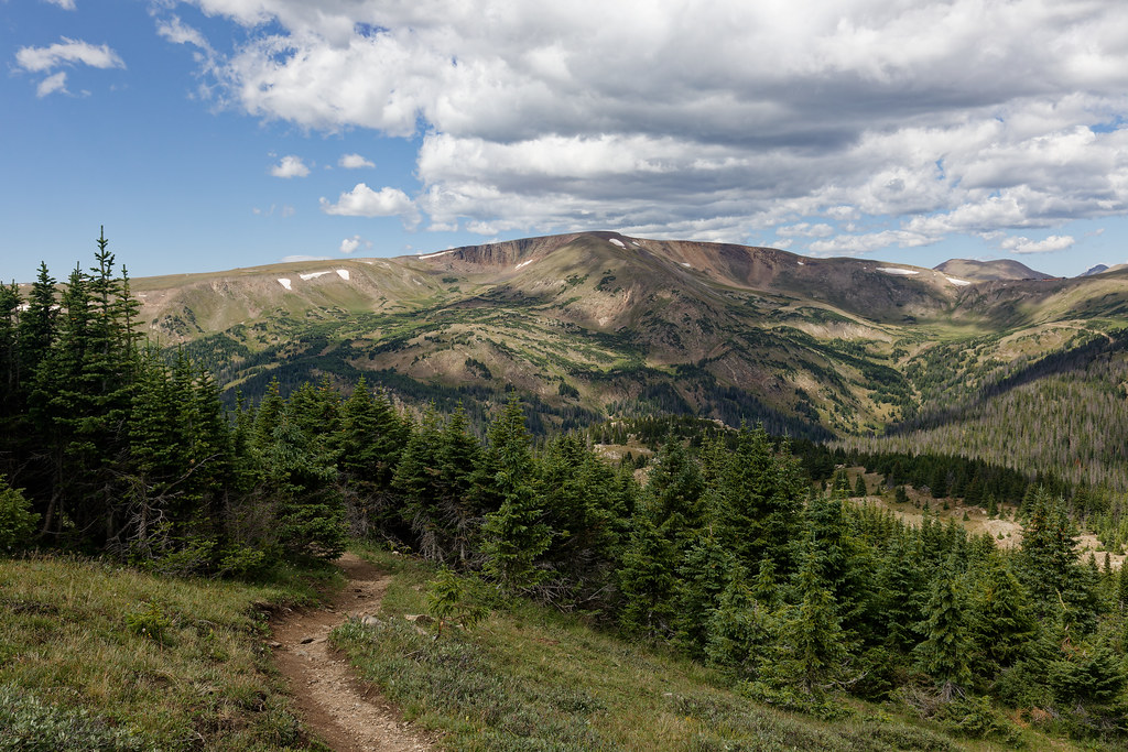 Chapin Pass Trail - Lower ForkHiking · ~3 min drivePhoto: KimonBerlin, CC BY-SA 2.0 (via Flickr)
 Hagues PeakHiking · ~10 min drivePhoto: plutonature333, CC BY-SA 3.0 (via Wikimedia Commons)Mount ChiquitaHiking · ~3 min drivePhoto: Unknown authorUnknown author, Public domain (via Wikimedia Commons)
 Ute TrailHiking · ~4 min drivePhoto: Vadim Manuylov, CC BY-SA 3.0 (via Wikimedia Commons)
 Marmot Point Hiking TrailHiking · ~4 min drivePhoto: Bas van Oorschot, CC BY-SA 3.0 (via Wikimedia Commons)Fairchild MountainHiking · ~10 min drivePhoto: plutonature333, CC BY-SA 3.0 (via Wikimedia Commons)
Also worth it near here
 Sundance MountainSummit · ~2 min drivePhoto: Dakota Duff, CC BY-SA 2.0 (via Wikimedia Commons)
 Fern FallsWaterfall · ~10 min drivePhoto: KimonBerlin, CC BY-SA 2.0 (via Wikimedia Commons)
 Fern Lake CampsiteCamping · ~10 min drivePhoto: KimonBerlin — CC BY-SA 2.0 (via Flickr)
