Nellie Creek
Campground
Campground · 5.3 mi from the trail
 Photo: John Sowell, CC BY-SA 4.0 (via Wikimedia Commons)
Closure in the area
There's a closure order in Grand Mesa, Uncompahgre and Gunnison National Forests. It doesn't name MATTERHORN CUTOFF, so check the source for the area it covers (2 listed).
Gold Mountain Wildfire Roads and Trails Closure Order v 4.0
Agency closure covering Grand Mesa, Uncompahgre and Gunnison National Forests · USFS · Grand Mesa, Uncompahgre and Gunnison National Forests
Ophir Pass Road Closure
Agency closure covering Grand Mesa, Uncompahgre and Gunnison National Forests · USFS · Grand Mesa, Uncompahgre and Gunnison National Forests
Potter Basin Road Closure Order
Agency alert covering Grand Mesa, Uncompahgre and Gunnison National Forests · USFS · Grand Mesa, Uncompahgre and Gunnison National Forests
Beaver Park Road Closure Order
Agency alert covering Grand Mesa, Uncompahgre and Gunnison National Forests · USFS · Grand Mesa, Uncompahgre and Gunnison National Forests
TERMINATION OF ORDER - FIRE RESTRICTIONS
Agency alert covering Grand Mesa, Uncompahgre and Gunnison National Forests · USFS · Grand Mesa, Uncompahgre and Gunnison National Forests
As of · Source: USFS · Grand Mesa, Uncompahgre and Gunnison National Forests. Agencies don't list every closure — check before you go.
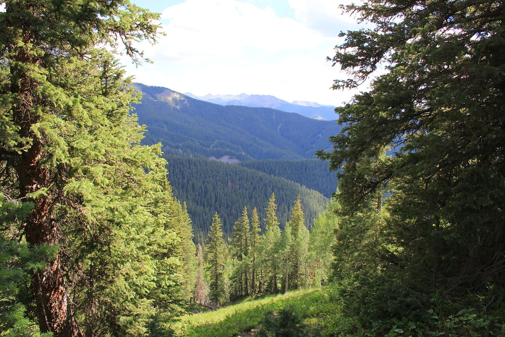
Matterhorn Cutoff is a 2.1-mile out-and-back hike in Colorado's Uncompahgre Wilderness, within the Gunnison Ranger District of the Grand Mesa, Uncompahgre and Gunnison National Forests. The Forest Service manages the land, and the route starts at about 11,436 feet, rising to a high point of 12,265 feet with a total gain of 960 feet. The climb is front-loaded, with the steepest stretch at about 0.8 miles in, where the grade reaches 20 percent. The hike is rated moderate, and the round trip takes about an hour. The route is short but steep, so plan for a steady pace on the way up and a similar one on the way down. Wetterhorn Peak Trail #256 lies about 0.6 miles away, and the Ridge Stock Driveway mountain biking route is about 0.4 miles off. Climbers can head to Mileski Wall, about 3.5 miles away, and paddlers will find Henson Creek about 4.1 miles from the trail.
Nellie Creek
Campground
Smuggler Union Tramhouse
Attraction
Places © OpenStreetMap contributors
More in TellurideNot on Roamze yet. Their page has how to reach them.
 Ridge Stock DrivewayMountain bikingPhoto: robert thigpen from diboll, texas, CC BY-SA 2.0 (via Wikimedia Commons)0.4 miWetterhorn Peak Trail #256HikingPhoto: John Sowell, CC BY-SA 4.0 (via Wikimedia Commons)0.6 mi
 Henson CreekCanoeingPhoto: Jeffrey Beall, CC BY 4.0 (via Wikimedia Commons)4.1 mi
Source: Roamze catalog (indexable pages within 10 miles, PostGIS distance)
Wetterhorn Peak Trail #256Hiking · ~1 min drivePhoto: John Sowell, CC BY-SA 4.0 (via Wikimedia Commons) Silver MountainHiking · ~7 min drivePhoto: kalestews, CC BY 2.0 (via Flickr)Big Blue CreekHiking · ~8 min drivePhoto: kalestews, CC BY 2.0 (via Flickr)
 Engineer Mountain TrailHiking · ~11 min drivePhoto: WKHarmon, CC BY 2.0 (via Flickr)Broken HillHiking · ~2 min drivePhoto: John Sowell, CC BY-SA 4.0 (via Wikimedia Commons)Sheep MountainHiking · ~7 min drivePhoto: kalestews, CC BY 2.0 (via Flickr)
 Bear Creek South Fork Trail (242)Hiking · ~12 min drivePhoto: WKHarmon, CC BY 2.0 (via Flickr)
 CourthouseHiking · ~12 min drivePhoto: daveynin, CC BY 2.0 (via Flickr)
 Mark MountainHiking · ~13 min drivePhoto: kalestews, CC BY 2.0 (via Flickr)
Also worth it near here
Ridge Stock DrivewayMountain biking · Next doorPhoto: robert thigpen from diboll, texas, CC BY-SA 2.0 (via Wikimedia Commons) Wetterhorn PeakSummit · ~2 min drivePhoto: Unknown authorUnknown author, CC BY-SA 3.0 (via Wikimedia Commons)Henson CreekCanoeing · ~7 min drivePhoto: Jeffrey Beall, CC BY 4.0 (via Wikimedia Commons)
