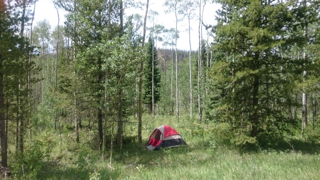
Bull Mountain Campground
Campground
Campground · 3.7 mi from the trail
Alert in the area
The Forest Service lists 3 alerts for Arapaho and Roosevelt National Forests.
Fire Restrictions
Agency alert covering Arapaho and Roosevelt National Forests · USFS · Arapaho and Roosevelt National Forests
Fire Restrictions
Agency alert covering Sulphur Ranger District · USFS · Sulphur Ranger District
Permanent Recreational Shooting Order
Agency alert covering Sulphur Ranger District · Order 02-10-00-25-02 · USFS · Sulphur Ranger District
As of · Source: USFS · Arapaho and Roosevelt National Forests. Agencies don't list every closure — check before you go.
Gilsonite is a short, easy out-and-back hike in the Sulphur Ranger District of the Arapaho and Roosevelt National Forests in Colorado, managed by the Forest Service. The trail is about 1.2 miles long, with a low point of 9,773 feet and a high of 9,868 feet, so the one-way climb is about 51 feet. The route is on natural surface, and both horses and bikes are allowed. Summer is the most comfortable time to go. Typical averages from a nearby weather station at Grand Lake show July highs around 76°F with lows near 40°F, while winter brings highs around 30°F and frequent snow days from December through February. That station sits roughly 1,150 feet lower than the trail, so temperatures on the hike run cooler. The trail is open from June 1 to November 15. Wolverine is a hike about 1.4 miles away, and the Gilsonite Trail and Stillwater Pass mountain biking routes are within about 2 miles. Bull Mountain Campground, about 3.7 miles off, offers a place to stay.
Bull Mountain Campground
Campground
Places © OpenStreetMap contributors, Places © Overture Maps Foundation
More in Estes ParkNot on Roamze yet. Their page has how to reach them.
 Stillwater PassMountain bikingPhoto: inkknife_2000 (7.5 million views +), CC BY-SA 2.0 (via Wikimedia Commons)2 mi
 Willow CreekCanoeingPhoto: Jeffrey Beall, CC BY 4.0 (via Wikimedia Commons)3.8 mi
Source: Roamze catalog (indexable pages within 10 miles, PostGIS distance)
 Beaver Line TrailHiking · ~3 min drivePhoto: Maria Vorontsova, Public Domain Dedication (CC0) (via Flickr)
 Blizzard Pass TrailHiking · ~5 min drivePhoto: Thomas — CC BY-SA 2.0 (via Flickr)
 Trail Creek Spur TrailHiking · ~3 min drivePhoto: Maria Vorontsova, Public Domain Dedication (CC0) (via Flickr)Pony Park TrailHiking · ~6 min drivePhoto: Thomas — CC BY-SA 2.0 (via Flickr)TRAIL CREEK SPURHiking · ~4 min drivePhoto: Maria Vorontsova, Public Domain Dedication (CC0) (via Flickr)Bull Mountain TrailHiking · ~4 min drivePhoto: Thomas — CC BY-SA 2.0 (via Flickr)
Also worth it near here
Stillwater PassMountain biking · ~3 min drivePhoto: inkknife_2000 (7.5 million views +), CC BY-SA 2.0 (via Wikimedia Commons)Willow CreekCanoeing · ~7 min drivePhoto: Jeffrey Beall, CC BY 4.0 (via Wikimedia Commons) River Run LoopCross-country skiing · ~7 min drivePhoto: Don Graham from Redlands, CA, USA - God bless it!, CC BY-SA 2.0 (via Wikimedia Commons)
 Cascade MountainSummit · ~10 min drivePhoto: mark byzewski, CC BY 2.0 (via Wikimedia Commons)
Best months: June and September. Best months have typical highs of 55–85 °F, lows of 30 °F or warmer (32 °F where the station doesn't record snow), at most one snowy day and no more than 12 wet days.
Jan
30° / 4°
14 wet · 14 snow
Feb
34° / 6°
13 wet · 12 snow
Mar
42° / 14°
12 wet · 9 snow
Apr
49° / 20°
11 wet · 6 snow
May
59° / 28°
12 wet · 2 snow
Jun
71° / 34°
11 wet
Jul
76° / 40°
14 wet
Aug
73° / 38°
15 wet
Sep
68° / 32°
12 wet · 1 snow
Oct
55° / 23°
10 wet · 4 snow
Nov
40° / 13°
11 wet · 9 snow
Dec
30° / 5°
14 wet · 13 snow
Typical high / low (°F) and days with rain or snow, 1991–2020. Measured at Grand Lake 1 Nw, CO, 6.3 mi away at 8,720 ft. The station sits about 1,100 ft lower than this place, so expect it a little cooler here. Source: NOAA NCEI U.S. Climate Normals 1991–2020.
