Bull Mountain Campground
Campground
Campground · 4.7 mi from the trail
Alert in the area
The Forest Service lists 3 alerts for Arapaho and Roosevelt National Forests.
Fire Restrictions
Agency alert covering Arapaho and Roosevelt National Forests · USFS · Arapaho and Roosevelt National Forests
Fire Restrictions
Agency alert covering Sulphur Ranger District · USFS · Sulphur Ranger District
Permanent Recreational Shooting Order
Agency alert covering Sulphur Ranger District · Order 02-10-00-25-02 · USFS · Sulphur Ranger District
As of · Source: USFS · Arapaho and Roosevelt National Forests. Agencies don't list every closure — check before you go.
The Wolverine hike is a 4.3-mile out-and-back in Colorado's Arapaho and Roosevelt National Forests, on the Forest Service's Sulphur Ranger District. The trail rises about 740 feet from a low point of 10,323 feet to a high of 11,058 feet, and it is rated moderate. The trail is open from June 1 to November 15. It is a natural-surface route that allows horses and bikes, so it works for riders and for pack animals as well as for hikers. The surrounding land is managed by the Forest Service. The Wolverine starts close to the Gilsonite Trail, a mountain biking route just 0.3 miles away, and Stillwater Pass is 0.9 miles off. GRAVEL MOUNTAIN, a nearby hike, is 1.1 miles away. For an overnight stay, Bull Mountain Campground sits about 4.7 miles from the trail.
Bull Mountain Campground
Campground
Wild Bear Tavern
Restaurant
Places © OpenStreetMap contributors
More in Estes ParkNot on Roamze yet. Their page has how to reach them.
 Photo: Thomas — CC BY-SA 2.0 (via Flickr)
Gilsonite Trail
~3 min drive
3.65-mile trail in Colorado with 800 ft of elevation gain.
Photo: Thomas — CC BY-SA 2.0 (via Flickr)Blizzard Pass Trail
~6 min drive
2.04-mile out-and-back hike in Colorado with 1,200 ft elevation gain to 11,800 ft.
HIKE
Blue Ridge
~4 min drive
7.11-mile out-and-back trail in Colorado with 929 ft elevation gain.
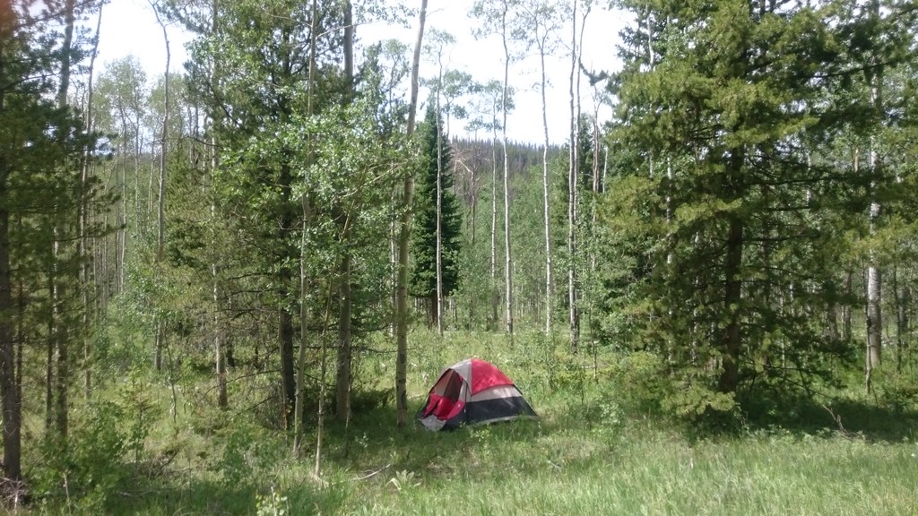 Photo: Maria Vorontsova, Public Domain Dedication (CC0) (via Flickr)
Trail Creek Spur Trail
~6 min drive
0.76-mile out-and-back trail in Colorado with 244 ft elevation gain
Photo: Thomas — CC BY-SA 2.0 (via Flickr)Pony Park Trail
~4 min drive
4.04-mile out-and-back trail in Colorado with 1,200 ft of elevation gain.
HIKE
NORTH SUPPLY LOOP
~4 min drive
12.2-mile out-and-back out-and-back in Colorado with 3,368 ft gain and 10,578 ft max elevation.
Photo: Maria Vorontsova, Public Domain Dedication (CC0) (via Flickr)TRAIL CREEK SPUR
~6 min drive
1.26-mile out-and-back trail in Colorado with 491 ft gain/loss.
HIKE
SHERMAN CREEK
~3 min drive
4.84-mile out-and-back trail in Colorado with 1,536 ft elevation gain
HIKE
Little Gravel Mountain Spur Trail
~8 min drive
4.83-mile trail in Colorado with 1,800 ft elevation gain.
Photo: Thomas — CC BY-SA 2.0 (via Flickr)Middle Supply Trail
~6 min drive
Middle Supply Trail is a 1.93-mile trail in Colorado with 400 feet of elevation gain.
Also worth it near here
 Photo: inkknife_2000 (7.5 million views +), CC BY-SA 2.0 (via Wikimedia Commons)
Stillwater Pass
~2 min drive
 Photo: Jeffrey Beall, CC BY 4.0 (via Wikimedia Commons)
Willow Creek
~7 min drive
 Photo: mark byzewski, CC BY 2.0 (via Wikimedia Commons)
Cascade Mountain
~8 min drive
 Photo: Don Graham from Redlands, CA, USA - God bless it!, CC BY-SA 2.0 (via Wikimedia Commons)
River Run Loop
~8 min drive
