Gill
- 4.7 mi
- loop
- 791 ft
- climb
- 7,236 ft
- high point
- Loop
- route
- May–Jul, Sep–Oct
- best months
Is Gill open right now?
Alert in the area
The Forest Service lists 8 alerts for Pike and San Isabel National Forests.
FSR 286, Radical Hill, is closed due to washouts and unsafe conditions
Agency alert covering Pike and San Isabel National Forests · USFS · Pike and San Isabel National Forests
Interlaken Hotel Tree Hazards
Agency alert covering Pike and San Isabel National Forests · USFS · Pike and San Isabel National Forests
Sharpe Fire Update
Agency alert covering Pike and San Isabel National Forests · USFS · Pike and San Isabel National Forests
Turquoise Lake Road (County Road 4) Closure
Agency alert covering Pike and San Isabel National Forests · USFS · Pike and San Isabel National Forests
Downed and weakened trees on South Platte Ranger District
Agency alert covering South Platte Ranger District · USFS · South Platte Ranger District
As of · Source: USFS · Pike and San Isabel National Forests. Agencies don't list every closure — check before you go.
Gill is a loop hike of about 4.7 miles on natural-surface trails in the South Platte Ranger District of the Pike and San Isabel National Forests in Colorado. It rises from a low point of about 6,517 feet to a high of about 7,236 feet, with a total elevation gain of about 791 feet, and is rated moderate. The trail is managed by the Forest Service. The trail begins at the Upper Cheesman Canyon Trailhead and runs all year. A typical trip takes about two hours. Bikes are not allowed on this route. Summer is the most comfortable time to go. Typical averages from a nearby weather station in Cheesman, at a similar elevation, put July highs around 84°F with lows near 53°F, while September cools to highs around 76°F with lows near 43°F. The South Platte River is less than a mile away, and the climbing areas at The Outback and Little Wigwam Dome sit within about 2 miles. Lone Rock Campground is about 2.7 miles off for an overnight stay.
Local outfitters
- Lostfork Basecamp27 mi away
- Broadmoor Outfitters37 mi away
Not on Roamze yet. Their page has how to reach them.
- South Platte RiverRiver fishing0.9 mi
- The OutbackRock climbing1.8 mi
- Little Wigwam DomeRock climbing2 mi
 YMCA Camo Shady BrookCampingPhoto: Jeffrey Beall, CC BY 4.0 (via Wikimedia Commons)2.3 mi
 Lone Rock Campground (co)CampingPhoto: Recreation.gov (RIDB) / public domain2.7 mi
- Horse CreekCanoeing3.4 mi
- Campground TrailMountain biking5.9 mi
- Kelsey Cut-OffMountain biking5.9 mi
Source: Roamze catalog (indexable pages within 10 miles, PostGIS distance)
 New Radio Head Rock Climbing trailHiking · ~14 min drivePhoto: Ben Mason, CC BY 2.0 (via Flickr)
- Long Hollow Trail 650Hiking · ~15 min drivePhoto: Ben Mason, CC BY 2.0 (via Flickr)
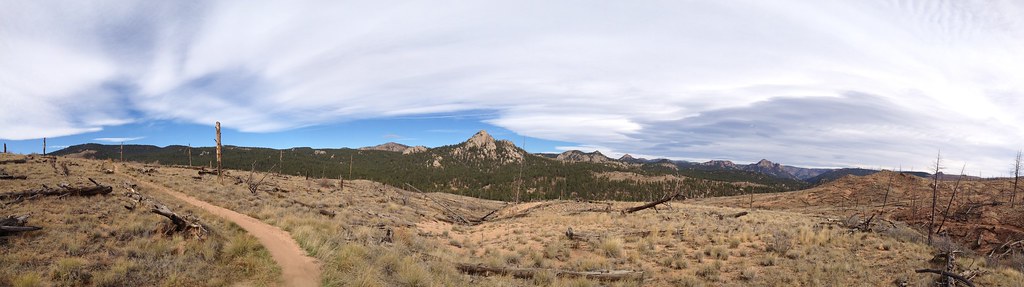 TramwayHiking · ~16 min drivePhoto: rb06, CC BY 2.0 (via Flickr)
- Goose CreekHiking · ~12 min drive
 Devils Head Spur Trail 679.AHiking · ~16 min drivePhoto: Ben Mason, CC BY 2.0 (via Flickr)
- 770.e Turtle MountainHiking · ~11 min drive
- FT 678 Ruby Creek TrailHiking · ~11 min drive
- Green MountainHiking · ~14 min drive
 QUARRY TRAILHiking · ~16 min drivePhoto: jaygannett, CC BY-SA 2.0 (via Flickr)
- Signal Butte Multi Use Trail - 717Hiking · ~16 min drive
Best time to visit Gill
Best months: May–July and September–October. Best months have typical highs of 55–85 °F, lows of 30 °F or warmer (32 °F where the station doesn't record snow), at most one snowy day and no more than 12 wet days.
Jan
45° / 14°
4 wet
Feb
46° / 16°
5 wet
Mar
53° / 23°
6 wet
Apr
58° / 29°
8 wet
May
67° / 38°
9 wet
Jun
79° / 47°
9 wet
Jul
84° / 53°
12 wet
Aug
82° / 51°
13 wet
Sep
76° / 43°
7 wet
Oct
64° / 32°
5 wet
Nov
53° / 23°
4 wet
Dec
44° / 15°
5 wet
Typical high / low (°F) and days with rain or snow, 1991–2020. Measured at Cheesman, CO, 0.8 mi away at 6,880 ft. This station doesn't record snowfall. Source: NOAA NCEI U.S. Climate Normals 1991–2020.
