Dowdy Lake Campground
Campground
Campground · 3.2 mi from the trail
Alert in the area
The Forest Service lists 4 alerts for Canyon Lakes Ranger District.
Salt Cabin Prescribed (RX) Fire Closure
Agency alert covering Canyon Lakes Ranger District · Order 02-10-05-26-11 · USFS · Canyon Lakes Ranger District
Fire Restrictions
Agency alert covering Arapaho and Roosevelt National Forests · USFS · Arapaho and Roosevelt National Forests
West Crystal A - Mechanical Fuelbreak Area and Road Closure
Agency alert covering Canyon Lakes Ranger District · Order 02-10-05-26-04 · USFS · Canyon Lakes Ranger District
Cameron Peak Fire Road Closures
Agency alert covering Canyon Lakes Ranger District · Order 02-10-05-26-01 · USFS · Canyon Lakes Ranger District
As of · Source: USFS · Canyon Lakes Ranger District. Agencies don't list every closure — check before you go.
Frog Pond Trail is a 7.7-mile out-and-back hike located in Colorado. This trail offers a straightforward route for hikers looking to explore the area with a simple turnaround point. The out-and-back format makes it easy to customize your hike distance—you can complete the full 7.7 miles or turn around earlier if preferred. The trail provides a solid day-hike option for those exploring Colorado's hiking opportunities. Being an out-and-back route, you'll retrace your steps on the return, allowing you to enjoy familiar sections of the trail from a different perspective. This hike is suitable for hikers seeking a moderate distance adventure without complicated navigation. The consistent path makes it accessible for various skill levels. Whether you're a local exploring nearby trails or visiting the area, Frog Pond Trail offers a straightforward hiking experience. Consider visiting during mild weather seasons for optimal conditions. Check local trail conditions before heading out, as Colorado weather can change rapidly at different elevations.
Dowdy Lake Campground
Campground
Homestead Museum
Museum
Places © OpenStreetMap contributors
More in Red Feather LakesNot on Roamze yet. Their page has how to reach them.
Best months: June and September. Best months have typical highs of 55–85 °F, lows of 30 °F or warmer (32 °F where the station doesn't record snow), at most one snowy day and no more than 12 wet days.
Jan
31° / 11°
9 wet
Feb
33° / 10°
9 wet
Mar
40° / 15°
10 wet
Apr
45° / 20°
10 wet
May
55° / 28°
10 wet
Jun
68° / 36°
10 wet
Jul
74° / 43°
13 wet
Aug
72° / 41°
14 wet
Sep
65° / 34°
10 wet
Oct
51° / 25°
8 wet
Nov
39° / 18°
9 wet
Dec
31° / 11°
9 wet
Typical high / low (°F) and days with rain or snow, 1991–2020. Measured at Hourglass Rsvr, CO, 16.5 mi away at 9,520 ft. This station doesn't record snowfall. Source: NOAA NCEI U.S. Climate Normals 1991–2020.
 Photo: KimonBerlin, CC BY-SA 2.0 (via Flickr)
Divide
~2 min drive
1.18-mile out-and-back trail in Colorado with 43 ft of elevation gain.
HIKE
Lady Moon
~4 min drive
5.53-mile out-and-back trail in Colorado with 170 ft elevation gain.
HIKE
Granite Ridge
~10 min drive
14.70-mile out-and-back trail in Colorado managed by Arapaho and Roosevelt National Forests.
 Photo: KimonBerlin, CC BY-SA 2.0 (via Flickr)
Frog Pond East Loop Trail
~2 min drive
0.66-mile out-and-back trail in Colorado with 140 ft elevation gain.
HIKE
Elkhorn Creek
~8 min drive
7.98-mile out-and-back trail in Colorado with 667 ft elevation gain.
HIKE
Lone Pine Creek
~10 min drive
11.05-mile out-and-back trail in Colorado with 624 ft elevation gain.
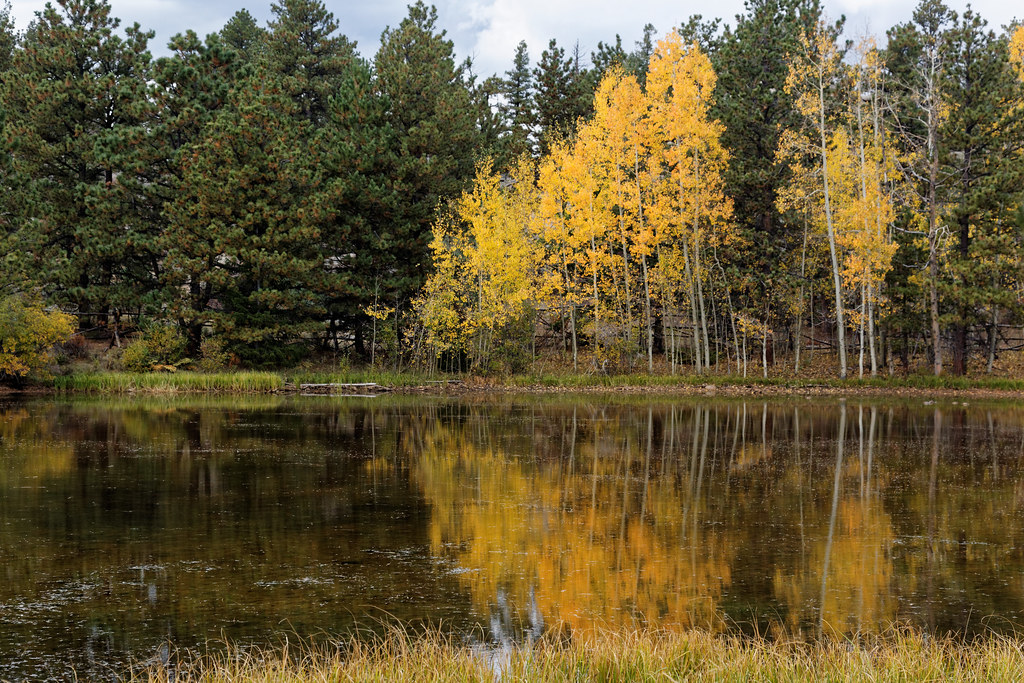 Photo: KimonBerlin, CC BY-SA 2.0 (via Flickr)
Columbine North Loop
~3 min drive
1.42-mile out-and-back trail in Colorado with 15 ft of elevation gain.
HIKE
Molly Moon
~8 min drive
4.24-mile out-and-back trail in Colorado with 136 ft gain and max elevation 8,544 ft.
 Photo: KimonBerlin, CC BY-SA 2.0 (via Flickr)
Frog Pond West Loop Trail
~3 min drive
0.8-mile out-and-back trail with 91 ft elevation gain in Colorado.
HIKE
Corral Rock Trail
~9 min drive
2.82-mile out-and-back hike in Colorado with 1,260 ft gain and loss.
Also worth it near here
Map and trail data © OpenStreetMap contributors
