Fall Mountain Peak Trail
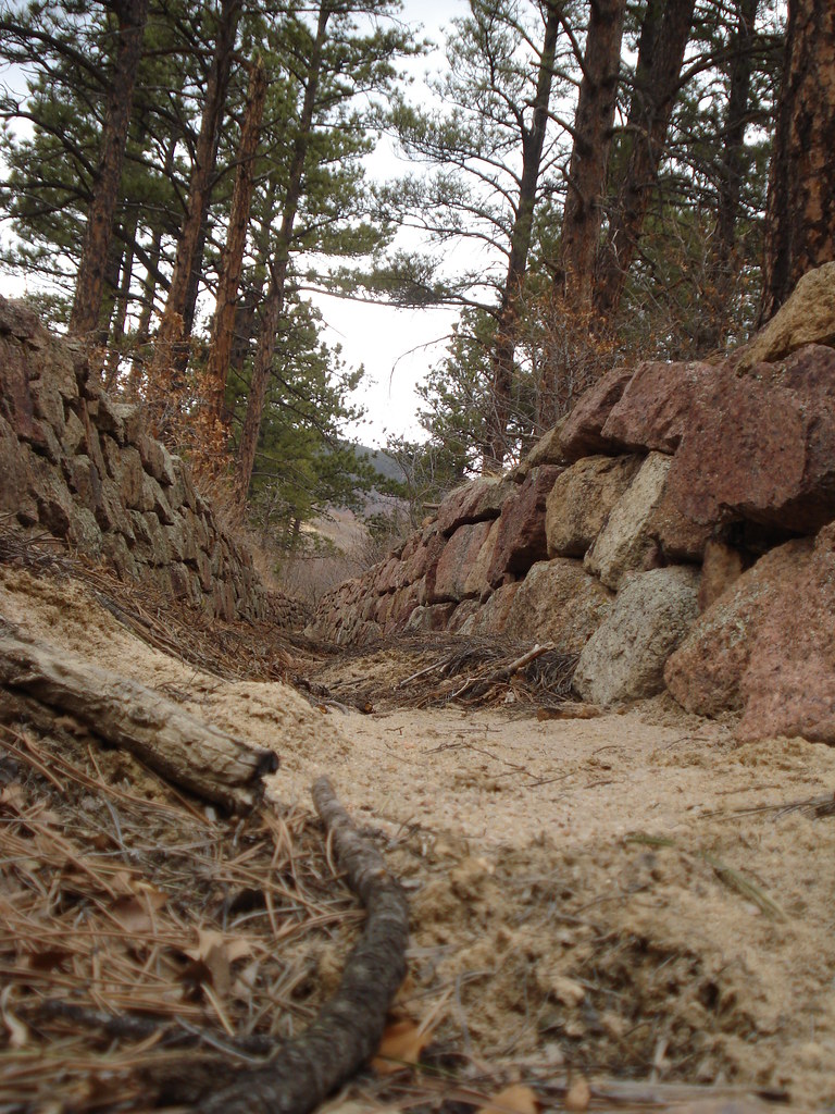
 Photo: bgautrea, CC BY-SA 2.0 (via Flickr)
- 0.9 mi
- round trip
- 716 ft
- climb
- 8,659 ft
- high point
- Out and back
- route
- May–Jun, Sep
- best months
Is Fall Mountain Peak Trail open right now?
Alert in the area
The Forest Service lists 11 alerts for Pike and San Isabel National Forests.
FSR 286, Radical Hill, is closed due to washouts and unsafe conditions
Agency alert covering Pike and San Isabel National Forests · USFS · Pike and San Isabel National Forests
Interlaken Hotel Tree Hazards
Agency alert covering Pike and San Isabel National Forests · USFS · Pike and San Isabel National Forests
Sharpe Fire Update
Agency alert covering Pike and San Isabel National Forests · USFS · Pike and San Isabel National Forests
Turquoise Lake Road (County Road 4) Closure
Agency alert covering Pike and San Isabel National Forests · USFS · Pike and San Isabel National Forests
Waldo Canyon Burn Area Closure
Agency alert covering Pikes Peak Ranger District · Order 02-12-09-24-07 · USFS · Pikes Peak Ranger District
As of · Source: USFS · Pike and San Isabel National Forests. Agencies don't list every closure — check before you go.
Fall Mountain Peak Trail is an easy out-and-back hike in Colorado's Pikes Peak Ranger District, part of the Pike and San Isabel National Forests. The Forest Service manages the land, and the route begins at about 8,641 feet and reaches a high point of 8,659 feet, so it's a short, low-elevation climb. The trail is 1.7 miles long and gains 716 feet, with the steepest stretch around 0.4 miles in at 22% grade. That makes it a quick outing of about an hour. The climb is back-loaded, so the highest point comes after most of the route. Summer is the most comfortable time to go. Typical averages from the nearby Ruxton Park weather station put July highs around 74°F with lows near 46°F, while winter highs stay around 39°F. Nearby, Mount Herman is about a mile away, and the Skull Crusher Boulder and Highball Boulder climbing areas are each roughly 1.6 miles off. Camping is available at Tent City, about 4.3 miles away.
Local outfitters
- Broadmoor Outfitters19 mi away
- Gold Belt Tour Scenic and Historic Byway32 mi away
Not on Roamze yet. Their page has how to reach them.
- Mount HermanHikingPhoto: bgautrea, CC BY-SA 2.0 (via Flickr)1 mi
 Skull Crusher BoulderRock climbingPhoto: bgautrea, CC BY-SA 2.0 (via Flickr)1.6 mi
- Highball BoulderRock climbingPhoto: bgautrea, CC BY-SA 2.0 (via Flickr)1.6 mi
- HELL CREEK SPUR TRAILHiking1.8 mi
- Tent CityCamping4.3 mi
 Monument CreekCanoeingPhoto: Jeffrey Beall, CC BY 4.0 (via Wikimedia Commons)5.1 mi
- Dikeside Boating SiteLake fishing5.6 mi
- Peregrine Pines Family CampCamping6.2 mi
Source: Roamze catalog (indexable pages within 10 miles, PostGIS distance)
- Mount Herman TrailHiking · ~3 min drivePhoto: bgautrea, CC BY-SA 2.0 (via Flickr)
 MonumentHiking · ~4 min drivePhoto: bgautrea, CC BY-SA 2.0 (via Flickr)
 La Deux Réservoirs TrailHiking · ~7 min drivePhoto: halseike, CC BY 2.0 (via Flickr)
- Raspberry Mountain TrailHiking · ~4 min drivePhoto: bgautrea, CC BY-SA 2.0 (via Flickr)
- SchubarthHiking · ~7 min drive
- Limbaugh CanyonHiking · ~5 min drive
- I-A FitnessHiking · ~4 min drivePhoto: bgautrea, CC BY-SA 2.0 (via Flickr)
- HELL CREEK TRAILHiking · ~6 min drive
- Rasberry Mountain TrailHiking · ~4 min drivePhoto: bgautrea, CC BY-SA 2.0 (via Flickr)
- Winding Stairs Connector TrailHiking · ~7 min drive
Also worth it near here
- Skull Crusher BoulderRock climbing · ~3 min drivePhoto: bgautrea, CC BY-SA 2.0 (via Flickr)
 Mount HermanSummit · ~3 min drivePhoto: Jeffrey Beall, CC BY 4.0 (via Wikimedia Commons)
 Stanley CanyonMountain biking · ~8 min drivePhoto: jared goss, CC BY-SA 3.0 (via Wikimedia Commons)
- Palmer LakeLake fishing · ~8 min drive
Best time to visit Fall Mountain Peak Trail
Best months: May–June and September. Best months have typical highs of 55–85 °F, lows of 30 °F or warmer (32 °F where the station doesn't record snow), at most one snowy day and no more than 12 wet days.
Jan
39° / 13°
5 wet
Feb
39° / 14°
6 wet
Mar
45° / 20°
7 wet
Apr
50° / 26°
8 wet
May
59° / 33°
10 wet
Jun
70° / 42°
11 wet
Jul
74° / 46°
16 wet
Aug
72° / 45°
16 wet
Sep
66° / 39°
9 wet
Oct
56° / 30°
6 wet
Nov
46° / 19°
5 wet
Dec
39° / 13°
5 wet
Typical high / low (°F) and days with rain or snow, 1991–2020. Measured at Ruxton Park, CO, 15 mi away at 9,060 ft. This station doesn't record snowfall. Source: NOAA NCEI U.S. Climate Normals 1991–2020.
Map and trail data © OpenStreetMap contributors
