Cataract Gulch
Campground
Campground · < 0.1 mi from the trail
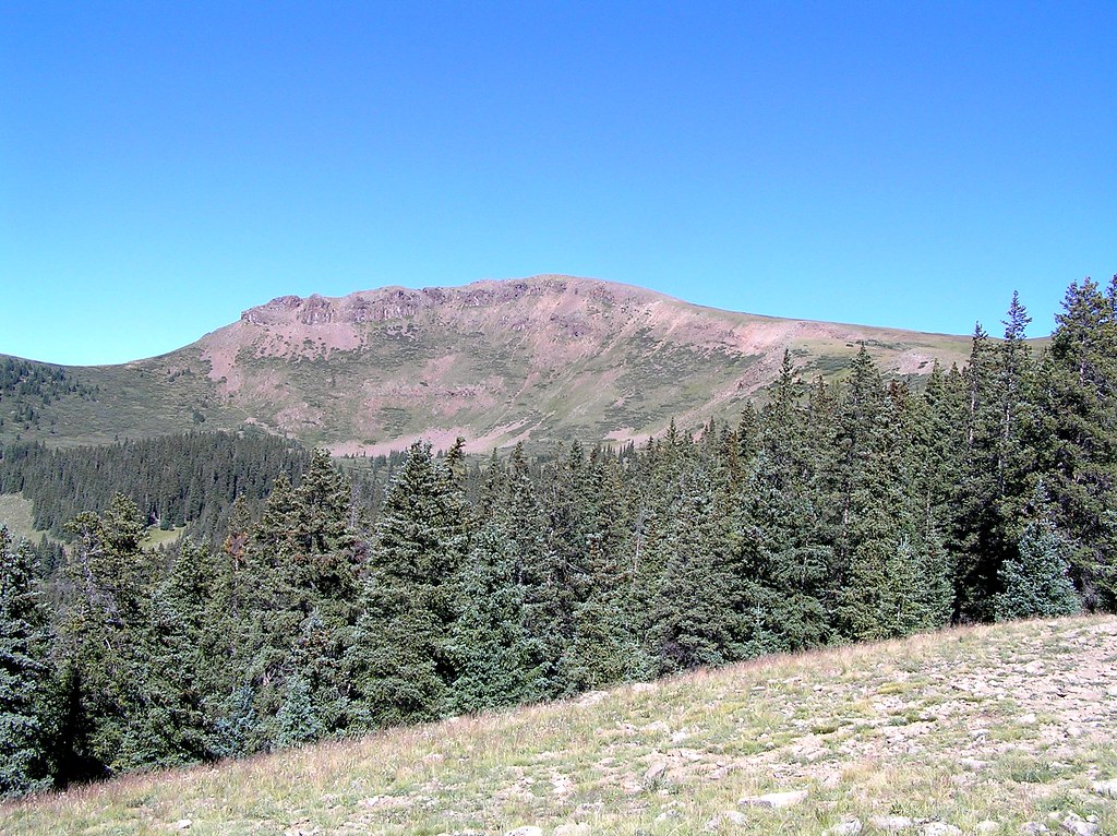
 Photo: markbyzewski, CC BY 2.0 (via Flickr)
Coney Point is a long, steep out-and-back hike in Colorado's Gunnison National Forest, managed by the Forest Service. The route is about 24 miles long, with a total elevation gain of roughly 6,500 feet, and it reaches a high point of about 13,300 feet. The climb is rated expert, and the trip is estimated to take about 11.5 hours. The route starts and ends at the Cataract Gulch campground, which sits about 0.1 mile from the trail. Carson Peak is also about 0.1 mile away, so the two can be combined into a single outing. Grizzly RT RV Park is about 1.3 miles off, and the Lake Fork canoeing spot is about 1.6 miles away.
Cataract Gulch
Campground
Red Mountain Brewing
Restaurant
Smuggler Union Tramhouse
Attraction
Places © OpenStreetMap contributors
More in TellurideNot on Roamze yet. Their page has how to reach them.
 Carson PeakHikingPhoto: markbyzewski, CC BY 2.0 (via Flickr)0.1 mi
 Cataract GulchCampingPhoto: Mitchtobin, CC BY-SA 4.0 (via Wikimedia Commons)0.1 mi
 Cataract CreekHikingPhoto: markbyzewski, CC BY 2.0 (via Flickr)1.7 mi
 Henson CreekCanoeingPhoto: Jeffrey Beall, CC BY 4.0 (via Wikimedia Commons)7 mi
 Eureka areaRock climbingPhoto: Greg Willis from Denver, CO, usa, CC BY-SA 2.0 (via Wikimedia Commons)7.2 mi
Source: Roamze catalog (indexable pages within 10 miles, PostGIS distance)
Cataract CreekHiking · ~3 min drivePhoto: markbyzewski, CC BY 2.0 (via Flickr) Redcloud PeakHiking · ~5 min drivePhoto: kalestews, CC BY 2.0 (via Flickr)
 Handies PeakHiking · ~8 min drivePhoto: WKHarmon, CC BY 2.0 (via Flickr)
 Heart LakeHiking · ~14 min drivePhoto: fringedbenefit, CC BY 2.0 (via Flickr)Mark MountainHiking · ~5 min drivePhoto: kalestews, CC BY 2.0 (via Flickr)
 Houghton MountainHiking · ~13 min drivePhoto: mjhbower, CC BY-SA 2.0 (via Flickr)
 Engineer Mountain TrailHiking · ~15 min drivePhoto: WKHarmon, CC BY 2.0 (via Flickr)Sunshine PeakHiking · ~5 min drivePhoto: kalestews, CC BY 2.0 (via Flickr)
© openrouteservice.org by HeiGIT | Map data © OpenStreetMap contributors
